Click to visit the main New York Public Library Homepage
The New York Public Library
Digital Collections
About Digital Collections
Browse
Search only public domain materials
Items
Collections
Divisions
Home
Search
Browse
About
Search only public domain materials
Items
Collections
Divisions
Digital Collections
Using Images
Using Data
Search
Filtered search
Show filters
Hide filters
Show Only Public Domain
topic
Real property
1604
Administrative and political divisions
440
Business enterprises
395
Railroads
352
Landowners
321
More
Less
name
Beers, F. W. (Frederick W.)
534
Perris, William
308
United States Coast Survey
264
Everts, Ensign & Everts
231
Bache, A. D. (Alexander Dallas), 1806-1867
207
More
Less
collection
Atlases of the United States
1613
Maps of North America
1535
Maps of New York City and State
799
Atlases of New York City
734
Lawrence H. Slaughter Collection of English maps, charts, globes, books and atlases
110
More
Less
place
New York (State)
1925
New York
528
Manhattan (New York, N.Y.)
380
New York (N.Y.)
333
United States
274
More
Less
genre
Maps
4996
Atlases
1565
Cadastral maps
266
Nautical charts
187
Prints
182
More
Less
publisher
publisher not identified
227
William Perris
142
U.S. Coast Survey
133
Perris & Browne
124
Chapman and Hall
109
More
Less
division
Map Division
4762
General Research Division
83
George Arents Collection
51
Rare Book Division
35
Schomburg Jean Blackwell Hutson Research and Reference Division
18
More
Less
type
x
cartographic
still image
131
text
120
Date Range
to
5,126 results found
Filtering on:
x
Date
: 1842 - 1879
x
Type
: cartographic
Sort by:
Title
Date created
Date digitized
Sequence
Results 1751 - 1800
Blatt XII: Freyburg, Bern
Blatt XIII: Interlaken, Sarne…
Blatt XIV: Altorf, Chur
Blatt XV: Davos, Martinsbruck
Blatt XVI: Geneve, Lausanne
Blatt XVII: Vevey, Sion
Blatt XIX: Bellinzona, Chiave…
Blatt XX: Sondrio, Bormio
Blatt XXI: Ubersicht der Blae…
Blatt XXII: Martigny, Aoste
Blatt XXIII: Domo d'Ossola, A…
Blatt XXIV: Lugano, Como
Blatt XXV: Höhen der vorzügli…
Blatt XVIII: Brieg, Airolo
Action of Aroge
A map of the confluence of th…
Map of the Hudson River near …
Map of Rensselaers Wyck, anno…
Field of the Missionary Convo…
Chart of the Diocese of New Y…
m
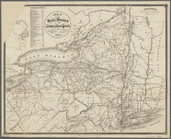
Map of the rail-roads of the …
Map of the New York state can…
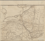
Engineers map of the state of…
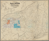
Map of the rail roads of the …
Revised map of the rail roads…
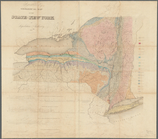
Agricultural and geological m…
Map of New York State showing…
New-York
Map shewing the location of t…
Karte von New York: zu Kapp's…
Map of the State of New-York …
Part of the boundary between …
Part of the boundary between …
Part of the boundary between …
Map showing the connections o…
Map of the United States with…
Disturnell's new map of the U…
Isothermal chart of the regio…
North America
Map of Niagara River or the s…
Map of the head waters of the…
m
Geological Survey of Wisconsin
Map of the great north west: …
Map of Massachusetts, Connect…
Carta particolare della nuoua…
Sketch of the states of Massa…
Topographical map of Seneca C…
Map of the United States exhi…
Topographical map of the coun…
Lake George and part of Lake …
1
2
…
5
6
7
8
9
10
11
12
…
20
21
Previous
Next
1
2
…
5
6
7
8
9
10
11
12
…
20
21
Previous
Next