Click to visit the main New York Public Library Homepage
The New York Public Library
Digital Collections
About Digital Collections
Browse
Search only public domain materials
Items
Collections
Divisions
Home
Search
Browse
About
Search only public domain materials
Items
Collections
Divisions
Digital Collections
Using Images
Using Data
Search
Filtered search
Show filters
Hide filters
Show Only Public Domain
topic
Real property
401
Business enterprises
217
Administrative and political divisions
78
Railroads
68
Fire insurance
53
More
Less
name
Beers, F. W. (Frederick W.)
181
Stone & Stewart
151
Beers, D. G. (Daniel G.)
101
Beers, S. N
99
Prindle, A. B
54
More
Less
collection
Atlases of the United States
473
Maps of North America
179
Atlases of New York City
151
Maps of New York City and State
121
Maps of the World
1
place
New York (State)
413
New York Metropolitan Area
63
Brooklyn (New York, N.Y.)
61
Westchester County (N.Y.)
57
New Jersey
50
More
Less
genre
Maps
851
Atlases
473
Cadastral maps
41
Prints
21
Manuscript maps
15
More
Less
publisher
Stone & Stewart
99
F. W. Beers, A. D. Ellis & others
54
Beers, Ellis & Soule
50
C. K. Stone
46
publisher not identified
46
More
Less
division
x
Map Division
type
cartographic
869
text
60
still image
13
Date Range
to
925 results found
Filtering on:
x
Date
: 1866 - 1870
x
Division
: Map Division
Sort by:
Title
Date created
Date digitized
Sequence
Map drawn for "The Morningsid…
Rice & Reed's township map of…
m
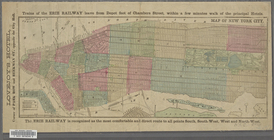
Outline map showing a new rou…
Hartford in 1640
Topographical map of that por…
The lake country of New Hamps…
Map of Atlantic, Mississippi …
Map showing detailed topograp…
Map of central Keweenaw Penin…
Outline map of the rail roads…
Enlarged map of the coast fro…
Map of Providence and Worcest…
Map of Indiana
Map of St. Louis and environs…
Map of property of the Ruther…
Map of the rail roads of the …
Balloon view of Narragansett …
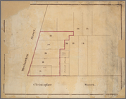
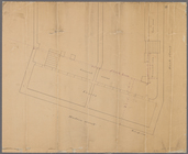
Block bounded by 2nd Ave., 99…
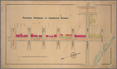
Proposed widening of Lexingto…
m
Manuscript maps of block boun…
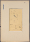
Manuscript map of "building" …
Fragment of a map, covering p…
The harbor of New Bedford
Magneto-geological chart of R…
m
Colton's new sectional map of…
Parts of 1st ward of the city…
Map showing the New York and …
Map of the vicinity of Washin…
McClung's map of Minnesota : …
Benham's new map of the city …
Manuscript map of lots at cor…
Manuscript map of corner of H…
Map of Old Jan's land & the B…
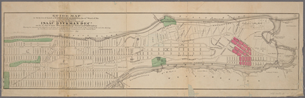
Guide map to 92 acres of land…
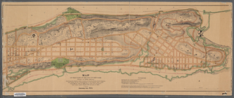
Map of that part of the city …
Map of New York City from 50t…
Manuscript map of corner of D…
Map showing the connections o…
Manuscript map of building at…
Vernon Co., Mo. : plat of tow…
Manuscript map of corner of C…
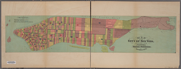
Map of the city of New York, …
Map of New York City.
Map of the City of New York. …
Map of the City of New York […
m
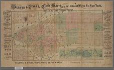
New York City map and directo…
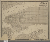
Plan of the City of New York …
Nashua River
Map of Talbot County Maryland
Verein-Staaten von Nord-Ameri…
1
2
3
4
Previous
Next
1
2
3
4
Previous
Next