Click to visit the main New York Public Library Homepage
The New York Public Library
Digital Collections
About Digital Collections
Browse
Search only public domain materials
Items
Collections
Divisions
Home
Search
Browse
About
Search only public domain materials
Items
Collections
Divisions
Digital Collections
Using Images
Using Data
Search
Filtered search
Show filters
Hide filters
Show Only Public Domain
topic
Real property
141
Description and travel
140
Business enterprises
86
Fire insurance
29
Railroads
18
More
Less
name
Beers, F. W. (Frederick W.)
173
Beers, Comstock & Cline
96
D.G. Beers & Co
87
Bourquin, F. (Frederick), 1808-
36
Worley & Bracher
36
More
Less
collection
Atlases of the United States
198
Atlases of New York City
111
Maps of North America
32
Maps of New York City and State
26
Map of part of the western coast of Africa extending from the Isles de Loss to Sherboro Island, particularly exhibiting the discoveries lately made to the N.E. of Sierra Leone by Surgeon O'Beirne and Major Laing
1
place
New York (State)
109
Long Island (N.Y.)
96
New Jersey
80
Steuben County (N.Y.)
52
Steuben County
51
More
Less
genre
Maps
368
Atlases
198
Cadastral maps
8
Manuscript maps
3
Topographic maps
3
More
Less
publisher
Beers, Comstock & Cline
96
D.G. Beers
52
D. G. Beers & Co
35
Spielmann & Brush,
29
Department of Public Parks?
16
More
Less
division
Map Division
367
Schomburg Jean Blackwell Hutson Research and Reference Division
1
type
x
cartographic
text
6
Date Range
to
368 results found
Filtering on:
x
Date
: 1873 - 1873
x
Type
: cartographic
Sort by:
Title
Date created
Date digitized
Sequence
Map showing location of lands…
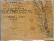
Colton's New York City, Brook…
m
Topographical map of central …
Plan of land on West Chester …
Map of Chicago and its wester…
Preliminary geological map of…
Blanchard's Guide map of Kans…
Portion of the copper distric…
Preliminary map of Central Co…
Thayer's map of Colorado
Thayer's map of Colorado
Preliminary map of the survey…
Topographical map showing the…
Map of the San Joaquin, Sacra…
Map of Northern Arizona
Campaign map of the Departmen…
Map of Chester Co., Pennsylva…
The Louisiana State Universit…
m
Map of Fulton Co., Pennsylvan…
m
Post route map of the states …
Colton's new township map of …
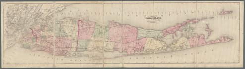
Map of Long Island
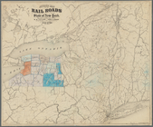
Map of the rail roads of New …
Map of property of the Dundee…
Map showing the rearrangement…
Map of pr[op]erty of Union Av…
Map showing location of lands…
Map showing location of lands…
Map of land belonging to Feli…
Map of the city of Worcester:…
Map of the town of Newton: [M…
Plan of burnt district (by fi…
Map of New England with adjac…
Map of Pennsylvania showing p…
City of Albany, New York
m
Watson's new county and railr…
m
Map of the United States and …
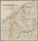
Map of Chautauqua County, N.Y…
m
Territory of the United State…
m
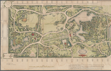
Map of the Central Park
Observed path of meteor of Ch…
Revised map of the rail roads…
Specimen of preliminary recon…
Sketch showing contour lines …
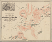
Adirondack Survey, 1873, seco…
Copy of map or survey showing…
Paving map [Reade Street from…
Map of property of New Bright…
m
Map showing the high and low …
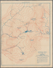
Map of the country thirty thr…
1
2
Previous
Next
1
2
Previous
Next