Click to visit the main New York Public Library Homepage
The New York Public Library
Digital Collections
About Digital Collections
Browse
Search only public domain materials
Items
Collections
Divisions
Home
Search
Browse
About
Search only public domain materials
Items
Collections
Divisions
Digital Collections
Using Images
Using Data
Search
Filtered keyword search
Show filters
Hide filters
Show Only Public Domain
topic
Nautical charts
79
Harbors
21
Coasts
11
Navigation
9
Railroads
3
More
Less
name
x
Bache, A. D. (Alexander Dallas), 1806-1867
United States Coast Survey
92
Mathiot, G
34
Alden, James, 1810-1877
13
Hassler, F. R. (Ferdinand Rudolph), 1770-1843
13
More
Less
collection
Maps of North America
83
Maps of New York City and State
10
place
Massachusetts
17
California
13
Virginia
11
Maryland
8
New York (State)
8
More
Less
genre
Maps
93
Nautical charts
60
Bathymetric maps
19
Illustrations
2
Pictorial works
1
More
Less
publisher
U.S. Coast Survey
37
U.S. Coast Survey Office
23
United States Coast Survey
8
The Survey
5
U.S. Coast Survey office
4
More
Less
division
x
Map Division
type
cartographic
93
still image
3
text
1
Date Range
to
93 results found for:
x
Reliefs
Filtering on:
x
Division
: Map Division
x
Name
: Bache, A. D. (Alexander Dallas), 1806-1867
Sort by:
Relevance
Title
Date created
Date digitized
Sequence
Map of eastern Virginia : com…
abstract:
…, rivers, and
relief
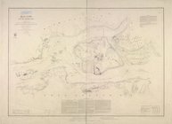
Hell Gate and its approaches
note:
Relief
shown by hachures. Depths shown
Mississippi City harbor, Miss…
abstract:
Relief
shown by hachures; depths shown
North Carolina & South Caroli…
abstract:
… and railroads.
Relief
shown
Middle Georgia & South Caroli…
abstract:
….
Relief
shown by hachures.
Mountain region of North Caro…
abstract:
Relief
shown by hachures. Includes list
Map of Virginia, part of West…
abstract:
… are printed in red.
Relief
Map of western Virginia : com…
abstract:
… of the map.
Relief
shown
Map of the state of Virginia
abstract:
… Richmond.
Relief
shown
Reconnaissance of the Pamunky…
abstract:
Relief
shown by landform drawings. Oriented
Sketch D, No. 2 showing the p…
abstract:
… inlets, and bays.
Relief
Reconnaissance of the eastern…
note:
Relief
shown by hachures. Depths shown
Preliminary Chart of entrance…
abstract:
Relief
shown by hachures. Depths shown
Preliminary chart of St. Mark…
abstract:
Facsimilie.
Relief
shown by hachures
Lynn Harbor, Massachusetts 18…
abstract:
Relief
shown by hachures. Depths shown
Reconnaissance of entrance & …
abstract:
Relief
shown by hachures. Depths shown
Preliminary survey of Turtle …
note:
Relief
shown by hachures. Depths shown
Preliminary chart of Plymouth…
abstract:
Relief
shown by soundings. Includes sailing
Asher & Adams' map of the bay…
note:
Relief
shown by hachures, depths shown
Preliminary sketch of Beaufor…
abstract:
Relief
shown by hacuhres; depths shown
Map of eastern Virginia : com…
abstract:
…, and North Carolina.
Relief
City of San Francisco and its…
abstract:
….
Relief
shown by contours
Bass River Harbor, Massachuse…
note:
Relief
shown by hachures. Depths shown
Preliminary sketch showing th…
abstract:
Relief
shown by gradient tints and shading
Horn Island Pass, Mississippi…
abstract:
Relief
shown by hachures. Depths shown
Reconnaissance of Trinidad Ba…
abstract:
Relief
shown by hachures. Depths shown
Preliminary chart of Kennebec…
note:
Relief
shown by hachures; depth shown
The harbor of Holmes' Hole: t…
note:
Relief
shown by hachures. Depths shown
York River and Cape Neddick h…
note:
Relief
shown by hachures; depth shown
Preliminary chart of San Luis…
abstract:
Relief
shown by hachures. Includes texts
The Harbor of New Bedford
note:
Relief
shown by hachures. Depths shown
Middle part of the southern c…
note:
Relief
shown by hachures.
The harbor of Holmes' Hole: t…
note:
Relief
shown by hachures. Depths shown
Preliminary chart of Gloucest…
note:
Relief
shown by harchures. Depths shown
Preliminary chart of the Rigo…
abstract:
Relief
shown by shading. Depths shown
Preliminary survey of Point R…
abstract:
Relief
shown by hachures. Depths shown
Reconnaissance of Semi-ah-moo…
note:
Relief
shown by hachures. Depths shown
Mouth of Chester River : (Har…
note:
Relief
shown by hachures. Depths shown
Rappahannock River, Virginia …
abstract:
Relief
shown by hachures. Depths shown
Preliminary survey of the ent…
abstract:
Relief
shown by hachures. Depths shown
Loudon County, Virginia
note:
Relief
shown by hachures.
Rappahannock River, Virginia …
abstract:
Relief
shown by hachures; depths shown
Preliminary chart of York Riv…
abstract:
Relief
shown by hachures. Depths shown
Entrance to Columbia River, O…
abstract:
Relief
shown by hachures. Depths shown
Preliminary chart of St. Andr…
note:
Relief
shown by hachures. Depths shown
The harbor of Wood's Hole, Ma…
abstract:
Relief
shown by hachures. Depths shown
Mare Island Straits, Californ…
abstract:
… and site of Vallejo.
Relief
Reconnaissance of Port Townsh…
abstract:
Relief
shown by hachures. Depths shown
Eastern part of St. George's …
abstract:
….
Relief
shown by hachures
Eastern part of the southern …
note:
Relief
shown by land forms; depths