


- The Library Shop
- Privacy Policy
- Rules and Regulations
- Using the Internet
- Website Terms and Conditions
- Gifts of Materials to NYPL
-
© The New York Public Library, 2024
The New York Public Library is a 501(c)(3) | EIN 13-1887440
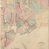
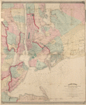
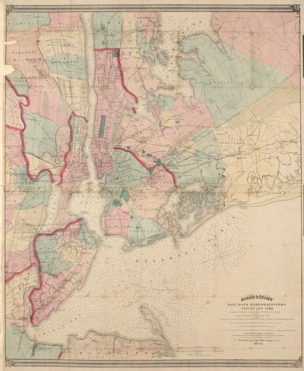
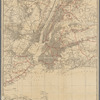
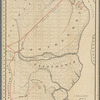
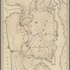
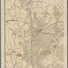
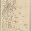
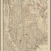
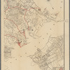
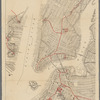
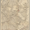
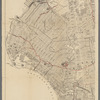
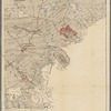
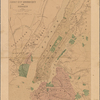
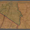
Lionel Pincus and Princess Firyal Map Division, The New York Public Library. "Asher & Adams' map of the bays, harbors and rivers around New York : showing the channels, soundings, lighthouses, buoys &c. and the complete topography of the surrounding country : including Hempstead, Sandy-Hook, South-Amboy, Newark, Yonkers, N. Rochelle & Glencove" The New York Public Library Digital Collections. 1874. https://digitalcollections.nypl.org/items/510d47e4-7368-a3d9-e040-e00a18064a99
Lionel Pincus and Princess Firyal Map Division, The New York Public Library. "Asher & Adams' map of the bays, harbors and rivers around New York : showing the channels, soundings, lighthouses, buoys &c. and the complete topography of the surrounding country : including Hempstead, Sandy-Hook, South-Amboy, Newark, Yonkers, N. Rochelle & Glencove" New York Public Library Digital Collections. Accessed April 28, 2024. https://digitalcollections.nypl.org/items/510d47e4-7368-a3d9-e040-e00a18064a99
Lionel Pincus and Princess Firyal Map Division, The New York Public Library. (1874). Asher & Adams' map of the bays, harbors and rivers around New York : showing the channels, soundings, lighthouses, buoys &c. and the complete topography of the surrounding country : including Hempstead, Sandy-Hook, South-Amboy, Newark, Yonkers, N. Rochelle & Glencove Retrieved from https://digitalcollections.nypl.org/items/510d47e4-7368-a3d9-e040-e00a18064a99
<ref name=NYPL>{{cite web | url=https://digitalcollections.nypl.org/items/510d47e4-7368-a3d9-e040-e00a18064a99 | title=
(cartographic)
Asher & Adams' map of the bays, harbors and rivers around New York : showing the channels, soundings, lighthouses, buoys &c. and the complete topography of the surrounding country : including Hempstead, Sandy-Hook, South-Amboy, Newark, Yonkers, N. Rochelle & Glencove, (1874)|author=Digital Collections, The New York Public Library |accessdate=April 28, 2024 |publisher=The New York Public Library, Astor, Lenox, and Tilden Foundations}}</ref>