Click to visit the main New York Public Library Homepage
The New York Public Library
Digital Collections
About Digital Collections
Browse
Search only public domain materials
Items
Collections
Divisions
Home
Search
Browse
About
Search only public domain materials
Items
Collections
Divisions
Digital Collections
Using Images
Using Data
Search
Filtered keyword search
Show filters
Hide filters
Show Only Public Domain
topic
x
Landowners
Real property
150
Administrative and political divisions
45
Villages
16
Railroads
15
More
Less
name
Smith, Robert Pearsall, 1827-1898
23
Walling, Henry Francis, 1825-1888
17
Dripps, M. (Matthew)
10
Worley & Bracher
10
Burr, David H., 1803-1875
9
More
Less
collection
Maps of North America
120
Maps of New York City and State
93
Atlases of the United States
9
Collection of property maps of parts of Westchester County, N.Y. : covering mostly Eastchester, Mount Vernon, and Yonkers
1
Lawrence H. Slaughter Collection of English maps, charts, globes, books and atlases
1
place
New York (State)
98
Massachusetts
22
New York
19
New York (N.Y.)
19
Pennsylvania
14
More
Less
genre
Maps
224
Cadastral maps
123
Atlases
9
Manuscript maps
8
Illustrations
6
More
Less
publisher
publisher not identified
23
M. Dripps
9
Published by authority of the Hon. the Secretary of War, Office of the Chief of Engineers, U.S. Army
6
J.B. Beers & Co
5
Publisher not identified
4
More
Less
division
x
Map Division
type
cartographic
223
still image
15
text
1
Date Range
to
224 results found for:
x
Reliefs
Filtering on:
x
Division
: Map Division
x
Topic
: Landowners
Sort by:
Relevance
Title
Date created
Date digitized
Sequence
m
Map of Belknap County, New Ha…
note:
Relief
shown by hachures.
Information map, Hd. Qrs. 20 …
note:
Relief
shown by hachures
Plan of the town of Newton in…
note:
Relief
shown by hachures
Information map only, H. Qrs.…
note:
Relief
shown by hachures
m
Position Army Cumbld., June 2…
note:
Relief
shown by hachures
Part of Cobb Co., Ga
note:
Relief
shown by hachures
m
Map of the Cedar Knolls, at B…
note:
….
Relief
by contour
Map of part of Fauquier Count…
abstract:
….
Relief
shown by hachures.
Map of the city of Newport an…
note:
Relief
shown by hachures.
m
Sketch of the battle of Frede…
note:
Relief
show by hachures
Map of Swanzey, 1890: [New Ha…
note:
Relief
shown by hachures.
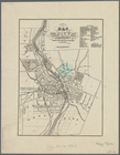
Map of the city of Rochester:…
note:
Relief
shown by hachures.
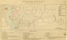
Cortlandt Manor map : prepare…
note:
Relief
shown pictorially.
Cattaraugus Reservation of th…
note:
Relief
shown by hachures.
Portions of 2nd, 3rd, and 4th…
note:
Relief
shown by hachures.
Birds-eye view of the Blue Gr…
abstract:
Relief
shown by hachures. Includes "Index
m
Map of the city of Poughkeeps…
note:
Relief
shown by hachures.
Port Jervis
note:
Relief
shown by hachures
Map of part of Orange County,…
note:
Relief
shown by hachures.
Map showing the Adirondack La…
note:
Relief
shown by hachures and spot heights.
Plat of the private claims at…
abstract:
… owner's names.
Relief
Map of the town of Ipswich, c…
note:
Relief
shown by hachures and spot heights.
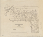
Map of Rockland Co: [New York]
note:
Relief
shown by hachures.
Ancient Windham County: names…
note:
Relief
shown by hachures.
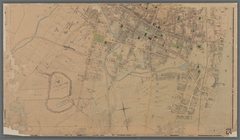
Town of Greenburgh, Westchest…
note:
Relief
shown by hachures.
Copy of a map of part of the …
note:
Relief
shown by hachures.
Plan of the Country Club Land…
note:
Relief
shown by hachures. Depths shown
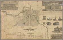
Map of the village of Auburn
abstract:
Relief
shown pictorially and by hachures
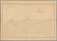
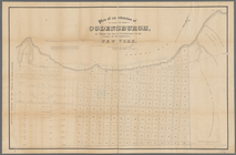
Map of Ogdensburgh
note:
Relief
shown by hachures. Depths shown
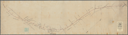
Plan showing route of Rochest…
note:
Relief
shown by spot heights.
Map of Marshfield, Mass.
abstract:
….
Relief
shown by hachures
Map of the town of Raynham, B…
abstract:
… and town districts.
Relief
Centennial map of Concord, 17…
note:
Relief
shown by hachures.
Map of Bristol County, Rhode …
note:
Relief
shown by hachures.
Map of West Chester County, N…
note:
Relief
shown by hachures.
Map of the iron mines of Lake…
abstract:
….
Relief
shown by hachures.
North Berwick: [Maine]
note:
Relief
shown by hachures.
Map of the city of Newport an…
note:
Relief
shown by hachures.
A map of the original allotme…
note:
Relief
shown by hachures.
Plan of the town of Concord, …
note:
Relief
shown by hachures.
Plan of an extension of the v…
note:
Relief
shown by hachures.
Map of the town of Blackstone…
abstract:
….
Relief
shown by hachures
A plan of Charles town
abstract:
…, churches and houses.
Relief
Portions of 1st, 2nd, and 3rd…
note:
Relief
shown by hachures.
Map of the town of Needham, M…
note:
Relief
shown by hachures.
Map of first district, Campbe…
note:
Relief
shown by hachures
Driving chart of Hartford and…
note:
Relief
shown by spot heights.
Map of Livingston Manor anno …
note:
Relief
shown pictorially.
Plan of Charlestown peninsula…
note:
Relief
shown by hachures.
m
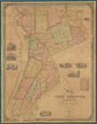
Map of Ontario County, New Yo…
note:
Relief
shown by hachures.