Click to visit the main New York Public Library Homepage
The New York Public Library
Digital Collections
About Digital Collections
Browse
Search only public domain materials
Items
Collections
Divisions
Home
Search
Browse
About
Search only public domain materials
Items
Collections
Divisions
Digital Collections
Using Images
Using Data
Search
Filtered search
Show filters
Hide filters
Show Only Public Domain
topic
Real property
48
Fire insurance
26
Cities & towns
22
Cuba
1
Fortification
1
More
Less
name
Sanborn Map Company
22
E.B. Hyde & Co
6
G.M. Hopkins & Co
6
Hyde, E. Belcher
6
Perris, William
6
More
Less
collection
Atlases of New York City
56
Atlases of the United States
11
Maps of New York City and State
4
Maps of North America
3
Atlases, gazetteers, guidebooks and other books
1
place
New York (State)
50
New York
22
Brooklyn (New York, N.Y.)
14
Queens (New York, N.Y.)
8
Manhattan (New York, N.Y.)
7
More
Less
genre
Maps
75
Atlases
11
Cadastral maps
1
Engineering drawings
1
Nautical charts
1
publisher
Sanborn Map Company
22
E. Belcher Hyde
12
G.M. Hopkins & Co
6
E. Belcher-Hyde
4
Lith. by Korff Brothers
3
More
Less
division
x
Map Division
type
cartographic
75
Date Range
to
75 results found
Filtering on:
x
Division
: Map Division
x
Title
: LUNCHEON [held by] ROYAL VICTORIA HOTEL [at] "NASSAU, THE BAHAMAS" (FOR )
Sort by:
Title
Date created
Date digitized
Sequence
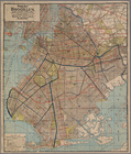
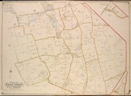
Rapid transit map of Kings, Q…
Plat of a survey of land "for…
Vereinigte Staaten von Nord-A…
Map of the United States of N…
Guide map of Brooklyn, Kings …
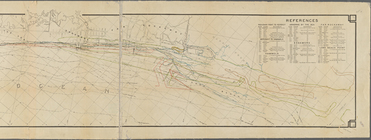
Sketch showing the ground und…
m
Map of Rockaway Peninsula fro…
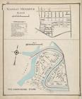
Nassau Heights; Meadowmere Pa…
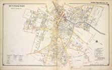
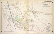
Huntington West of Nassau Ave.
Huntington East of Nassau Ave.
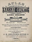
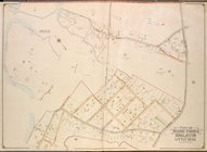
Atlas of Nassau County Long I…
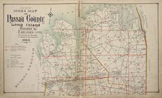
Upper section Index Map of Na…
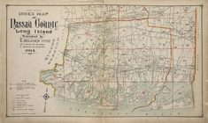
Lower section Index Map of Na…
Suffolk County, V. 1, Double …
Suffolk County, V. 1, Double …
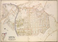
Robinson's atlas of the city …
Newark, V. 1, Double Page Pla…
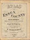
Atlas of Essex County New Jer…
Map bounded by Liberty Street…
Map bounded by Liberty Street…
Map bounded by Nassau Street,…
Plate 24: Bounded by Emery St…
Plate 25: Bounded by 2nd Stre…
Plate 30: Bounded by Nassau R…
Bounded by Manhattan Avenue, …
Bounded by Meserole Avenue, F…
Bounded by Reade Street, Nass…
Map bound by U.S. Navy Yard, …
Map bound by Poplar St., Sand…
Map bound by Sands St., U.S. …
Map bound by Manhattan Ave., …
Map bound by Whale Creek Cana…
Map bound by Norman Ave. King…
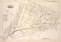
2nd Ward. [Map bounded by Bro…
Plate 3: Map bounded by Dey S…
Plate 4: Map bounded by Maide…
1st Ward. [Map bounded by Lib…
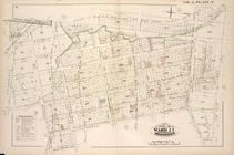
2nd & 4th Wards. [Map bounded…
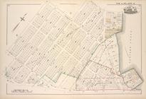
Plate 6: Map bounded by Broad…
Queens, Vol. 2, Double Page P…
Queens, Vol. 2, Double Page P…
Queens, Vol.2, Double Page Pl…
Queens, Vol. 3, Double Page P…
Queens, Vol. 3, Double Page P…
Queens, Vol. 2, Double Page P…
Queens, Vol. 2, Double Page P…
Queens, Vol. 2, Double Page N…
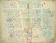
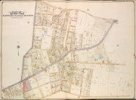
Brooklyn, Vol. 4, Double Page…
Brooklyn, Vol. 1, 2nd Part, D…
Brooklyn, Vol. 1, 2nd Part, D…