Click to visit the main New York Public Library Homepage
The New York Public Library
Digital Collections
About Digital Collections
Browse
Search only public domain materials
Items
Collections
Divisions
Home
Search
Browse
About
Search only public domain materials
Items
Collections
Divisions
Digital Collections
Using Images
Using Data
Search
Filtered keyword search
Show filters
Hide filters
Show Only Public Domain
topic
Administrative and political divisions
21
Nautical charts
20
Railroads
14
Harbors
11
Real property
10
More
Less
name
United States Coast Survey
20
Bache, A. D. (Alexander Dallas), 1806-1867
14
Geological Survey (U.S.)
10
United States. Army. Corps of Engineers
8
Julius Bien & Co
7
More
Less
collection
Maps of North America
122
Lawrence H. Slaughter Collection of English maps, charts, globes, books and atlases
23
John H. Levine Collection
3
Atlases, gazetteers, guidebooks and other books
2
Atlases of the United States
1
More
Less
place
California
17
United States
15
Michigan
12
North America
11
Alaska
10
More
Less
genre
Maps
152
Nautical charts
17
Bathymetric maps
14
Topographic maps
10
Cadastral maps
7
More
Less
publisher
U.S. Coast Survey
9
U.S. Coast Survey Office
8
U.S. Geological Survey
7
publisher not identified
7
General Land Office
4
More
Less
division
x
Map Division
type
cartographic
152
still image
5
text
1
Date Range
to
152 results found for:
x
V. H. D
Filtering on:
x
Division
: Map Division
Sort by:
Relevance
Title
Date created
Date digitized
Sequence
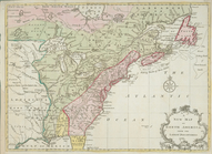
Nieuwe en nauwkeurige kaart v…
parent:
ad81e510-c5
d
4-012f-c43a-58
d
385a7bc34
Map of the states of Ohio Ind…
parent:
a8799910-dd0e-0135-08
d
3-63189acbf5ed
Omaha and vicinity : Nebraska…
parent:
3b516680-
d
21b-0135-953f-04ddc41
d
582e
An accurate map of North Amer…
parent:
6a5739c0-c5
d
4-012f-7f0b-58
d
385a7bc34
Philadelphia and vicinity : P…
parent:
43
d
78210-c969-0135-afce-27ef828b31c7
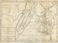
A map of Maryland with the De…
parent:
002b8df0-c5
d
5-012f-256b-58
d
385a7bc34
A new and accurate map of Nor…
parent:
68c8da20-c5
d
5-012f-b24e-58
d
385a7bc34
Plan
d
'York en
parent:
6
d
252
d
90-c5
d
4-012f-5
d
8f-58
d
385a7bc34
Carte de la Louisiane cours d…
parent:
225af000-c5
d
5-012f-37c2-58
d
385a7bc34
Carte de l'Amérique septentrionale, depuis la baye
d
parent:
6e5f8660-c5
d
4-012f-f9ba-58
d
385a7bc34
Carte
d
'une partie de l'Amérique
parent:
6bdb38a0-c5
d
4-012f-ca4e-58
d
385a7bc34
Explorations in Alaska, 1898 …
parent:
6e4a64c0-fd42-0135-0672-691
d
6893db83
Reconnaissance of Pass Fourch…
first:
d
7ab61a0-22e5-0135-0ffc-393da38bc3c9
…'à la Riviere
d
'Hudson : réduite
d
'après
parent:
70ade5f0-c5
d
4-012f-083a-58
d
385a7bc34
California, Nevada City speci…
note:
… Survey, Charles
D
Dominia Anglorum in America S…
parent:
275eb760-c5
d
5-012f-b1f9-58
d
385a7bc34
Official topographical map of…
parent:
8b213ea0-
d
20f-0135-295a-0316fac68768
D
'Engelze volkplanting in Virginie
parent:
05a80
d
50-c5
d
5-012f-890a-58
d
385a7bc34
Iles Marianes
parent:
3
d
2af090-c603-012f-8938-58
d
385a7bc34
Carte de la Pensylvanie et du…
parent:
7025c320-c5
d
4-012f-54ed-58
d
385a7bc34
Carte de la Virginie, du Mary…
parent:
6f8dad70-c5
d
4-012f-0285-58
d
385a7bc34
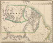
Guyanes
parent:
3c6e28f0-c603-012f-01
d
2-58
d
385a7bc34
A new map of North America fr…
parent:
2886ba10-c5
d
5-012f-67ae-58
d
385a7bc34
California (Los Angeles Co.) …
parent:
8e056520-1401-0136-0989-0436223a19
d
5
m
Colorado
parent:
df02a850-1fe6-0136-3000-01f9978
d
7944
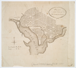
Plan of the city of Washington
parent:
e19599c0-c5
d
4-012f-dd45-58
d
385a7bc34
…
d
'etat de Vermont
parent:
6eed46
d
0-c5
d
4-012f-44c2-58
d
385a7bc34
m
Post route map of the states …
parent:
51ec6220-a146-0135-de3a-00382
d
16690f
California (Nevada Co.), Neva…
note:
… Survey, Charles
D
Galveston entrance, Texas
parent:
f5a23a70-e81b-0135-b7e6-396757a6328
d
Galveston entrance, Texas: fr…
parent:
62c19f00-e81a-0135-983
d
-078a44e2ad92
Explorations in Alaska, 1898 …
parent:
d
4fe8590-b142-0132-
d
8c1-58
d
385a7bbd0
Hydrographic map of Lake Beul…
parent:
f404
d
380-
d
446-012f-412b-58
d
385a7b928
Hydrographic map of Elkhart L…
parent:
5f7f72c0-e34a-0135-7501-003712bad3
d
4
C.
H
. Amerine's sectional map of Puget Sound
parent:
24714
d
70-b145-0132-a6be-58
d
385a7bbd0
…
D
]
parent:
7
d
6ec580-c5ec-012f-fca2-58
d
385a7bc34
County & township map of the …
parent:
bf8f2e30-9c9a-0135-033
d
-0c3c047fdc26
m
Map of Kentucky & Tennessee :…
parent:
88344050-b143-0132-1c22-58
d
385a7bbd0
m
Wisconsin
parent:
f404
d
380-
d
446-012f-412b-58
d
385a7b928
Map no. 1, from San Francisco…
parent:
13c3a900-0083-0136-50bc-37afebfd2f6
d
m
Map [of the republic] of Texa…
parent:
1e5
d
3cf0-bc18-0135-4dcd-319bf841f2b4
A new and accurate map of Nor…
parent:
6840cfe0-c5
d
5-012f-2ae2-58
d
385a7bc34
Illinois--Missouri, St. Louis…
parent:
8147
d
220-c95f-0135-a482-0bfaa8f16ae4
Indiana
parent:
76e029
d
0-b143-0132-
d
8e6-58
d
385a7bbd0
An Accurate map of New York i…
parent:
811f71
d
0-c6f0-012f-001c-3c075448cc4b
Hydrographic map of Delavan a…
parent:
e2
d
496a0-e348-0135-a526-061a364ab2ec
m
Map of the state of Indiana
parent:
76e029
d
0-b143-0132-
d
8e6-58
d
385a7bbd0
Entrance to Wilmington Harbor…
parent:
108b2370-1349-0136-0db3-6148a3acf64
d
m
Map of Michigan & part of Wis…
parent:
c2e47e80-b143-0132-9cdd-58
d
385a7bbd0
m
Map of Ohio and Indiana : exh…
parent:
1707
d
5c0-e745-0135-bf96-0fcf3e645bef