Click to visit the main New York Public Library Homepage
The New York Public Library
Digital Collections
About Digital Collections
Browse
Search only public domain materials
Items
Collections
Divisions
Home
Search
Browse
About
Search only public domain materials
Items
Collections
Divisions
Digital Collections
Using Images
Using Data
Search
Filtered keyword search
Show filters
Hide filters
Show Only Public Domain
topic
History
6
Railroads
3
Canals
2
Geography
2
Post roads
2
More
Less
name
Humphreys, A. A. (Andrew Atkinson), 1810-1883
2
Morse, Jedidiah, 1761-1826
2
Stockdale, John, 1749?-1814
2
United States. Army. Corps of Topographical Engineers
2
Williams, W. (Wellington)
2
More
Less
collection
Maps of North America
13
Lawrence H. Slaughter Collection of English maps, charts, globes, books and atlases
4
I. N. Phelps Stokes Collection of American Historical Prints
1
Maps of New York City and State
1
The generall historie of Virginia, New-England, and the Summer Isles: with the names of the adventurers, planters, and governours from their first beginning, año: 1584. to this present 1626. With the proceedings of those severall colonies and the accidents that befell them in all their journyes and discoveries. Also the maps and descriptions of all those countryes, their commodities, people, government, customes, and religion yet knowne. Divided into sixe bookes
1
place
x
United States
Cuba
2
New England
2
North America
2
Richmond (Va.)
2
More
Less
genre
x
Maps
Prints
2
Illustrations
1
Portraits
1
Road maps
1
publisher
Printed for J. Stockdale
2
A.C. Austin Eng. Co
1
Corps of Topographical Engineers
1
Government Printing Office?
1
H.S. Tanner
1
More
Less
division
Map Division
18
Rare Book Division
1
Wallach Division: Print Collection
1
type
cartographic
20
still image
1
text
1
Date Range
to
20 results found for:
x
International Health Exhibition (1884 : London, England)
Filtering on:
x
Genre
: Maps
x
Place
: United States
Sort by:
Relevance
Title
Date created
Date digitized
Sequence
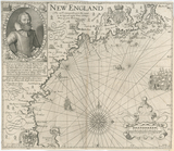
New
England
use:
Can be used inside free NYPL
exhibition
New
England
.
use:
Can be used inside free NYPL
exhibition
Sketch
exhibiting
the approaches to Richmond …
use:
Can be used inside free NYPL
exhibition
Sketch
exhibiting
the position of Yorktown
use:
Can be used inside free NYPL
exhibition
m
Mitchell's new national map
exhibiting
use:
Can be used inside free NYPL
exhibition
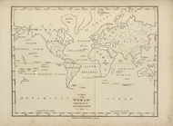
A map of the world,
exhibiting
all the new
use:
Can be used inside free NYPL
exhibition
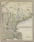
A map of New
England
, New York, New
use:
Can be used inside free NYPL
exhibition
County Map of the United States
exhibiting
use:
Can be used inside free NYPL
exhibition
Map
exhibiting
the lines of march passed
use:
Can be used inside free NYPL
exhibition
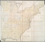
Map of the United States
exhibiting
use:
Can be used inside free NYPL
exhibition
Map
exhibiting
the fixed location
use:
Can be used inside free NYPL
exhibition
… of
internal
communication
use:
Can be used inside free NYPL
exhibition
Map of the United States
exhibiting
use:
Can be used inside free NYPL
exhibition
… island,
exhibiting
use:
Can be used inside free NYPL
exhibition
Map
exhibiting
the approaches to the city
use:
Can be used inside free NYPL
exhibition
… of New
England
in which
use:
Can be used inside free NYPL
exhibition
…,
exhibiting
the tributaries
use:
Can be used inside free NYPL
exhibition
Map of the United States,
exhibiting
use:
Can be used inside free NYPL
exhibition
m
Map of the United States :
exhibiting
use:
Can be used inside free NYPL
exhibition
…;
exhibiting
the boundaries
use:
Can be used inside free NYPL
exhibition
End of results
|
Top