


- The Library Shop
- Privacy Policy
- Rules and Regulations
- Using the Internet
- Website Terms and Conditions
- Gifts of Materials to NYPL
-
© The New York Public Library, 2024
The New York Public Library is a 501(c)(3) | EIN 13-1887440
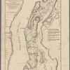
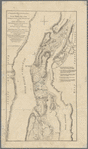
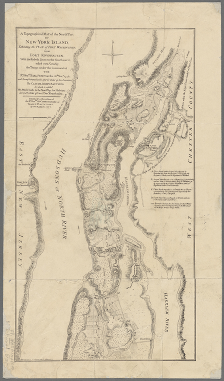
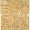
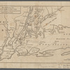
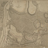
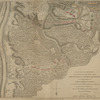
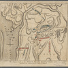
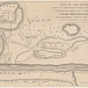
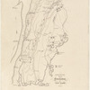
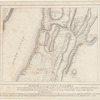
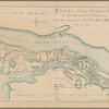
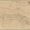
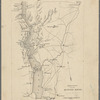
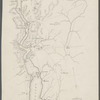
Lionel Pincus and Princess Firyal Map Division, The New York Public Library. "A topographical map of the north.n part of New York island, exhibiting the plan of Fort Washington, now Fort Knyphausen, " The New York Public Library Digital Collections. 1898. https://digitalcollections.nypl.org/items/8e691000-d303-0135-7184-5b89d8226c33
Lionel Pincus and Princess Firyal Map Division, The New York Public Library. "A topographical map of the north.n part of New York island, exhibiting the plan of Fort Washington, now Fort Knyphausen, " New York Public Library Digital Collections. Accessed April 27, 2024. https://digitalcollections.nypl.org/items/8e691000-d303-0135-7184-5b89d8226c33
Lionel Pincus and Princess Firyal Map Division, The New York Public Library. (1898). A topographical map of the north.n part of New York island, exhibiting the plan of Fort Washington, now Fort Knyphausen, Retrieved from https://digitalcollections.nypl.org/items/8e691000-d303-0135-7184-5b89d8226c33
<ref name=NYPL>{{cite web | url=https://digitalcollections.nypl.org/items/8e691000-d303-0135-7184-5b89d8226c33 | title=
(cartographic)
A topographical map of the north.n part of New York island, exhibiting the plan of Fort Washington, now Fort Knyphausen, , (1898)
|author=Digital Collections, The New York Public Library |accessdate=April 27, 2024 |publisher=The New York Public Library, Astor, Lenox, and Tilden Foundations}}</ref>