Click to visit the main New York Public Library Homepage
The New York Public Library
Digital Collections
About Digital Collections
Browse
Search only public domain materials
Items
Collections
Divisions
Home
Search
Browse
About
Search only public domain materials
Items
Collections
Divisions
Digital Collections
Using Images
Using Data
Search
Filtered keyword search
Show filters
Hide filters
Show Only Public Domain
topic
Landowners
30
Administrative and political divisions
29
Real property
24
Railroads
15
Altitudes
13
More
Less
name
Smith, Robert Pearsall, 1827-1898
14
Burr, David H., 1803-1875
5
Gillette, John E
5
Hassler, F. R. (Ferdinand Rudolph), 1770-1843
5
United States Coast Survey
5
More
Less
collection
x
Maps of New York City and State
place
New York (State)
82
New York (N.Y.)
19
New York Metropolitan Area
12
New York
10
Erie Canal (N.Y.)
8
More
Less
genre
x
Maps
Cadastral maps
23
Topographic maps
5
Aerial views
2
Early works to 1800
2
More
Less
publisher
C. Scribner's Sons
3
Published by J.H. Colton & Co
3
Survey of the Coast of the United States
3
s.n
3
A.G. Gillett Publisher
2
More
Less
division
Map Division
99
type
cartographic
98
still image
3
text
1
Date Range
to
99 results found for:
x
Tables
Filtering on:
x
Genre
: Maps
x
Collection
: Maps of New York City and State
For more collection details, visit the
Maps of New York City and State collection page
.
Sort by:
Relevance
Title
Date created
Date digitized
Sequence
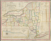
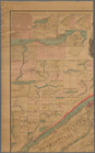
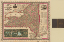
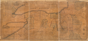
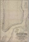
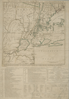
Map of the state of New York …
note:
…
tables
, statistical
tables
and elevation
The tourist's map of the stat…
note:
…. : statistical
tables
; 13 cm.
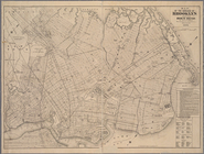
Map of the borough of Brookly…
abstract:
…. Includes
tables
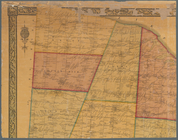
Map of lands in the town of Y…
note:
Includes recapitulation
tables
.
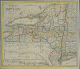
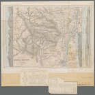
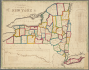
Map of the State of New York …
note:
Includes text and statistical
tables
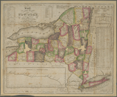
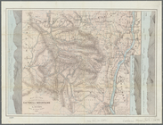
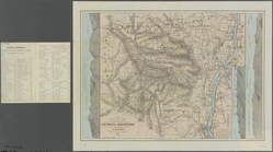
Map of the state of New York …
note:
Includes inset statistical
tables
m
New map of St. Lawrence Count…
note:
…, illus.,
tables
of county
m
Map of the City of Utica, One…
note:
Includes statistical
tables
and local
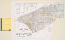
New map of the city of New Yo…
note:
Includes
tables
of the assembly, senatorial
m
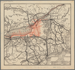
Rand, McNally & Co.'s complet…
note:
Also includes
tables
listing train
m
A new township map of the sta…
note:
… "Excelsior," 2
tables
of 1860
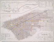
Map of the city of New York, …
note:
Includes fire alarm information and
tables
m
Map of the western part of th…
note:
Includes statistical
tables
m
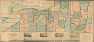
Map of Monroe County, New York
note:
Includes text, statistical
tables
, inset "Map
… country ... : also a
table
note:
….) and
tables
of distances
m
Map of Washington County, New…
abstract:
… statistical
tables
, 16
Hammond's new guide map of Ma…
note:
…
tables
on verso.
m
Maps of the picturesque Catsk…
m
Flushing Bay, Long Island, N.…
note:
Also includes
tables
: Borings
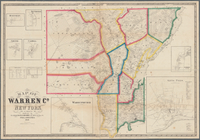
Map of Warren Co., New York
note:
Includes statistical
tables
, and insets
A map of the confluence of th…
note:
Includes
tables
of references.
m
Map of the state of New-York …
note:
Includes indexed
tables
of references
Map of the state of New York …
note:
Includes indexed
tables
of references
m
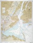
United States--east coast, Ne…
note:
Includes source diagram,
tables
of channel
m
Map of Rensselaer County, New…
note:
Includes statistical
tables
, local
m
Street guide of Manhattan and…
note:
Includes
tables
listing surface car routes
m
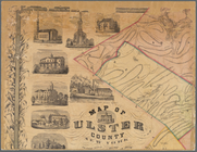
Map of Ulster County, New York
note:
Includes notes, statistical
tables
, 2 inset
m
Map of Tioga County, New York…
note:
Includes statistical
tables
, indexed
The Empire State, New York : …
note:
Includes notes and 3
tables
A map of the state of New Yor…
note:
Includes note,
table
of statistics
m
Map of Ulster County, New York
abstract:
…, statistical
tables
, 3 inset
m
Map of Clinton Co., New York:…
abstract:
… of towns, 4 views,
tables
m
Map of the state of New-York:…
note:
Includes indexed
tables
of references
m
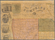
Map of Tompkins County, New Y…
note:
Includes statistical
tables
, local
m
Map of Orange and Rockland Co…
note:
Also Includes
table
Map of the western part of th…
note:
Includes
tables
of statistics and notes.
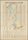
Chart of the Diocese of New Y…
note:
Includes text and
tables
.
Map of water shed of Housaton…
note:
… of the consulting Engineers,
tables
m
New map of that part of the c…
note:
Includes
tables
of statistics regarding
m
Post route map of the State o…
note:
Includes
tables
: General statistics
Topographical map of Seneca C…
note:
… of 1850 statistical
table
, "Village statistics"
table
m
Map of the Catskill Mountains
note:
Also in cover: [3] p.
table
with title
Map of the Catskill Mountains
note:
Also in cover: [3] p.
table
with title
m
Map of the Catskill Mountains
note:
Also in cover: [3] p.
table
with title
The Country twenty five miles…
note:
… "Chronological
table
of the most
Map of Broome County, New York
note:
…, county statistical
table
, distance
table
, inset "Map
Map of the State of New York
note:
…
table
.
Distance map of the state of …
note:
… in the state [diagram and
table
Map of the Rome, Watertown an…
note:
Includes
table
of distances.
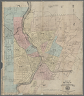
Map of the city of Rochester
note:
Includes city acreage statistical
table