Click to visit the main New York Public Library Homepage
The New York Public Library
Digital Collections
About Digital Collections
Browse
Search only public domain materials
Items
Collections
Divisions
Home
Search
Browse
About
Search only public domain materials
Items
Collections
Divisions
Digital Collections
Using Images
Using Data
Search
Filtered keyword search
Show filters
Hide filters
Show Only Public Domain
topic
Railroads
22
Administrative and political divisions
21
Maps
20
Geography
17
Nautical charts
13
More
Less
name
Geological Survey (U.S.)
16
Mitchell, S. Augustus (Samuel Augustus), 1792-1868
12
Moll, Herman, -1732
12
Thornton, Samuel
12
M.I.T. Press
10
More
Less
collection
Maps of North America
101
Lawrence H. Slaughter Collection of English maps, charts, globes, books and atlases
42
Maps of New York City and State
32
Atlases, gazetteers, guidebooks and other books
23
Atlases of the United States
16
More
Less
place
New England
61
New York (State)
55
New York (N.Y.)
29
New Jersey
26
United States
20
More
Less
genre
x
Maps
Prints
17
Atlases
15
Nautical charts
12
Geological maps
4
More
Less
publisher
The Suvery
13
publisher not identified
11
MIT Press
10
Chapman and Hall
7
s.n
7
More
Less
division
Map Division
242
Wallach Division: Print Collection
13
General Research Division
4
Rare Book Division
3
Schomburg Jean Blackwell Hutson Research and Reference Division
3
More
Less
type
cartographic
258
still image
18
text
4
Date Range
to
269 results found for:
x
International Health Exhibition (1884 : London, England)
Filtering on:
x
Genre
: Maps
Sort by:
Relevance
Title
Date created
Date digitized
Sequence
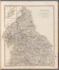
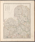
England
I
use:
Can be used inside free NYPL
exhibition
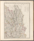
England
IV
use:
Can be used inside free NYPL
exhibition
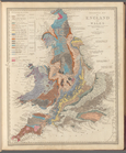
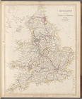
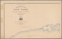
Geological map of
England
and Wales
use:
Can be used inside free NYPL
exhibition
England
II
use:
Can be used inside free NYPL
exhibition
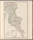
England
III
use:
Can be used inside free NYPL
exhibition
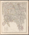
England
V
use:
Can be used inside free NYPL
exhibition
England
with its canals and railways
use:
Can be used inside free NYPL
exhibition
England
& Wales
use:
Can be used inside free NYPL
exhibition
m
Chart of the world
exhibiting
its chief pysical
use:
Can be used inside free NYPL
exhibition
m
Mercator projection
exhibiting
the discoveries
use:
Can be used inside free NYPL
exhibition
… for the Great
Exhibition
of 1892
use:
Can be used inside free NYPL
exhibition
m
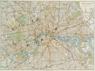
Reynolds' map of modern
London
divided
use:
Can be used inside free NYPL
exhibition
Plan of
London
use:
Can be used inside free NYPL
exhibition
… to
exhibit
the localities
use:
Can be used inside free NYPL
exhibition
… are
exhibited
use:
Can be used inside free NYPL
exhibition
England
and Wales or South Britain
use:
Can be used inside free NYPL
exhibition
Map of New
England
, with adjacent portions of New
use:
Can be used inside free NYPL
exhibition
Map of New
England
with adjacent portions of New
use:
Can be used inside free NYPL
exhibition
Map of New
England
and the provinces to accompany
use:
Can be used inside free NYPL
exhibition
… part of
London
use:
Can be used inside free NYPL
exhibition
m
London
surveyed
use:
Can be used inside free NYPL
exhibition
A chart of the world :
exhibiting
use:
Can be used inside free NYPL
exhibition
…
Exhibition
at Philadelphia
use:
Can be used inside free NYPL
exhibition
… of New
England
in which
use:
Can be used inside free NYPL
exhibition
Map
exhibiting
the fixed location
use:
Can be used inside free NYPL
exhibition
…
Exhibition
at Philadelphia
use:
Can be used inside free NYPL
exhibition
… island,
exhibiting
use:
Can be used inside free NYPL
exhibition
A plat
exhibiting
the state of the surveys
use:
Can be used inside free NYPL
exhibition
Health
Department physicians to the poor
use:
Can be used inside free NYPL
exhibition
Map
exhibiting
the routes between Fort
use:
Can be used inside free NYPL
exhibition
… in New
England
in America
use:
Can be used inside free NYPL
exhibition
Sketch
exhibiting
the approaches to Richmond …
use:
Can be used inside free NYPL
exhibition
Map
exhibiting
the salt marsh, tide
use:
Can be used inside free NYPL
exhibition
Sketch
exhibiting
the approaches to Richmond from
use:
Can be used inside free NYPL
exhibition
…-Mississippi and
International
use:
Can be used inside free NYPL
exhibition
A map of New
England
& ye country
use:
Can be used inside free NYPL
exhibition
International
Railway and Steamship
use:
Can be used inside free NYPL
exhibition
Map of the United States
exhibiting
use:
Can be used inside free NYPL
exhibition
Map of New
England
City, Dade County, Ga. …
use:
Can be used inside free NYPL
exhibition
…
exhibiting
the post offices
use:
Can be used inside free NYPL
exhibition
A plat
exhibiting
the state of the surveys
use:
Can be used inside free NYPL
exhibition
A plat
exhibiting
the state of the surveys
use:
Can be used inside free NYPL
exhibition
A plat
exhibiting
the state of the surveys
use:
Can be used inside free NYPL
exhibition
A plat
exhibiting
the state of the surveys
use:
Can be used inside free NYPL
exhibition
m
…,
exhibiting
the structure
use:
Can be used inside free NYPL
exhibition
Rail road map of New
England
, Canada
use:
Can be used inside free NYPL
exhibition
Albany Rural Cemetery,
1884
use:
Can be used inside free NYPL
exhibition
…,
1884
use:
Can be used inside free NYPL
exhibition
Southern New
England
use:
Can be used inside free NYPL
exhibition
Southern New
England
and New York
use:
Can be used inside free NYPL
exhibition
1
2
Previous
Next
1
2
Previous
Next