Click to visit the main New York Public Library Homepage
The New York Public Library
Digital Collections
About Digital Collections
Browse
Search only public domain materials
Items
Collections
Divisions
Home
Search
Browse
About
Search only public domain materials
Items
Collections
Divisions
Digital Collections
Using Images
Using Data
Search
Filtered keyword search
Show filters
Hide filters
Show Only Public Domain
topic
Railroads
22
Administrative and political divisions
21
Maps
20
Geography
17
Nautical charts
13
More
Less
name
Geological Survey (U.S.)
16
Mitchell, S. Augustus (Samuel Augustus), 1792-1868
12
Moll, Herman, -1732
12
Thornton, Samuel
12
M.I.T. Press
10
More
Less
collection
Maps of North America
101
Lawrence H. Slaughter Collection of English maps, charts, globes, books and atlases
42
Maps of New York City and State
32
Atlases, gazetteers, guidebooks and other books
23
Atlases of the United States
16
More
Less
place
New England
61
New York (State)
55
New York (N.Y.)
29
New Jersey
26
United States
20
More
Less
genre
x
Maps
Prints
17
Atlases
15
Nautical charts
12
Geological maps
4
More
Less
publisher
The Suvery
13
publisher not identified
11
MIT Press
10
Chapman and Hall
7
s.n
7
More
Less
division
Map Division
242
Wallach Division: Print Collection
13
General Research Division
4
Rare Book Division
3
Schomburg Jean Blackwell Hutson Research and Reference Division
3
More
Less
type
cartographic
258
still image
18
text
4
Date Range
to
269 results found for:
x
International Health Exhibition (1884 : London, England)
Filtering on:
x
Genre
: Maps
Sort by:
Relevance
Title
Date created
Date digitized
Sequence
…:
Exhibiting
the Geographical
use:
Can be used inside free NYPL
exhibition
… to
exhibit
the localities
use:
Can be used inside free NYPL
exhibition
Plan of
London
use:
Can be used inside free NYPL
exhibition
… are
exhibited
use:
Can be used inside free NYPL
exhibition
A chart of the world :
exhibiting
use:
Can be used inside free NYPL
exhibition
…-
England
, and the Summer
use:
Can be used inside free NYPL
exhibition
m
… and townships :
exhibiting
use:
Can be used inside free NYPL
exhibition
… world :
exhibiting
use:
Can be used inside free NYPL
exhibition
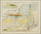
A map of the state of New York :
exhibiting
use:
Can be used inside free NYPL
exhibition
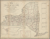
A map of the State of New York :
exhibiting
use:
Can be used inside free NYPL
exhibition
…,
exhibiting
the line of the N
use:
Can be used inside free NYPL
exhibition
m
The ideal tour: [New
England
]
use:
Can be used inside free NYPL
exhibition
m
Map of New York
exhibiting
the post offices
use:
Can be used inside free NYPL
exhibition
…
England
, New York, New
use:
Can be used inside free NYPL
exhibition
…
England
, New York ....
use:
Can be used inside free NYPL
exhibition
A new map of New
England
and New York
use:
Can be used inside free NYPL
exhibition
New
England
and New York
use:
Can be used inside free NYPL
exhibition
Health
use:
Can be used inside free NYPL
exhibition
Health
(cont.)…
use:
Can be used inside free NYPL
exhibition
Hospitals and
Health
Facilities
use:
Can be used inside free NYPL
exhibition
Health
use:
Can be used inside free NYPL
exhibition
Health
(cont.)…
use:
Can be used inside free NYPL
exhibition
Health
(cont.)…
use:
Can be used inside free NYPL
exhibition
The Bronx Hospitals and
Health
Facilities
use:
Can be used inside free NYPL
exhibition
Brooklyn Hospitals and
Health
Facilities
use:
Can be used inside free NYPL
exhibition
Manhattan Hospitals and
Health
Facilities
use:
Can be used inside free NYPL
exhibition
Queens Hospitals and
Health
Facilities
use:
Can be used inside free NYPL
exhibition
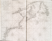
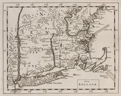
A chart of the sea coasts of New-
England
use:
Can be used inside free NYPL
exhibition
… belongs to
England
, Spain
use:
Can be used inside free NYPL
exhibition
m
… Scotland, New
England
, New
use:
Can be used inside free NYPL
exhibition
m
… territories of
England
use:
Can be used inside free NYPL
exhibition
…
England
and Wales.
use:
Can be used inside free NYPL
exhibition
m
London
surveyed
use:
Can be used inside free NYPL
exhibition
A chart of the sea coasts of New
England
use:
Can be used inside free NYPL
exhibition
New
England
and New York
use:
Can be used inside free NYPL
exhibition
A new map of North America wi…
use:
Can be used inside free NYPL
exhibition
…, villages,
internal
use:
Can be used inside free NYPL
exhibition
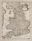
England
and Wales or South Britain
use:
Can be used inside free NYPL
exhibition
Map of North America :
exhibiting
use:
Can be used inside free NYPL
exhibition
England
, Scotland & Ireland, with the iles
use:
Can be used inside free NYPL
exhibition
England
.
use:
Can be used inside free NYPL
exhibition
New
England
.
use:
Can be used inside free NYPL
exhibition
…;
exhibiting
the boundaries
use:
Can be used inside free NYPL
exhibition
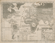
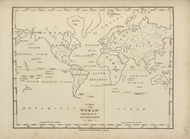
A map of the world,
exhibiting
all the new
use:
Can be used inside free NYPL
exhibition
m
…,
exhibiting
the structure
use:
Can be used inside free NYPL
exhibition
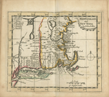
A map of New
England
, New York, New
use:
Can be used inside free NYPL
exhibition
m
…,
exhibiting
the United States
use:
Can be used inside free NYPL
exhibition
This colour'd map
exhibits
a general view
use:
Can be used inside free NYPL
exhibition
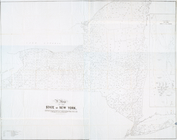
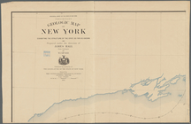
Map of the State of New-York
exhibiting
use:
Can be used inside free NYPL
exhibition
… territories of
England
use:
Can be used inside free NYPL
exhibition
1
2
Previous
Next
1
2
Previous
Next