Click to visit the main New York Public Library Homepage
The New York Public Library
Digital Collections
About Digital Collections
Browse
Search only public domain materials
Items
Collections
Divisions
Home
Search
Browse
About
Search only public domain materials
Items
Collections
Divisions
Digital Collections
Using Images
Using Data
Search
Filtered keyword search
Show filters
Hide filters
Show Only Public Domain
topic
Real property
69
Fire insurance
18
Cities & towns
16
Administrative and political divisions
13
Landowners
13
More
Less
name
G.W. Bromley & Co
22
Sanborn Map Company
16
Perris, William
14
Bromley, George Washington
6
Bromley, Walter Scott
6
More
Less
collection
Atlases of New York City
67
Bancker plans
32
Maps of New York City and State
26
Maps of North America
16
Collection of broadside real estate maps announcing auctions of lots in early 19th century New York City
4
More
Less
place
New York (State)
87
New York
61
Manhattan (New York, N.Y.)
42
Brooklyn (New York, N.Y.)
15
New York (N.Y.)
14
More
Less
genre
x
Maps
Surveys
32
land surveys
31
Cadastral maps
10
Illustrations
3
More
Less
publisher
G.W. Bromley & Co
22
Sanborn Map Company
16
Lith. by Korff Brothers
8
William Perris, Civil Engineer
8
Perris & Browne
7
More
Less
division
Map Division
113
Manuscripts and Archives Division
32
No Division
1
Rare Book Division
1
type
cartographic
149
text
5
still image
4
Date Range
to
150 results found for:
x
Pearl
Filtering on:
x
Genre
: Maps
Sort by:
Relevance
Title
Date created
Date digitized
Sequence
m
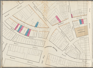
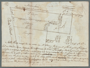
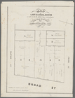
Maps of property in the city …
note:
… index, map of 277
Pearl
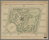
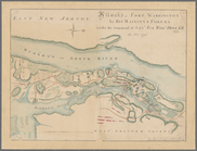
Plan of the Central Park, Cit…
note:
…"[L]ith. by G[eo.] Hayward, 171
Pearl
Street
Block sketch 1679, New York C…
Design for laying out the gro…
Map of the enlarged city of B…
m
Watson's new map of New York …
m
Map & plan of the contemplate…
abstract:
…, Stone Street,
Pearl
Map & plan of the contemplate…
abstract:
…, Stone Street,
Pearl
Map of valuable property in t…
abstract:
…,
Pearl
Street
Map of lots & buildings as sh…
abstract:
Water Street, Broad Street,
Pearl
Street
m
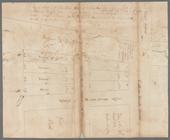
Topographical map of the coun…
note:
…
Pearl
Street, New York."…
A sketch of the operations of…
note:
…. Hayward, 171
Pearl
St
m
Map [of the republic] of Texa…
note:
…. 174
Pearl
St. New York."…
m
City of Toledo, Lucas Co., Oh…
note:
… & architect, No. 140
Pearl
St
Indexed commercial map of Cin…
Map of Perry County, Ohio
note:
…
Pearl
Street, New York.
Hawaiian Islands
abstract:
…:
Pearl
River and lochs
Attacks of Fort Washington by…
note:
…
Pearl
St., New York.
m
Watson and Adams new topograp…
Map of the "Hunter Fly Farm" …
m
Map of n. eastern Virginia an…
note:
…
Pearl
St., N.Y."…
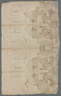
m
Great Dock
note:
…, and includes
Pearl
Street
m
Pine Street from
Pearl
Street to South
m
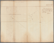
Griswold's encroachment
note:
… of
Pearl
Street.
m
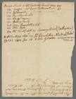
1810 January 8
collection:
Pearl
Street, Maiden Lane, Old Slip
m
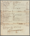
1810 January 7
collection:
Pearl
Street, Maiden Lane, Old Slip
m
Hague Street, Skinner Street,…
note:
For Isaac Gouverneur. Includes
Pearl
m
Jacob Walton's
note:
Pearl
Street to Water Street along South
m
Pine Street drain
note:
…. Pine Street,
Pearl
m
Pine Street drain
note:
…?). Pine Street,
Pearl
m
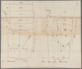
Pearl
Street to Water Street
m
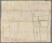
Pearl
and Pine Streets
m
Pearl
Street
note:
For Thomas Collins.
Pearl
Street between
m
Pearl
Street
m
Pearl
and John Street
m
South side of
Pearl
Street
m
Division Street and
Pearl
Street
m
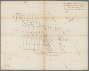
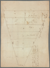
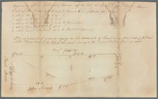
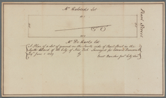
Pearl
Street
m
Pearl
Street
m
Pearl
Street
m
Pearl
Street
m
Pearl
Street
m
Pearl
Street
m
Pearl
Street near Rutgers and Chatham Walk
note:
… side of
Pearl
Street.
m
Pearl
Street, formerly Hanover Square
m
Queen Street, Water Street, F…
note:
Walton's lots. Water Street to
Pearl
m
Governeur's drain
note:
Water Street and
Pearl
Street
m
Mr. Walton's
note:
Pearl
Street to South Street along Old
m
Bridge,
Pearl
, Front, and Water Streets
m
Pearl
Street and Maiden Lane