Click to visit the main New York Public Library Homepage
The New York Public Library
Digital Collections
About Digital Collections
Browse
Search only public domain materials
Items
Collections
Divisions
Home
Search
Browse
About
Search only public domain materials
Items
Collections
Divisions
Digital Collections
Using Images
Using Data
Search
Filtered keyword search
Show filters
Hide filters
Show Only Public Domain
topic
Real property
98
Administrative and political divisions
81
Nautical charts
75
Landowners
72
Railroads
64
More
Less
name
Mitchell, S. Augustus (Samuel Augustus), 1792-1868
69
United States Coast Survey
58
Bache, A. D. (Alexander Dallas), 1806-1867
53
Burr, David H., 1803-1875
32
New York (N.Y.). Department of Parks. Topographical Division
29
More
Less
collection
Maps of North America
299
Maps of New York City and State
99
Atlases of the United States
72
Atlases, gazetteers, guidebooks and other books
52
Lawrence H. Slaughter Collection of English maps, charts, globes, books and atlases
37
More
Less
place
New York (State)
120
United States
66
New York (N.Y.)
55
New York Metropolitan Area
39
New Jersey
32
More
Less
genre
x
Maps
Atlases
62
Nautical charts
49
Cadastral maps
45
Topographic maps
40
More
Less
publisher
S. A. Mitchell, jr
50
The Division
29
U.S. Coast Survey
28
Stone and Clark,
26
publisher not identified
16
More
Less
division
Map Division
604
Rare Book Division
2
George Arents Collection
1
Manuscripts and Archives Division
1
Wallach Division: Print Collection
1
type
cartographic
603
still image
21
text
14
Date Range
to
609 results found for:
x
Tables
Filtering on:
x
Genre
: Maps
Sort by:
Relevance
Title
Date created
Date digitized
Sequence
A chart of coasts of CIMBEBAS…
A chart of Delaware Bay and R…
note:
Includes text and "Tide
table
."…
A chart of Delaware Bay and R…
note:
Includes tide-
table
and list of pilots
A chart of Delaware Bay and R…
note:
Includes tide-
table
and list of pilots
A chart of Delaware Bay and R…
note:
Includes list of subscribers and "Tide
table
."…
A chart of Delaware Bay and R…
note:
Includes list of subscribers and "Tide
table
."…
m
A chart of North and South Am…
note:
… notes, and
tables
A chart of North and South Am…
note:
… notes, and
tables
m
A chart of the harbour of Rho…
abstract:
…
table
of reference
A chart of the world : exhibi…
note:
Includes notes,
table
of "Extent
A general map of the middle B…
note:
Includes historical notes, 3 distance
tables
A general map of the middle B…
note:
Includes historical notes, 3 distance
tables
A general map of the world, o…
note:
Includes text, diagrams, and
tables
.
A map of Mexico, Louisiana, a…
note:
Includes
tables
of latitude, longitude, Native
A map of Philadelphia and par…
abstract:
… to the "
Table
of distances
m
A map of Schuylkill County, P…
abstract:
…,
tables
of distances
m
A map of South Carolina and a…
abstract:
Prime meridian: London. Includes
tables
m
A map of South Carolina and a…
abstract:
… by soundings. Includes
tables
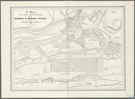
A map of the confluence of th…
note:
Includes
tables
of references.
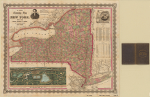
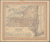
A map of the state of New Yor…
note:
Includes note,
table
of statistics
A map of the state of Virgini…
abstract:
… and geology, and
tables
m
A map of the state of Virgini…
note:
…, population
table
, statistical
table
, geographical
A map of the states of Connec…
note:
Print contains a
table
of postroad
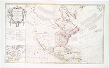
A map of the whole continent …
A new and accurate chart (fro…
note:
Includes 6 views, notes, and "
Table
A new and accurate chart (fro…
note:
Includes 4 views, notes, and "
Table
A new and exact map of France…
note:
[Includes: an alphabetical
table
A new chart of the vast Atlan…
note:
Includes text, notes, and "A
table
A new chart of the vast Atlan…
note:
Includes notes and "A
table
comparing
A new chart of the vast Atlan…
note:
Includes notes and "A
table
comparing
A new county map of the state…
note:
Statistical
table
shows population
A new map of Carolina
abstract:
… by soundings. Includes a "
Table
m
A new map of Indiana : exhibi…
abstract:
…
table
of population
A new map of New York: with i…
note:
Includes
table
of distances for steam boat
A new map of North America: w…
note:
…, and a
table
showing
A new map of Pennsylvania : w…
note:
…" and
tables
of steamboat
A new map of the Hudson River…
note:
… and distance
table
on inside
A new map of the states of Ca…
abstract:
… explanation,
table
A new map of the whole contin…
note:
… & Hudsons bays,"
tables
A new plan of ye great town o…
abstract:
….
Table
of references
m
A new township map of the sta…
note:
… "Excelsior," 2
tables
of 1860
A series of columnar sections…
note:
Includes notes,
table
of "Geographical
A sketch of the environs of C…
note:
… of
table
of references.
A sketch of the environs of C…
note:
… of
table
of references.
A sketch of the operations of…
abstract:
….
Table
of references
A topographical map of Steube…
note:
Includes population statistical
table
, local
A.R. Roessler's latest map of…
abstract:
… of Texas," with "
Tables
…, New York.;
Table
… County. ;
Table
…. ;
Table
of Distances
1
2
3
Previous
Next
1
2
3
Previous
Next