Click to visit the main New York Public Library Homepage
The New York Public Library
Digital Collections
About Digital Collections
Browse
Search only public domain materials
Items
Collections
Divisions
Home
Search
Browse
About
Search only public domain materials
Items
Collections
Divisions
Digital Collections
Using Images
Using Data
Search
Filtered keyword search
Show filters
Hide filters
Show Only Public Domain
topic
Real property
98
Administrative and political divisions
81
Nautical charts
75
Landowners
72
Railroads
64
More
Less
name
Mitchell, S. Augustus (Samuel Augustus), 1792-1868
69
United States Coast Survey
58
Bache, A. D. (Alexander Dallas), 1806-1867
53
Burr, David H., 1803-1875
32
New York (N.Y.). Department of Parks. Topographical Division
29
More
Less
collection
Maps of North America
299
Maps of New York City and State
99
Atlases of the United States
72
Atlases, gazetteers, guidebooks and other books
52
Lawrence H. Slaughter Collection of English maps, charts, globes, books and atlases
37
More
Less
place
New York (State)
120
United States
66
New York (N.Y.)
55
New York Metropolitan Area
39
New Jersey
32
More
Less
genre
x
Maps
Atlases
62
Nautical charts
49
Cadastral maps
45
Topographic maps
40
More
Less
publisher
S. A. Mitchell, jr
50
The Division
29
U.S. Coast Survey
28
Stone and Clark,
26
publisher not identified
16
More
Less
division
Map Division
604
Rare Book Division
2
George Arents Collection
1
Manuscripts and Archives Division
1
Wallach Division: Print Collection
1
type
cartographic
603
still image
21
text
14
Date Range
to
609 results found for:
x
Tables
Filtering on:
x
Genre
: Maps
Sort by:
Relevance
Title
Date created
Date digitized
Sequence
Results 251 - 300
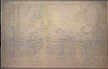
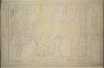
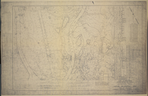
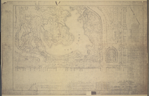
M-T-10-107: [Bounded by West …
note:
…
table
of coordinates, notes,
table
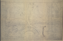
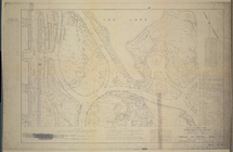
M-T-10-108: [Bounded by North…
note:
…
table
of coordinates, notes,
table
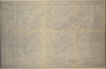
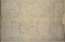
M-T-10-109: [Bounded by West …
note:
…
table
of coordinates, notes,
table
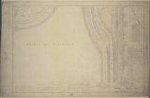
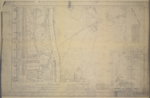
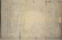
M-T-10-110: [Bounded by Bridl…
note:
…
table
of coordinates, notes,
table
M-T-10-111: [Bounded by West …
note:
…
table
of coordinates, notes,
table
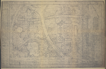
M-T-10-112: [Bounded by Bridl…
note:
…
table
of coordinates, notes,
table
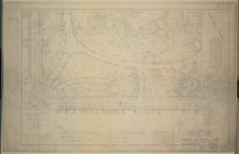
M-T-10-113: [Bounded by West …
note:
…
table
of coordinates, notes,
table
M-T-10-114: [Bounded by Bridl…
note:
…
table
of coordinates, notes,
table
M-T-10-115: [Bounded by West …
note:
…
table
of coordinates, notes,
table
M-T-10-116: [Bounded by East …
note:
…
table
of coordinates, notes,
table
M-T-10-118: [Bounded by East …
note:
…
table
of coordinates, notes,
table
M-T-10-119: [Bounded by West …
note:
…
table
of coordinates, notes,
table
M-T-10-120: [Bounded by (The …
note:
…
table
of coordinates, notes,
table
M-T-10-121: [Bounded by West …
note:
…
table
of coordinates, notes,
table
M-T-10-122: [Bounded by (The …
note:
…
table
of coordinates, notes,
table
M-T-10-123: [Bounded by West …
note:
…
table
of coordinates, notes,
table
M-T-10-124: [Bounded by (The …
note:
…
table
of coordinates, notes,
table
M-T-10-125: [Bounded by West …
note:
…
table
of coordinates, notes,
table
M-T-10-126: [Bounded by (The …
note:
…
table
of coordinates, notes,
table
M-T-10-127: [Bounded by Colum…
note:
…
table
of coordinates, notes,
table
M-T-10-128: [Bounded by (The …
note:
…
table
of coordinates, notes,
table
War Department weather map: N…
abstract:
…. Includes
table
Map of the eastern townships …
note:
…
table
of distances
Map of the United States : wi…
note:
… and statistical
table
The country twenty five miles…
note:
… "Chronological
table
of the most
m
Lay's map of the United States
note:
… "Statistical
table
of the United States" and
table
m
Map of the United States with…
note:
Includes statistical
table
and inset
Hydrographic reconnaissance o…
abstract:
…. Includes notes, tide
table
, and magnetic variation
table
Map of Virginia : showing the…
note:
… comparison
table
of Virginia
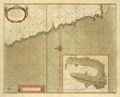
A chart of coasts of CIMBEBAS…
Mitchell's travellers guide t…
note:
… routes, statistical
table
Map of the United States and …
note:
…, historical notes, "
Table
of Distances", and "
Table
m
Map Of The State Of Maine
note:
…
table
from 1860
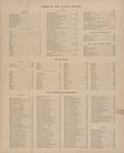
Table
of Contents. ; Maps. ; Illustrations.
Map of Broome County, New York
note:
…, county statistical
table
, distance
table
, inset "Map
A chart of Delaware Bay and R…
note:
Includes tide-
table
and list of pilots
City of San Francisco and its…
note:
U.S. Coast Survey ; from a plane
table
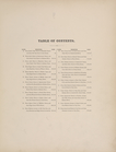
Table
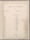
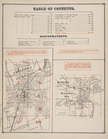
of Contents: Village Plans - Towns.
Table
of Distances
Table
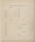
of Contents.
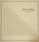
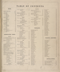
Table
of Air-Line Distances for Erie County, N
collection:
Table
of Air-Line Distances for Erie County
Table
of Contents.
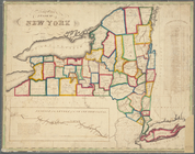
Map of the State of New York
note:
…
table
.
m
Post route map of the states …
abstract:
… offices,
table
of general statistics, and
table
Distance map of the state of …
note:
… in the state [diagram and
table
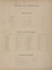
Table
of contents.
Table
of Contents.
Table
Of Contents.
Table
of Contents.
Table
of Contents.
1
2
3
Previous
Next
1
2
3
Previous
Next