Click to visit the main New York Public Library Homepage
The New York Public Library
Digital Collections
About Digital Collections
Browse
Search only public domain materials
Items
Collections
Divisions
Home
Search
Browse
About
Search only public domain materials
Items
Collections
Divisions
Digital Collections
Using Images
Using Data
Search
Filtered keyword search
Show filters
Hide filters
Show Only Public Domain
topic
Real property
98
Administrative and political divisions
81
Nautical charts
75
Landowners
72
Railroads
64
More
Less
name
Mitchell, S. Augustus (Samuel Augustus), 1792-1868
69
United States Coast Survey
58
Bache, A. D. (Alexander Dallas), 1806-1867
53
Burr, David H., 1803-1875
32
New York (N.Y.). Department of Parks. Topographical Division
29
More
Less
collection
Maps of North America
299
Maps of New York City and State
99
Atlases of the United States
72
Atlases, gazetteers, guidebooks and other books
52
Lawrence H. Slaughter Collection of English maps, charts, globes, books and atlases
37
More
Less
place
New York (State)
120
United States
66
New York (N.Y.)
55
New York Metropolitan Area
39
New Jersey
32
More
Less
genre
x
Maps
Atlases
62
Nautical charts
49
Cadastral maps
45
Topographic maps
40
More
Less
publisher
S. A. Mitchell, jr
50
The Division
29
U.S. Coast Survey
28
Stone and Clark,
26
publisher not identified
16
More
Less
division
Map Division
604
Rare Book Division
2
George Arents Collection
1
Manuscripts and Archives Division
1
Wallach Division: Print Collection
1
type
cartographic
603
still image
21
text
14
Date Range
to
609 results found for:
x
Tables
Filtering on:
x
Genre
: Maps
Sort by:
Relevance
Title
Date created
Date digitized
Sequence
Results 501 - 550
The harbor of Holmes' Hole: t…
note:
Includes
table
of tides and notes
m
Map of Garrard and Lincoln co…
abstract:
… directory, population
table
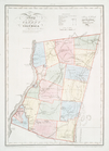
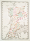
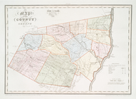
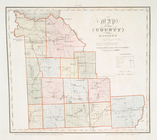
Map of the county of Columbia
note:
…
table
.
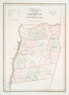
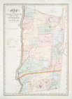
Map of the County of Renssela…
note:
…
table
.
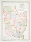
Map of the county of Saratoga
note:
…
table
.
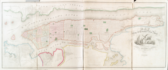
Map of the city and county of…
note:
…
table
.
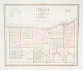
Map of the county of Onondaga
note:
…
table
.
Map of the county of Cayuga
note:
…
table
.
Map of the county of Seneca
note:
…
table
.
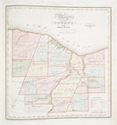
Map of the county of Wayne
note:
…
table
.
Map of the county of Monroe
note:
…
table
.
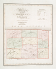
Map of the county of Orleans
note:
…
table
.
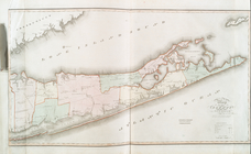
Map of the county of Suffolk
note:
…
table
.
Map of the county of Erie
note:
…
table
.
Map of the county of Westches…
note:
…
table
.
Map of the counties of Dutche…
note:
…
table
.
Map of the county of Ulster
note:
…
table
.
Map of Virginia showing the d…
note:
Includes population
table
"Census of 1860."…
Preliminary chart of Hampton …
abstract:
… on tides and a
table
Traveller's map of Michigan, …
abstract:
… a population
table
and 3 insets
The Province of New Jersey : …
note:
Includes
table
of "Astronomical observations."…
m
Map of Scott Co., Kentucky : …
abstract:
…, population
table
, and 4 inset
m
The travellers pocket map of …
abstract:
…
table
of steam boat
m
Map of Montgomery County, Ken…
abstract:
…, population
table
, and 4 inset
Nome City, Alaska, and vicini…
abstract:
Recto includes
table
of distances
m
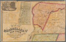
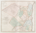
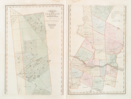
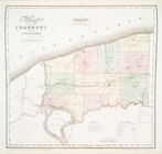
Map of Rensselaer Co., New Yo…
note:
Includes a
table
of distances, local business
Preliminary chart of the sea …
abstract:
… includes: tide
table
; note
Map illustrating the plan of …
note:
Includes distance
table
.
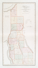
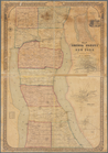
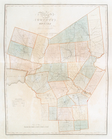
Map of Seneca County, New Yor…
note:
Includes population statistical
table
, bar scale
Océan Atlantique nord, côtes …
abstract:
…
table
of tide
Sketch of the action on the h…
note:
Includes a
table
of "References" identifying
A topographical map of Steube…
note:
Includes population statistical
table
, local
m
New map of Kings and Queens c…
note:
…
table
" (a directory
The harbor of Holmes' Hole: t…
note:
Includes
table
of tides and notes
Preliminary chart of Gloucest…
note:
…, bottoms
table
and dangers
m
Map of Christian County, Ky. …
abstract:
…, population
table
, and insets
m
Map of New-York Bay and Harbo…
note:
Includes text,
table
of currents, notes
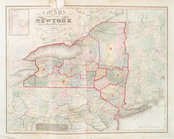
Map of the state of New-York …
note:
…
table
.
Map of the county of Greene
note:
…
table
.
Map of the county of Herkimer
note:
…
table
.
Map of the county of Oneida
note:
…
table
.
Map of the county of Madison
note:
…
table
.
Map of the county of Niagara
note:
…
table
.
Legare Anchorage : Florida re…
abstract:
…
Table
; Note regarding
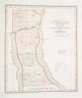
Post route map of the state o…
note:
Includes
table
of "Distances computed
m
New map of Burlington County:…
note:
…
table
, and 5 vignettes
m
A chart of the harbour of Rho…
abstract:
…
table
of reference
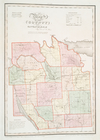
Map of the general government…
note:
Includes
table
showing progress
m
Map of Marion and Washington …
abstract:
… directory, population
table
The Hawaiian Islands: compile…
abstract:
…, and
table
of distances from
1
2
3
Previous
Next
1
2
3
Previous
Next