Click to visit the main New York Public Library Homepage
The New York Public Library
Digital Collections
About Digital Collections
Browse
Search only public domain materials
Items
Collections
Divisions
Home
Search
Browse
About
Search only public domain materials
Items
Collections
Divisions
Digital Collections
Using Images
Using Data
Search
Filtered keyword search
Show filters
Hide filters
Show Only Public Domain
topic
Geography
418
Nautical charts
381
Atlases
172
History
157
Maps in education
98
More
Less
name
United States Coast Survey
202
Thornton, Samuel
173
Bache, A. D. (Alexander Dallas), 1806-1867
171
Ortelius, Abraham, 1527-1598
126
Coignet, Michel, 1549-1623
125
More
Less
collection
Lawrence H. Slaughter Collection of English maps, charts, globes, books and atlases
1218
Maps of North America
372
Atlases, gazetteers, guidebooks and other books
185
Maps of New York City and State
98
In motion : the African-American migration experience: Maps by Michael Siegel
47
More
Less
place
Great Britain
237
United States
220
America
186
Maps
140
North America
125
More
Less
genre
x
Maps
Nautical charts
397
Bathymetric maps
103
Charts
83
Prints
59
More
Less
publisher
Printed for Ieames Shawe, and are to be solde at his shoppe nigh Ludgate,
125
Printed by the author, and are to be had at his house
115
Chapman and Hall
109
U.S. Coast Survey
95
Printed by A. Godbid and J. Playford, for R. Scott, bookseller
53
More
Less
division
Map Division
1909
General Research Division
69
Schomburg Jean Blackwell Hutson Research and Reference Division
49
Rare Book Division
15
Spencer Collection
12
More
Less
type
cartographic
1967
still image
149
text
91
Date Range
to
Looking for this collection?
Lawrence H. Slaughter Collection of English maps, charts, globes, books and atlases
1,252 items
2,092 results found for:
x
Charts
Filtering on:
x
Genre
: Maps
Sort by:
Relevance
Title
Date created
Date digitized
Sequence
Chart
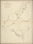
of the entrance of Hudson's River
topic:
Nautical
charts
Pas kaart van de zee kusten v…
topic:
Nautical
charts
…
chart
for the West
topic:
Nautical
charts
A
Chart
of ye coast of New England, New York
topic:
Nautical
charts
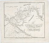
The bay and river of Delaware
topic:
Nautical
charts
Atlantic Coast, Chesapeake en…
topic:
Nautical
charts
Bowles's new pocket map of th…
topic:
Nautical
charts
m
Eastern part of Long Island S…
abstract:
Includes
charts
of tides, bottom types
m
Oyster Bay and Huntington, Hu…
topic:
Nautical
charts
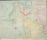
A draught of New York and Per…
topic:
Nautical
charts
A Generall
chart
topic:
Nautical
charts
A draught of New York from th…
topic:
Nautical
charts
Chart
of a part of the Gulf of Mexico …
topic:
Nautical
charts
Map of Sacramento River and b…
topic:
Nautical
charts
Reconnaissance of Canal de Ha…
topic:
Nautical
charts
A
chart
of Delaware Bay and River
note:
Nautical
charts
, with depths shown by soundings
America, N.W. Coast, Strait o…
topic:
Nautical
charts
Preliminary sketch of Wachapr…
abstract:
…. Includes tidal
chart
…
chart
for the West
topic:
Nautical
charts
Ocean Atlantique, ou, Mer du …
topic:
Nautical
charts
Chart
of the coast of America : From Albermarle
The State of New Jersey.
collection:
Charts
and maps
A
chart
of the coast of New York, New
Coast
chart
topic:
Nautical
charts
Preliminary
chart
of the sea coast of Virginia …
topic:
Nautical
charts
Maryland
collection:
Charts
and maps
The English empire in America
collection:
Charts
and maps
A new map of the United State…
collection:
Charts
and maps
m
Atlas eclipticalis 1950.0
topic:
Celestial
charts
A Generall
chart
of the Western Ocean.
topic:
Nautical
charts
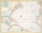
The Western Ocean.
note:
Chart
of the Atlantic Ocean with rhumb
A
chart
of the coast of New York, New
topic:
Nautical
charts
A new and accurate
chart
of the vast
topic:
Nautical
charts
Chart
of the entrance of Hudson's River
topic:
Nautical
charts
A
chart
of New York Harbour : with the banks
topic:
Nautical
charts
Ocean Atlantique, ou, Mer du …
topic:
Nautical
charts
A
chart
of the bar of Sandy Hook
note:
Appears in Faden's Collection of
charts
Pascaerte vande Vlaemsche, So…
topic:
Nautical
charts
A
chart
of the Atlantick Ocean from Buttons
topic:
Nautical
charts
Preliminary
chart
of the sea coast of part
topic:
Nautical
charts
Middle part of Long Island So…
abstract:
… by soundings. Includes
charts
A
chart
of the Atlantic Ocean. I sheet.
topic:
Nautical
charts
Virginia, Maryland, Pennsilva…
note:
Nautical
chart
of the coast from New York Bay
Chart
of the entrance of Hudson's River
topic:
Nautical
charts
…, this
chart
, extending from
topic:
Nautical
charts
Preliminary
chart
of Hampton Roads and James
topic:
Nautical
charts
Approximate cotidal lines of …
topic:
Nautical
charts
Map of parts of Boston Harbor…
topic:
Nautical
charts
m
Carte trigonométrique des côt…
A mapp of New Jersey in Ameri…
collection:
Charts
and maps
1
2
3
4
5
6
7
8
9
Previous
Next
1
2
3
4
5
6
7
8
9
Previous
Next