Click to visit the main New York Public Library Homepage
The New York Public Library
Digital Collections
About Digital Collections
Browse
Search only public domain materials
Items
Collections
Divisions
Home
Search
Browse
About
Search only public domain materials
Items
Collections
Divisions
Digital Collections
Using Images
Using Data
Search
Filtered keyword search
Show filters
Hide filters
Show Only Public Domain
topic
Administrative and political divisions
236
Railroads
184
Real property
154
Landowners
112
Indian reservations
77
More
Less
name
United States. General Land Office
60
United States Coast Survey
47
Bien, Julius, 1826-1909
45
Rand McNally and Company
42
Julius Bien & Co
36
More
Less
collection
Maps of North America
913
Maps of New York City and State
61
Lawrence H. Slaughter Collection of English maps, charts, globes, books and atlases
6
Circulars no. 1-4
2
Cosmographia
2
More
Less
place
California
107
Michigan
74
Wisconsin
58
United States
56
Pennsylvania
54
More
Less
genre
x
Maps
Cadastral maps
140
Topographic maps
53
Nautical charts
43
Geological maps
40
More
Less
publisher
publisher not identified
105
General Land Office
30
Published by Warner & Foote
25
Department of the Interior, General Land Office
23
U.S. Coast Survey
22
More
Less
division
Map Division
981
Rare Book Division
5
Wallach Division: Print Collection
2
type
cartographic
988
still image
65
text
34
Date Range
to
988 results found for:
x
Columns
Filtering on:
x
Genre
: Maps
Sort by:
Relevance
Title
Date created
Date digitized
Sequence
Townships of Franklin and Som…
collection:
…
columns
of description
m
Township of Franklin situate …
collection:
…," with two
columns
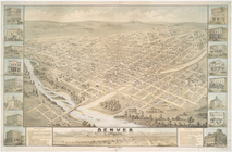
Denver, Colorado, 1874
note:
Print contains 2
columns
of description
Antinoë [Antinoöpolis]. 1. Pl…
topic:
Columns
m
Map showing Indian reservatio…
note:
…,
column
b, row 5
The ichnography of Charles-to…
note:
Print contains 7
columns
of references
Carte pour servir à l'itinéra…
abstract:
… divided into 2
columns
A new and correct chart shewi…
note:
Includes text and ill.,
columns
of text
A plan of the battle, on Bunk…
abstract:
…. Printed text in 3
columns
Map of the world
note:
Roman type (Proctor 2556); 2
columns
, 44-45
Map of India
note:
Roman type (Proctor 2556); 2
columns
, 44-45
Map no. I : [to accompany A b…
note:
Printed in double
columns
.
Map no. II : [to accompany A …
note:
Printed in double
columns
.
Map no. III : [to accompany A…
note:
Printed in double
columns
.
Map of Cincinnati and suburbs…
note:
…,
column
a, no. 1
Real estate map of property b…
note:
…,
column
3, row 2
Sketch of the public surveys …
note:
…,
column
1, no. 1
m
Map of the village of Jamaica…
note:
…,
column
2, row 2
Yosemite Valley : [Calif.]
note:
…,
column
2, no. 7
Map of Nebraska
note:
…,
column
1, no. 5
m
Prospect Park, plaza lots
note:
…,
column
1, row 6
Map of the homestead of the l…
note:
…,
column
2, row 3
Sectional map of New York, Br…
note:
…,
column
3, row 7
Ohio, Indiana, and Michigan
note:
…,
column
c, no. 5
Railroad map of Wisconsin : p…
note:
…,
column
2, no. 5
Plan of streets etc. on the L…
note:
…,
column
1, row 6
Norwood in the 24th ward of t…
note:
…,
column
2, row 1
New map of Brooklyn including…
note:
…,
column
3, row 3
m
New map of the city of Brookl…
note:
…,
column
2, row 4.
m
Map of Brooklyn Ferry, in 176…
note:
…,
column
1, row 1
Green-Wood Cemetery, 1886
note:
…,
column
2, row 4
Map of the city of Chicago
note:
…,
column
3, no. 3
Map of Galveston Harbor impr…
note:
…,
column
1, row 4
Rand, McNally & Co.'s. Colora…
note:
…,
column
2, no. 5
Map of Honolulu
note:
…,
column
2, row 3
Attacks of Fort Washington by…
note:
…,
column
3, no. 7
Missuri
note:
…,
column
1, no. 2
Costes et rivieres de Virgini…
note:
BM maps, X,
column
479
Railroads of Minneapolis and …
note:
…,
column
2, no. 6
m
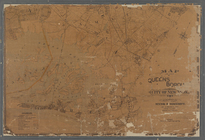
Map of the Queens Boro[ugh], …
note:
…,
column
3, row 4
Map of Indiana
note:
…,
column
3, no. 4
m
Map of the 23rd ward, New Yor…
note:
…,
column
1, row 7
A sketch of the public survey…
note:
…,
column
3, no. 2
Map of the city of Chicago
note:
…,
column
3, no. 1
Geological reconnaissances in…
note:
…,
column
1, no. 3
A Tracing of parts of the sta…
note:
…,
column
a, no. 2
Map of part of Washington and…
note:
…,
column
3, row 3
Oregon
note:
…,
column
1, no. 3
Indiana, 1820
note:
…,
column
1, no. 1
Alaska and adjoining region
note:
…,
column
1, no. 1
1
2
3
4
Previous
Next
1
2
3
4
Previous
Next