Click to visit the main New York Public Library Homepage
The New York Public Library
Digital Collections
About Digital Collections
Browse
Search only public domain materials
Items
Collections
Divisions
Home
Search
Browse
About
Search only public domain materials
Items
Collections
Divisions
Digital Collections
Using Images
Using Data
Search
Filtered keyword search
Show filters
Hide filters
Show Only Public Domain
topic
Real property
8310
Fire insurance
5203
Cities & towns
4996
City planning
942
Social conditions
942
More
Less
name
Sanborn Map Company
5080
G.W. Bromley & Co
2384
New York (N.Y.). City Planning Commission
978
M.I.T. Press
942
Bromley, George Washington
760
More
Less
collection
x
Atlases of New York City
place
New York (State)
9643
New York
4239
New York (N.Y.)
2523
Manhattan (New York, N.Y.)
1899
Brooklyn (New York, N.Y.)
884
More
Less
genre
x
Maps
Topographic maps
120
Index maps
78
Indexes
65
Cadastral maps
52
More
Less
publisher
Sanborn Map Company
5127
G.W. Bromley & Co
2208
MIT Press
942
E. Belcher Hyde
646
E. Robinson Co
331
More
Less
division
Map Division
11380
type
cartographic
10514
still image
946
text
126
Date Range
to
Looking for this collection?
Atlases of New York City
11,722 items
11,510 results found for:
x
atlases of new york city
Filtering on:
x
Genre
: Maps
x
Collection
: Atlases of New York city.||de1dcfb0-c5f6-012f-1dfc-58d385a7bc34
Sort by:
Relevance
Title
Date created
Date digitized
Sequence
Results 251 - 300
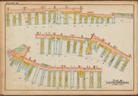
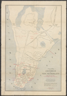
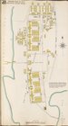
Key Plan Continued
use:
… partner (e.g.,
New
York
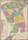
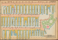
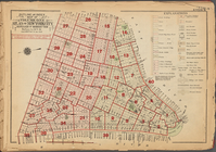
Plate 22: Map bounded by Thom…
use:
… partner (e.g.,
New
York
Brooklyn, Section 8; [Includi…
use:
… partner (e.g.,
New
York
Brooklyn, Section 10; [Includ…
use:
… partner (e.g.,
New
York
City
of
New
York
. Board of Estimate
use:
… partner (e.g.,
New
York
City
of
New
York
. Board of Estimate
use:
… partner (e.g.,
New
York
Plate 39: Plan of Hudson Rive…
use:
… partner (e.g.,
New
York
Plate 40: Plan of East River …
use:
… partner (e.g.,
New
York
Plate 40: Plan of East River …
use:
… partner (e.g.,
New
York
Plate 39: Plan of Hudson Rive…
use:
… partner (e.g.,
New
York
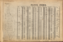
Block Index
use:
… partner (e.g.,
New
York
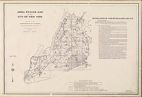
Area Zoning Map.
City
of
New
York
. 1953
use:
… partner (e.g.,
New
York
Amsterdam in
New
Netherland, 1653-1664
use:
… partner (e.g.,
New
York
Area Zoning Map Section No. 2
use:
… partner (e.g.,
New
York
Area Zoning Map Section No. 4
use:
… partner (e.g.,
New
York
Area Zoning Map Section No. 7
use:
… partner (e.g.,
New
York
Area Zoning Map Section No. 8
use:
… partner (e.g.,
New
York
Area Zoning Map Section No. 11
use:
… partner (e.g.,
New
York
Area Zoning Map Section No. 14
use:
… partner (e.g.,
New
York
Area Zoning Map Section No. 15
use:
… partner (e.g.,
New
York
Area Zoning Map Section No. 16
use:
… partner (e.g.,
New
York
Area Zoning Map Section No. 17
use:
… partner (e.g.,
New
York
Area Zoning Map Section No. 18
use:
… partner (e.g.,
New
York
Area Zoning Map Section No. 19
use:
… partner (e.g.,
New
York
Area Zoning Map Section No. 24
use:
… partner (e.g.,
New
York
Area Zoning Map Section No. 27
use:
… partner (e.g.,
New
York
Area Zoning Map Section No. 30
use:
… partner (e.g.,
New
York
Area Zoning Map Section No. 32
use:
… partner (e.g.,
New
York
Area Zoning Map Section No. 35
use:
… partner (e.g.,
New
York
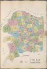
…, Atlas of
New
York
City
use:
… partner (e.g.,
New
York
m
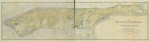
1609. The island of Manhattan…
use:
… partner (e.g.,
New
York
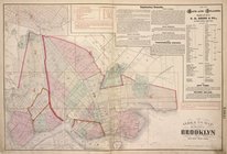
… of the
city
of Brooklyn and East
New
York
. [Front]
use:
… partner (e.g.,
New
York
… Street,
City
Hall Square
use:
… partner (e.g.,
New
York
… by Eastchester Bay,
City
Island
use:
… partner (e.g.,
New
York
Plate 1: Map bounded by North…
use:
… partner (e.g.,
New
York
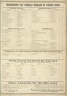
Warehouse for General Storage…
use:
… partner (e.g.,
New
York
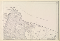
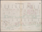
Key Plan Showing the System o…
use:
… partner (e.g.,
New
York
Map bounded by West 57th Stre…
use:
… partner (e.g.,
New
York
Map bounded by Battery Place,…
use:
… partner (e.g.,
New
York
Map bounded by Rector Street,…
use:
… partner (e.g.,
New
York
Map bounded by Laight Street,…
use:
… partner (e.g.,
New
York
Map bounded by Spring Street,…
use:
… partner (e.g.,
New
York
Map bounded by Hamersley Stre…
use:
… partner (e.g.,
New
York
Map bounded by Houston Street…
use:
… partner (e.g.,
New
York
Map bounded by East 20th Stre…
use:
… partner (e.g.,
New
York
Map bounded by West 18th Stre…
use:
… partner (e.g.,
New
York
Map bounded by West 22nd Stre…
use:
… partner (e.g.,
New
York
Map bounded by Bleeker Street…
use:
… partner (e.g.,
New
York
Map bounded by Charles Street…
use:
… partner (e.g.,
New
York
Map bounded by 12th Street, S…
use:
… partner (e.g.,
New
York
1
2
3
4
5
6
7
8
9
10
…
46
47
Previous
Next
1
2
3
4
5
6
7
8
9
10
…
46
47
Previous
Next