Click to visit the main New York Public Library Homepage
The New York Public Library
Digital Collections
About Digital Collections
Browse
Search only public domain materials
Items
Collections
Divisions
Home
Search
Browse
About
Search only public domain materials
Items
Collections
Divisions
Digital Collections
Using Images
Using Data
Search
Filtered keyword search
Show filters
Hide filters
Show Only Public Domain
topic
Administrative and political divisions
11
School districts
6
Local transit
5
Piers
5
Ferries
3
More
Less
name
Trow City Directory Company
4
Matthews-Northrup Company
3
Fisk & Russell
2
New York (N.Y.) Topographical Bureau
1
Webster, Joseph O. B
1
More
Less
collection
x
Maps of New York City and State
place
x
Bronx (New York, N.Y.)
New York (State)
13
Manhattan (New York, N.Y.)
12
New York (N.Y.)
12
New York
6
More
Less
genre
Maps
13
Manuscript maps
1
Topographic maps
1
publisher
Cushing & Bardua
3
Matthews-Northrup Co
3
The Trow City Directory Company
2
Department of Public Works
1
Fisk & Russel Relief Map & Line, Engravers
1
More
Less
division
Map Division
13
type
cartographic
13
Date Range
to
13 results found for:
x
Sections
Filtering on:
x
Place
: Bronx (New York, N.Y.)
x
Collection
: Maps of New York City and State
For more collection details, visit the
Maps of New York City and State collection page
.
Sort by:
Relevance
Title
Date created
Date digitized
Sequence
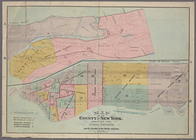
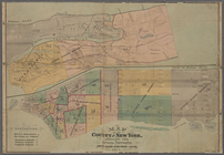
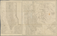
Map of the County of New York…
note:
Map in two
sections
.
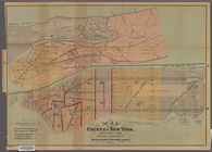
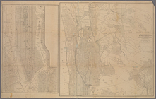
Map of the County of New York…
note:
Map in two
sections
.
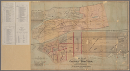
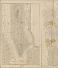
Map of the County of New York…
note:
Map in two
sections
.
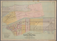
Map of the County of New York…
note:
Map in two
sections
.
Map of the County of New York…
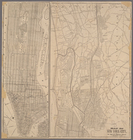
Map of New York City
m
Plan of the Harlem River Driv…
note:
Includes cross
sections
of Driveway
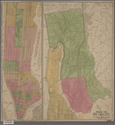
Map of the County of New York…
Map of New York City
Map of northern part of New Y…
Map of northern part of New Y…
m
Map of northern part of New Y…
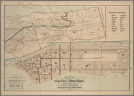
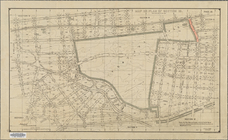
Map or plan of
section
10 [Crotona Park]
End of results
|
Top