Click to visit the main New York Public Library Homepage
The New York Public Library
Digital Collections
About Digital Collections
Browse
Search only public domain materials
Items
Collections
Divisions
Home
Search
Browse
About
Search only public domain materials
Items
Collections
Divisions
Digital Collections
Using Images
Using Data
Search
Filtered keyword search
Show filters
Hide filters
Show Only Public Domain
topic
Real property
415
Zoning
114
Atlases, British
57
Geography, Ancient
41
Maps in education
41
More
Less
name
E. Belcher Hyde Map Company
296
E.B. Hyde & Co
296
Ullitz, Hugo
296
New York (N.Y.). Board of Estimate and Apportionment
114
Hyde, E. Belcher
112
More
Less
collection
Atlases of New York City
410
Atlases of the United States
150
Lawrence H. Slaughter Collection of English maps, charts, globes, books and atlases
104
Maps of North America
100
Maps of Asia
43
More
Less
place
x
Maps
New York (State)
544
New York
415
Brooklyn (New York, N.Y.)
316
Early works to 1800
124
More
Less
genre
Maps
871
Atlases
150
Indexes
14
Title pages
10
Prints
6
More
Less
publisher
E. Belcher Hyde
297
E. Belcher-Hyde
112
The Board
76
Berlin
41
Printed at the Theater,
41
More
Less
division
Map Division
882
Schomburg Jean Blackwell Hutson Research and Reference Division
19
Wallach Division: Print Collection
5
Wallach Division: Picture Collection
2
type
cartographic
874
text
41
still image
5
Date Range
to
Looking for one of these collections?
Lawrence H. Slaughter Collection of English maps, charts, globes, books and atlases
1,252 items
Maps of North America
3,345 items
908 results found for:
x
map
Filtering on:
x
Place
: Maps
Sort by:
Relevance
Title
Date created
Date digitized
Sequence
A chart of Delawar Bay : with…
note:
… to Early
Maps
of the Middle
A chart of Delawar River from…
note:
LC
Maps
of North America, 1750-1789, 1369
A chart of Delaware Bay and R…
note:
… the
map
.
A chart of Delaware Bay and R…
note:
… the
map
.
A chart of the Atlantic Ocean…
note:
… to Early
Maps
of the Middle
m
A chart of the Atlantic or We…
note:
… to Early
Maps
of the Middle
A chart of the Atlantic or We…
note:
… pasted on verso of
map
A chart of the sea coasts of …
note:
… to Early
Maps
of the Middle
A chart of the sea coasts of …
note:
… consisting of
maps
by Wit
m
A chart of the West Indias fr…
note:
… to Early
Maps
of the Middle
m
A chart of the West Indias fr…
note:
… to Early
Maps
of the Middle
A chart of the West Indies fr…
note:
… consisting of
maps
by Wit
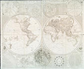
A chart of the world : exhibi…
note:
… to Early
Maps
of the Middle
A general chart of the West I…
collection:
… of English
maps
, charts
A general
map
of the world, or terraqueous
note:
… to Early
Maps
of the Middle
A geographical table containi…
topic:
Maps
in education
A geological section of the c…
note:
… to Early
Maps
of the Middle
A
map
and chart of those parts of the Bay
note:
… to Early
Maps
of the Middle
A
map
of Florida and ye Great Lakes
A
map
of New England and New York
note:
… to Early
Maps
of the Middle
A
map
of the canals & rail roads
note:
… to Early
Maps
of the Middle
A
map
of the canals & rail roads
note:
… to Early
Maps
of the Middle
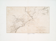
A
map
of the country from Rariton River
note:
… to Early
Maps
of the Middle
A
map
of the most inhabited part of Virginia
note:
Described in: Fry & Jefferson
map
of Virginia
m
A
map
of the most inhabited part of Virginia
note:
…. This
map
is most humbly
A
map
of the state of New York : exhibiting
note:
… to Early
Maps
of the Middle
A
map
of the United States of America
note:
… to Early
Maps
of the Middle
A
map
of the village of Williamsburgh
note:
… to Early
Maps
of the Middle
A
map
of the world from the best
note:
… to Early
Maps
of the Middle
A New & accurate
map
of North America
note:
… to Early
Maps
of the Middle
A new and accurat
map
of the world
note:
Imprint on
map
indicates this is 4th state
A new and accurate chart (fro…
note:
… edge of
map
covering
A new and accurate chart (fro…
note:
… to Early
Maps
of the Middle
A New and accurate
map
of the present
note:
… and accurate
map
of the present
A New and accurate
map
of Virginia
note:
… to Early
Maps
of the Middle
A New and correct chart of th…
note:
Differs from similar
map
. Uncolored
A new and correct
map
of North America
note:
… to Early
Maps
of the Middle
A new and general
map
of the middle
note:
… to Early
Maps
of the Middle
A new chart of the coast of N…
note:
… to Early
Maps
of the Middle
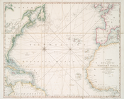
A new chart of the vast Atlan…
note:
… great
Map
of the British
A new chart of the vast Atlan…
note:
… to Early
Maps
of the Middle
A new
map
and profile of the proposed
note:
… to Early
Maps
of the Middle
A new
map
o East
topic:
Maps
in education
A new
map
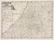
of the Land of Canaan and part
topic:
Maps
in education
A new
map
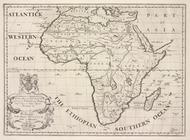
of Africk shewing its present
topic:
Maps
in education
A new
map
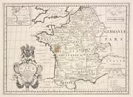
of ancient Gaul or Gallia
topic:
Maps
in education
A new
map
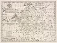
of ancient Germany, Rhætia,…
topic:
Maps
in education
A new
map
of ancient Greece Thrace
topic:
Maps
in education
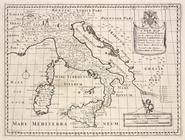
A new
map
of ancient Italy, together
topic:
Maps
in education
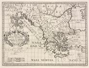
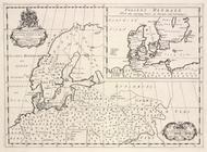
A new
map
of ancient Scandinavia
topic:
Maps
in education
1
2
3
4
Previous
Next
1
2
3
4
Previous
Next