Click to visit the main New York Public Library Homepage
The New York Public Library
Digital Collections
About Digital Collections
Browse
Search only public domain materials
Items
Collections
Divisions
Home
Search
Browse
About
Search only public domain materials
Items
Collections
Divisions
Digital Collections
Using Images
Using Data
Search
Filtered keyword search
Show filters
Hide filters
Show Only Public Domain
topic
Real property
78
Zoning
6
Business enterprises
3
Commerce
3
Directories
3
More
Less
name
Ullitz, Hugo
54
E.B. Hyde & Co
50
E. Belcher Hyde Map Company
47
G.W. Bromley & Co
18
Bromley, George Washington
9
More
Less
collection
Atlases of New York City
86
Maps of New York City and State
16
New York City directories
3
New York World's Fair 1939 and 1940 Incorporated records
1
place
x
New York
New York (State)
106
Brooklyn (New York, N.Y.)
61
Maps
43
Manhattan (New York, N.Y.)
21
More
Less
genre
Maps
106
Books
3
Directories
3
Registers (Lists)
3
Cadastral maps
1
More
Less
publisher
E. Belcher Hyde
49
G.W. Bromley & Co
15
E. Robinson Co
5
E.B. Hyde & Co
4
New York (N.Y.). Board of Estimate and Apportionment
3
More
Less
division
Map Division
101
Rare Book Division
3
Manuscripts and Archives Division
1
type
x
cartographic
text
5
Date Range
to
106 results found for:
x
27
Filtering on:
x
Place
: New York
x
Type
: cartographic
Sort by:
Relevance
Title
Date created
Date digitized
Sequence
…, Double Page Plate No.
27
; Part of Wards
27
& 28
Plate
27
: [Bounded by Bedford Avenue, Montgomery
Plate
27
: Bounded by Withers Street, Kingsland
Bounded by Flushing Avenue, M…
collection:
… &
27
. Land Map Sections, Nos. 18 &
27
. Volume
…; Part of Wards 18 &
27
…; Part of Wards
27
& 28
…, 18, 19,
27
& 28. City
…; Part of Ward
27
…; Part of Wards
27
& 28
Height District Map Section No.
27
Use District Map Section No.
27
Plate
27
Area District Map Section No.
27
Plate
27
, Part of Section 2
m
What annexation would accompl…
Area District Map Section No.
27
Plate
27
, Part of Section 2
Height District Map Section No.
27
Use District Map Section No.
27
Plate
27
, Part of Section 10, Borough
Ville de New-York
Staten Island, V. 1, Plate No.
27
[Map
Plate
27
: Bounded by E. 64th Street
Plate
27
, Part of Sections 3&4: [Bounded by W
Plate
27
, Part of Section 5: [Bounded
Plate
27
, Part of Section 5: [Bounded by E
Map showing the location of t…
Plate
27
:…
m
Map of Brooklyn Ferry, in 176…
Plate
27
: Bounded by Eighth Avenue, W. 129th
Bounded by Dekalb Avenue, Cyp…
collection:
Part of Wards
27
& 28. Land Map Section
m
Plate
27
, Part of Sections 3&4: [Bounded by W
Brooklyn, Vol. 6, Double Page Plate No.
27
Queens, Vol. 1A, Double Page Plate No.
27
Block sketch 1679, New York C…
Map showing route of proposed…
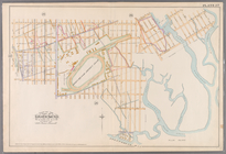
Green-wood cemetery
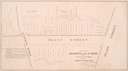
Map of property in the 2nd wa…
Plate
27
: [Bounded by Avenue U, Gerritsen
Double Page Plate No.
27
, Part of Ward
Brooklyn, Vol. 3, Double Page…
collection:
Wards 13, 14, 15, 16, 17, 18, 19,
27
Brooklyn, Vol. 3, Double Page…
collection:
Wards 13, 14, 15, 16, 17, 18, 19,
27
Brooklyn, Vol. 3, Double Page…
collection:
Wards 13, 14, 15, 16, 17, 18, 19,
27
Brooklyn, Vol. 3, Double Page…
collection:
Wards 13, 14, 15, 16, 17, 18, 19,
27
Brooklyn, Vol. 3, Double Page…
collection:
Wards 13, 14, 15, 16, 17, 18, 19,
27
Brooklyn, Vol. 3, Double Page…
collection:
Wards 13, 14, 15, 16, 17, 18, 19,
27
Brooklyn, Vol. 3, Double Page…
collection:
Wards 13, 14, 15, 16, 17, 18, 19,
27
Brooklyn, Vol. 3, Double Page…
collection:
Wards 13, 14, 15, 16, 17, 18, 19,
27
Brooklyn, Vol. 3, Double Page…
collection:
Wards 13, 14, 15, 16, 17, 18, 19,
27
Brooklyn, Vol. 3, Double Page…
collection:
Wards 13, 14, 15, 16, 17, 18, 19,
27