Click to visit the main New York Public Library Homepage
The New York Public Library
Digital Collections
About Digital Collections
Browse
Search only public domain materials
Items
Collections
Divisions
Home
Search
Browse
About
Search only public domain materials
Items
Collections
Divisions
Digital Collections
Using Images
Using Data
Search
Filtered keyword search
Show filters
Hide filters
Show Only Public Domain
topic
Real property
305
Railroads
90
Railroads, Elevated
44
Zoning
41
Local transit
40
More
Less
name
E. Belcher Hyde Map Company
265
E.B. Hyde & Co
265
Ullitz, Hugo
265
New York (N.Y.). Board of Estimate and Apportionment
43
Rand McNally and Company
20
More
Less
collection
Atlases of New York City
309
Maps of New York City and State
230
Wallach Division Picture Collection
9
New York World's Fair 1939 and 1940 Incorporated records
6
Photographic views of New York City, 1870's-1970's, from the collections of the New York Public Library
5
More
Less
place
x
New York
New York (State)
563
Brooklyn (New York, N.Y.)
340
Maps
303
New York (N.Y.)
104
More
Less
genre
Maps
514
Indexes
12
Photographs
11
Cadastral maps
10
Aerial views
9
More
Less
publisher
E. Belcher Hyde
269
New York (N.Y.). Board of Estimate and Apportionment
38
The Company
21
publisher unknown
14
G.W. & C.B. Colton & Co
8
More
Less
division
Map Division
538
Manuscripts and Archives Division
9
Milstein Division
5
Wallach Division: Picture Collection
5
Rare Book Division
1
More
Less
type
cartographic
515
text
29
still image
28
Date Range
to
563 results found for:
x
Scales
Filtering on:
x
Place
: New York
Sort by:
Relevance
Title
Date created
Date digitized
Sequence
m
Manhattan: 11th Avenue - 17th…
topic:
Scales
m
Manhattan: 11th Avenue - 18th…
topic:
Scales
m
Brooklyn: Flatbush Avenue - 5…
topic:
Scales
m
…
scales
m
Bronx: 149th Street (East) - …
topic:
Scales
m
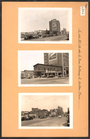
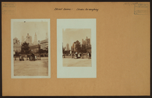
Street scenes -
Scales
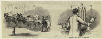
for weighing
Shipping specie to the interi…
topic:
Scales
City guide
note:
Scales
vary.
m
Hudson River vehicular tunnel…
note:
Scales
not given.
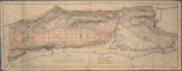
Map of boroughs of Manhattan …
note:
Scales
differ (W 74°03ʹ31ʺ--W 71°49ʹ43ʺ/N
m
Borough of Manhattan, 300 foot
scale
note:
Scale
1:7,200; 1 inch = 300 feet.
m
Rand, McNally & Co.'s complet…
note:
… borough [
scale
1:12,000].
Railroads in Manhattan, Jerse…
note:
Scale
1:15,840,
scale
4" - 1 mile ; (W
m
Metropolitan district local a…
note:
… and Newark" [
scale
1:46,000].
Livingston Heights : Livingto…
note:
Scale
not given (W 74°06ʹ40ʺ--W 74°06ʹ19ʺ/N
m
Map of New York City : showin…
note:
Scale
[ca. 1:44,000].
Mapa de la ciudad de Nueva Yo…
note:
Includes inset: Greater New York [
Scale
m
New guide map of New York Cit…
note:
… at reduced
scale
. Segment
Map of that part of the City …
note:
Scale
ca. 1:6,400.
m
Street guide of Manhattan and…
note:
….] (
scale
1:18,000).
m
Flushing Bay, Long Island, N.…
note:
…. and vicinity [
scale
1:70,000
Map of the borough of Brookly…
note:
Scale
approximately 1:27,000.
Full size and
scale
details of gallery rail
Full size and
scale
details of railings
Hallet's Point
note:
…
scale
" "Longitudinal
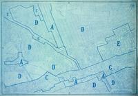
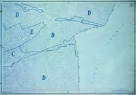
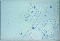
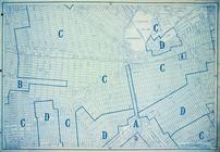
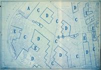
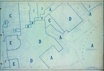
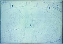
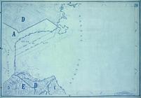
Area District Map Section No.…
note:
Scale
[1:18,000]. 1 in. = 1500 ft.
Area District Map Section No.…
note:
Scale
[1:18,000]. 1 in. = 1500 ft.
Area District Map Section No.…
note:
Scale
[1:18,000]. 1 in. = 1500 ft.
Area District Map Section No.…
note:
Scale
[1:18,000]. 1 in. = 1500 ft.
Area District Map Section No.…
note:
Scale
[1:18,000]. 1 in. = 1500 ft.
Area District Map Section No.…
note:
Scale
[1:18,000]. 1 in. = 1500 ft.
Area District Map Section No.…
note:
Scale
[1:18,000]. 1 in. = 1500 ft.
Area District Map Section No.…
note:
Scale
[1:18,000]. 1 in. = 1500 ft.
Area District Map Section No.…
note:
Scale
[1:18,000]. 1 in. = 1500 ft.
Area District Map Section No.…
note:
Scale
[1:18,000]. 1 in. = 1500 ft.
Area District Map Section No.…
note:
Scale
[1:18,000]. 1 in. = 1500 ft.
Area District Map Section No.…
note:
Scale
[1:18,000]. 1 in. = 1500 ft.
Area District Map Section No.…
note:
Scale
[1:18,000]. 1 in. = 1500 ft.
Area District Map Section No.…
note:
Scale
[1:18,000]. 1 in. = 1500 ft.
Area District Map Section No.…
note:
Scale
[1:18,000]. 1 in. = 1500 ft.
Area District Map Section No.…
note:
Scale
[1:18,000]. 1 in. = 1500 ft.
Area District Map Section No.…
note:
Scale
[1:18,000]. 1 in. = 1500 ft.
Area District Map Section No.…
note:
Scale
[1:18,000]. 1 in. = 1500 ft.
Area District Map Section No.…
note:
Scale
[1:18,000]. 1 in. = 1500 ft.
Area District Map Section No.…
note:
Scale
[1:18,000]. 1 in. = 1500 ft.
Area District Map Section No.…
note:
Scale
[1:18,000]. 1 in. = 1500 ft.
Area District Map Section No.…
note:
Scale
[1:18,000]. 1 in. = 1500 ft.
Area District Map Section No.…
note:
Scale
[1:18,000]. 1 in. = 1500 ft.
Area District Map Section No.…
note:
Scale
[1:18,000]. 1 in. = 1500 ft.
Area District Map Section No.…
note:
Scale
[1:18,000]. 1 in. = 1500 ft.
1
2
3
Previous
Next
1
2
3
Previous
Next