Click to visit the main New York Public Library Homepage
The New York Public Library
Digital Collections
About Digital Collections
Browse
Search only public domain materials
Items
Collections
Divisions
Home
Search
Browse
About
Search only public domain materials
Items
Collections
Divisions
Digital Collections
Using Images
Using Data
Search
Filtered keyword search
Show filters
Hide filters
Show Only Public Domain
topic
Local transit
69
Railroads
69
Administrative and political divisions
61
Piers
56
Maps
40
More
Less
name
New York (N.Y.). Board of Estimate and Apportionment
42
Ashworth, Irving F
37
M.B. Brown Printing and Binding Co
37
New York (N.Y.). Department of City Planning
37
Dripps, M. (Matthew)
15
More
Less
collection
Maps of New York City and State
257
Atlases of New York City
116
Photographic views of New York City, 1870's-1970's, from the collections of the New York Public Library
5
New York Public Library Visual Materials
2
Photographic views of New York City, 1870's-1970's, from the collections of the New York Public Library. Supplement
2
More
Less
place
x
New York (N.Y.)
New York (State)
241
Manhattan (New York, N.Y.)
185
New York
104
Bronx (New York, N.Y.)
39
More
Less
genre
Maps
373
Manuscript maps
16
Cadastral maps
14
Photographs
9
Aerial views
6
More
Less
publisher
M.B. Brown Printing & Binding Co.,
37
New York (N.Y.). Dept. of City Planning
37
G.W. & C.B. Colton & Co
12
Rand, McNally & Co
7
publisher not identified
7
More
Less
division
Map Division
376
Milstein Division
9
Manuscripts and Archives Division
2
Wallach Division: Picture Collection
2
Wallach Division: Print Collection
1
type
cartographic
373
still image
18
text
4
Date Range
to
390 results found for:
x
Scales
Filtering on:
x
Place
: New York (N.Y.)
Sort by:
Relevance
Title
Date created
Date digitized
Sequence
….
Scales
; horse drawn
m
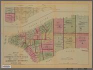
Manhattan: 11th Avenue - 17th…
topic:
Scales
m
Manhattan: 11th Avenue - 18th…
topic:
Scales
m
Brooklyn: Flatbush Avenue - 5…
topic:
Scales
m
Bronx: 149th Street (East) - …
topic:
Scales
m
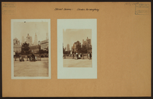
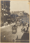
Street scenes -
Scales
for weighing
… on a reduced
scale
.
note:
Scales
differ. (W 74°02ʹ58ʺ--W 73°55ʹ41ʺ/N
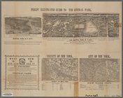
Phelps' New York city guide t…
abstract:
… to the Central Park.
Scales
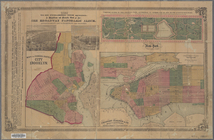
Map of boroughs of Manhattan …
note:
Scales
differ (W 74°03ʹ31ʺ--W 71°49ʹ43ʺ/N
… on a reduced
scale
/ engraved
note:
Scale
[ca. 1:24,000]. (W 74°02ʹ56ʺ--W 73°57
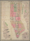
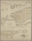
Map of the County of New York…
note:
Scale
ca. 1:20,000.
… on a reduced
scale
/ engraved
note:
Scale
[ca. 1:24,000]. (W 74°02ʹ56ʺ--W 73°57
m
Borough of Manhattan, 300 foot
scale
note:
Scale
1:7,200; 1 inch = 300 feet.
New York City south of 93rd S…
note:
Scale
approximately 1:12,000. (W 74°02ʹ28ʺ--W
m
Colton's new map of the city …
note:
Scale
[ca. 1:12,000] (W 74°01ʹ28ʺ--W 73°51
m
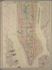
Map of New York City : showin…
note:
Scale
[ca. 1:44,000].
City of New York
note:
Scale
approximately 1:36,000. (W 74°02ʹ55ʺ--W
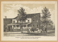
Residence of John Edwards,
Scale
Bean
Mapa de la ciudad de Nueva Yo…
note:
Includes inset: Greater New York [
Scale
m
New guide map of New York Cit…
note:
… at reduced
scale
. Segment
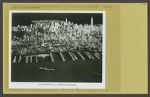
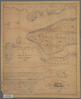
New York and vicinity
note:
Scale
: 2 3/4 in. = 1 mile.
m
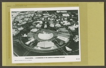
Flushing Meadow Park
collection:
World's Fair, 1964-65:
scale
model
m
Street guide of Manhattan and…
note:
….] (
scale
1:18,000).
Map of New York and vicinity
note:
Scale
approximately 1:17,300.
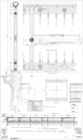
Full size and
scale
details of gallery rail
Full size and
scale
details of railings
m
Flushing Meadow Park
collection:
World's Fair, 1964-65:
scale
model (New
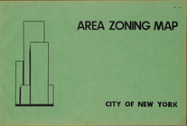
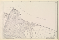
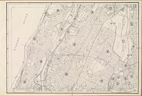
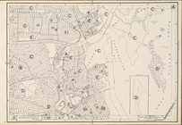
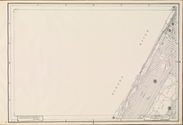
Area Zoning Map. City of New …
note:
Scale
of maps ca. 1:9,600.
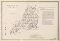
Area Zoning Map. City of New …
note:
Scale
of maps ca. 1:9,600.
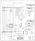
Area Zoning Map Section No. 1
note:
Scale
of maps ca. 1:9,600.
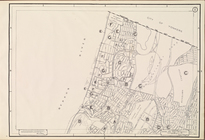
Area Zoning Map Section No. 2
note:
Scale
of maps ca. 1:9,600.
Area Zoning Map Section No. 3
note:
Scale
of maps ca. 1:9,600.
Area Zoning Map Section No. 4
note:
Scale
of maps ca. 1:9,600.
Area Zoning Map Section No. 5
note:
Scale
of maps ca. 1:9,600.
Area Zoning Map Section No. 6
note:
Scale
of maps ca. 1:9,600.
Area Zoning Map Section No. 7
note:
Scale
of maps ca. 1:9,600.
Area Zoning Map Section No. 8
note:
Scale
of maps ca. 1:9,600.
Area Zoning Map Section No. 9
note:
Scale
of maps ca. 1:9,600.
Area Zoning Map Section No. 10
note:
Scale
of maps ca. 1:9,600.
Area Zoning Map Section No. 11
note:
Scale
of maps ca. 1:9,600.
Area Zoning Map Section No. 12
note:
Scale
of maps ca. 1:9,600.
Area Zoning Map Section No. 13
note:
Scale
of maps ca. 1:9,600.
Area Zoning Map Section No. 14
note:
Scale
of maps ca. 1:9,600.
Area Zoning Map Section No. 15
note:
Scale
of maps ca. 1:9,600.
Area Zoning Map Section No. 16
note:
Scale
of maps ca. 1:9,600.
Area Zoning Map Section No. 17
note:
Scale
of maps ca. 1:9,600.
Area Zoning Map Section No. 18
note:
Scale
of maps ca. 1:9,600.
Area Zoning Map Section No. 19
note:
Scale
of maps ca. 1:9,600.
Area Zoning Map Section No. 20
note:
Scale
of maps ca. 1:9,600.
Area Zoning Map Section No. 21
note:
Scale
of maps ca. 1:9,600.
1
2
Previous
Next
1
2
Previous
Next