Click to visit the main New York Public Library Homepage
The New York Public Library
Digital Collections
About Digital Collections
Browse
Search only public domain materials
Items
Collections
Divisions
Home
Search
Browse
About
Search only public domain materials
Items
Collections
Divisions
Digital Collections
Using Images
Using Data
Search
Filtered keyword search
Show filters
Hide filters
Show Only Public Domain
topic
Nautical charts
21
Warships
7
Naval warfare
6
Trade routes
4
1810-1819
3
More
Less
name
Alabama (Screw sloop)
3
Bellin, Jacques Nicolas, 1703-1772
3
Bowen, Emanuel, 1693 or 1694-1767
2
Bowen, Emanuel, d. 1767
2
Choiseul, Etienne-François, duc de, 1719-1785
2
More
Less
collection
Lawrence H. Slaughter Collection of English maps, charts, globes, books and atlases
15
Maps of the Oceans
14
Wallach Division Picture Collection
7
Maps of North America
3
John H. Levine Collection
2
More
Less
place
x
North Atlantic Ocean
Atlantic Ocean
13
Maps
10
Early works to 1800
8
United States
8
More
Less
genre
Maps
34
Naval prints
5
Conjectural works
2
Prints
2
Photographs
1
publisher
Depost des cartes, plans et journaux de la marine
2
Chez Gerard Jollain, ruë St. Jacques a la ville de Cologne
1
Chez Jean Covens & Corneille Mortier
1
Chez Pierre Mortier libraire
1
Chez Pierre Mortier libraire,
1
More
Less
division
Map Division
34
Wallach Division: Picture Collection
7
Schomburg Photographs and Prints Division
1
type
cartographic
34
still image
8
Date Range
to
42 results found for:
x
North Atlantic Ocean
Filtering on:
x
Place
: North Atlantic Ocean
Sort by:
Relevance
Title
Date created
Date digitized
Sequence
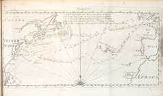
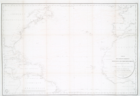
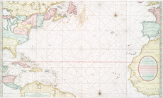
Chart of the
Atlantic
Ocean
note:
Nautical chart of the
North
Atlantic
Ocean
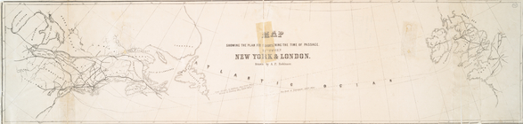
Map showing the plan for shor…
note:
…
Atlantic
Seaboard.
… map of the
Atlantic
or Western
Ocean
.
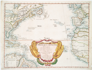
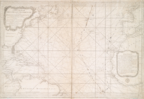
A new chart of the vast
Atlantic
Ocean
A new chart of the vast
Atlantic
Ocean
note:
…
Atlantic
Seaboard.
… the tracks across the
North
Atlantic
Ocean
, of Don
note:
…
Atlantic
Seaboard.
A new chart of the vast
Atlantic
Ocean
note:
…
Atlantic
Seaboard.
Annual passage of the herring…
note:
Map of
North
Atlantic
Ocean
.
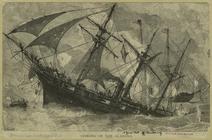
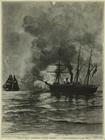
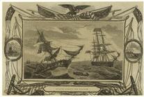
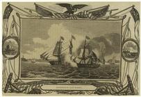
Sinking of the Alabama
Map of the
North
Atlantic
Ocean
to accompany
note:
…
Atlantic
Seaboard.
m
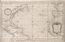
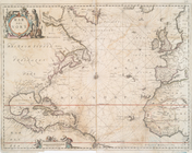
A chart of the
Atlantic
or Western
Ocean
note:
Shows
North
Atlantic
Ocean
.
Carte reduite de l'
Ocean
occidental.
A chart of the
Atlantic
Ocean
. I sheet.
note:
…
Atlantic
Seaboard.
A new chart of the
Atlantic
or Western
Ocean
note:
Covers
North
Atlantic
Ocean
.
…
Atlantic
or Western
Ocean
.
Ocean
Atlantique, ou, Mer du Nord : ou
note:
Covers the
Atlantic
Ocean
from N 56º to S 6º.
Ocean
Atlantique, ou, Mer du Nord : ou
note:
Covers the
Atlantic
Ocean
from N 56º to S 6º. …
…
Ocean
reduced
note:
Covers
Atlantic
Ocean
between N 620
Carta general del Oceano Atla…
note:
…
Atlantic
Seaboard.
L'Ameriqve françoise, ou son …
note:
Covers
North
Atlantic
Ocean
and adjacent
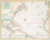
Terra nova, ac maris tractus …
note:
Oriented with
north
to the left.
Combat de l'"Alabama" et du "…
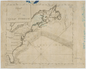
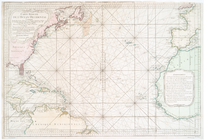
A Chart of the
Atlantic
or Western
Ocean
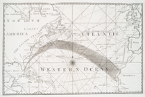
Chart of the Gulf Stream
note:
…
Atlantic
Seaboard.
… of the Western or
Atlantic
Ocean
note:
…
Atlantic
Seaboard.
…'
Océan
Atlantique
note:
…
Atlantic
Seaboard.
Carte réduite de l'
Ocean
occidental
note:
…
Atlantic
Seaboard.
Mar del nort
note:
…
Atlantic
Seaboard.
Carte réduite de l'
Ocean
occidental
note:
…
Atlantic
Seaboard.
Nieuwe wassende graade zee ka…
… of the
Atlantic
Ocean
note:
… topography of
North
America
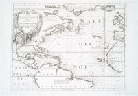
Mare del Nord
note:
Appears in Vincenzo Coronelli's
Atlante
Veneto.
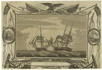
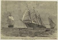
Hornet sinking the Peacock
Wasp and Frolic
An actual survey of the sea c…
note:
… of the
Atlantic
Ocean
."…
The Hornet sinking the Peacock
Enterprise and Boxer
… a cutter on the
North
Atlantic
patrol
note:
… on the
North
Atlantic
patrol
Carte du Mexique et de la Flo…
note:
Covers
North
America as far
north
Amerikanisch-Spanischer krieg…
note:
Insets: Der Nordatlant.
Ocean
-- Puerto
Sinking of the "Alabama" ("29…
A chart of Delaware Bay and R…
collection:
… part of the
North
End of results
|
Top