Click to visit the main New York Public Library Homepage
The New York Public Library
Digital Collections
About Digital Collections
Browse
Search only public domain materials
Items
Collections
Divisions
Home
Search
Browse
About
Search only public domain materials
Items
Collections
Divisions
Digital Collections
Using Images
Using Data
Search
Filtered search
Show filters
Hide filters
Show Only Public Domain
topic
Real property
12
name
G.W. Bromley & Co
12
collection
x
Atlases of New York City
place
New York (N.Y.)
12
Queens (New York, N.Y.)
12
genre
Cadastral maps
12
Maps
12
publisher
G. W. Bromley & Co
12
division
Map Division
12
type
cartographic
12
Date Range
to
12 results found
Filtering on:
x
Collection
: Atlases of New York City
x
Title
: Part of the Borough of Queens, New town, Ward 2.
For more collection details, visit the
Atlases of New York City collection page
.
Sort by:
Title
Date created
Date digitized
Sequence
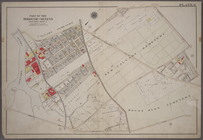
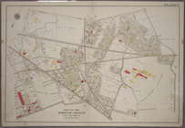
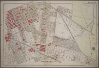
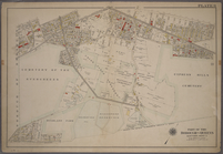
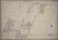
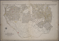
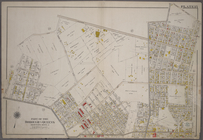
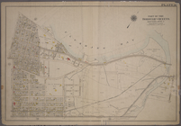
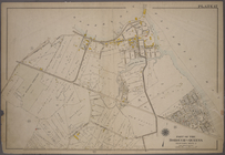
Plate 6: Bounded by Laurel Hi…
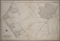
Plate 7: Bounded by Maspeth A…
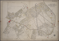
Plate 8: Bounded by Stanhope …
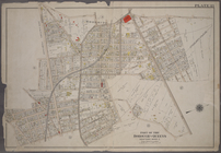
Plate 9: Bounded by Covert St…
Plate 10: Bounded by Trotting…
Plate 11: Bounded by Juniper …
Plate 12: Bounded by Maurice …
Plate 13: Bounded by Astoria …
Plate 14: Bounded by Railroad…
Plate 15: Bounded by Meadow R…
Plate 16: Bounded by Flushing…
Plate 17: Bounded by Bowery B…
End of results
|
Top