Click to visit the main New York Public Library Homepage
The New York Public Library
Digital Collections
About Digital Collections
Browse
Search only public domain materials
Items
Collections
Divisions
Home
Search
Browse
About
Search only public domain materials
Items
Collections
Divisions
Digital Collections
Using Images
Using Data
Search
Filtered search
Show filters
Hide filters
Show Only Public Domain
topic
Real property
72
Description and travel
37
Fire insurance
20
Cities & towns
19
Lighthouses
13
More
Less
name
Beers, F. W. (Frederick W.)
32
Beers, Comstock & Cline
27
Sanborn Map Company
19
E.B. Hyde & Co
14
Everts, Ensign & Everts
14
More
Less
collection
Atlases of New York City
67
Maps of North America
47
Lawrence H. Slaughter Collection of English maps, charts, globes, books and atlases
45
Atlases of the United States
44
Maps of New York City and State
24
More
Less
place
New York (State)
86
North America
41
New York
31
United States
28
Long Island (N.Y.)
27
More
Less
genre
Maps
309
Atlases
44
Prints
22
Illustrations
14
Cadastral maps
8
More
Less
publisher
Beers, Comstock & Cline
27
Sanborn Map Company
19
U.S. Light-House Board
13
Impr. impériale
10
E. Belcher Hyde
8
More
Less
division
Map Division
267
General Research Division
28
Rare Book Division
13
Schomburg Jean Blackwell Hutson Research and Reference Division
7
Schomburg Manuscripts, Archives and Rare Books Division
6
More
Less
type
x
cartographic
text
5
still image
2
Date Range
to
326 results found
Filtering on:
x
Title
: Justice James O'Malley viewing the "L" spur structure.
x
Type
: cartographic
Sort by:
Title
Date created
Date digitized
Sequence
Representation la plus nouvel…
Carte des Isles de L'Amerique…
Carte de L'Isle de Saint-Domi…
L"empire du Monomotapa et la …
Partie Septentrionale de L'An…
Plan du port, ville, citadell…
m
Carte d'une partie de l'Etat …
Carte de l'Ancien Continent.
Carte de l'Amerique
Lower right section of a shee…
Carte routière de l'Indochine…
Carte routière de l'Indochine…
Carte routière de l'Indochine…
Carte routière de l'Indochine…
Carte routière de l'Indochine…
Environs du Kaire [Cairo]. Pl…
Rouine d'un Tempio d'Iside pr…
Bounded by Avenue K., Ralph A…
Bounded by E. 103rd Street, A…
Bounded by Avenue D., Ralph A…
m
Park, L.Y
Map of Chicago showing water …
Map of a portion of Point Ke…
Plan des achats des compagnie…
J.L. Hill Printing Co.'s map …
A sketch of the siege of Fort…
Position de l'armée Américain…
R.L. Polk & Co's map of the c…
m
Map of the vicinity of Philad…
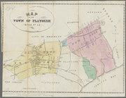
Map of the town of Flatbush, …
Carte figurative de l'instruc…
A map of the Congo regions pu…
L'aigle, antinoűs, la flêche,…
L'eridan, orion & le lievre
m
Bounds of Mr. Barclay's and L…
Map of Hon. Wm. L. Scott's es…
Réduction à la meme échelle d…
Carte de l'Arabie Pétrée levé…
Carte de l'Arabie Pétrée indi…
Carte réduite des côtes et de…
Carte de l'Istrie et de la Da…
Océan Atlantique nord, côtes …
Thirteenth l. h. district
Fifteenth l.h. district
Eleventh l. h. district
Fourteenth l.h. district
Twelfth l. h. district
First l. h. district
Tenth l. h. district
Seventh l. h. district
1
2
Previous
Next
1
2
Previous
Next