Click to visit the main New York Public Library Homepage
The New York Public Library
Digital Collections
About Digital Collections
Browse
Search only public domain materials
Items
Collections
Divisions
Home
Search
Browse
About
Search only public domain materials
Items
Collections
Divisions
Digital Collections
Using Images
Using Data
Search
Filtered keyword search
Show filters
Hide filters
Show Only Public Domain
topic
x
History
Fortification
8
Boundaries
7
Administrative and political divisions
4
Landowners
4
More
Less
name
American Civil War (1861-1865)
25
United States. Army. Corps of Topographical Engineers
17
United States Coast Survey
13
Humphreys, A. A. (Andrew Atkinson), 1810-1883
10
Krebs, Charles G
9
More
Less
collection
Maps of North America
91
Maps of New York City and State
11
Cartographic materials from the Emmet collection of manuscripts etc. relating to American history
2
I. N. Phelps Stokes Collection of American Historical Prints
1
Lawrence H. Slaughter Collection of English maps, charts, globes, books and atlases
1
More
Less
place
United States
60
Virginia
51
Richmond (Va.)
14
Richmond Region (Va.)
13
New York (State)
10
More
Less
genre
Maps
108
Military maps
10
Prints
3
Manuscript maps
2
Thematic maps
2
More
Less
publisher
Corps of Topographical Engineers
10
U.S. Coast Survey Office
10
Office of Surveys and Maps, Army of the Potomac
7
U.S. Light-House Board
7
publisher not identified
5
More
Less
division
Map Division
105
Wallach Division: Print Collection
3
type
x
cartographic
still image
2
Date Range
to
108 results found for:
x
D. C
Filtering on:
x
Topic
: History
x
Type
: cartographic
Sort by:
Relevance
Title
Date created
Date digitized
Sequence
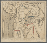
Map no. 12, Port Hudson and v…
parent:
b8e12
c
20-
c
52a-012f-11bb-3
c
075448cc4b
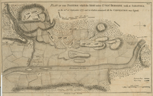
Plan of the position which th…
parent:
db0b6760-
c
5
d
4-012f-bbca-58
d
385a7bc34
m
The engagement on the White P…
parent:
0
d
8dad90-
c
5ab-012f-51
d
5-58
d
385a7bc34
Map of a portion of Virginia:…
parent:
b8e12
c
20-
c
52a-012f-11bb-3
c
075448cc4b
A prospective plan on the bat…
parent:
39bb8900-
c
5ed-012f-2af7-58
d
385a7bc34
Statistical map of the United…
parent:
b94
d
1370-
c
52a-012f-
c
874-3
c
075448cc4b
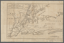
A plan of New York Island wit…
parent:
3b8b8280-
c
5f0-012f-
c
6dc-58
d
385a7bc34
m
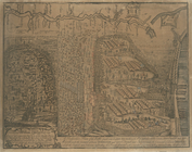
Plate from The tapestry hangi…
parent:
670b6ba0-
c
607-012f-01ea-58
d
385a7bc34
… with part of New Jersey, &
c
parent:
a1a9
d
830-
c
5a6-012f-00ec-58
d
385a7bc34
… with part of New Jersey, &
c
parent:
450f98
d
0-
c
5aa-012f-026a-58
d
385a7bc34
Map exhibiting the approaches…
parent:
b8e12
c
20-
c
52a-012f-11bb-3
c
075448cc4b
Map of the seat of war in Vir…
parent:
b8e12
c
20-
c
52a-012f-11bb-3
c
075448cc4b
Yorktown, armament of batteri…
parent:
b8e12
c
20-
c
52a-012f-11bb-3
c
075448cc4b
Historical map of Nantucket
parent:
dd4eb950-6303-0134-b3
c
8-00505686a51
c
Historical map of Nantucket
parent:
54dd7430-688f-0134-1e70-00505686a51
c
Historical map of Nantucket
parent:
38f07aa0-6307-0134-94be-00505686a51
c
m
Central Virginia
parent:
54620da0-511e-0135-
d
680-05791
c
6
c
7cbe
A plan of the country from Fr…
parent:
0b2df5
d
0-
c
5ab-012f-e53b-58
d
385a7bc34
Map of Virginia : showing the…
parent:
87229fd0-
c
52b-012f-390
d
-3
c
075448cc4b
Department of Arizona, Sheet …
parent:
4162e680-
c
52b-012f-
c
2dc-3
c
075448cc4b
A plan of New York Island, wi…
parent:
6
d
36eab0-
c
5aa-012f-6e90-58
d
385a7bc34
m
Copy of section of photograph…
parent:
87229fd0-
c
52b-012f-390
d
-3
c
075448cc4b
m
Thirty five miles around Rich…
parent:
87229fd0-
c
52b-012f-390
d
-3
c
075448cc4b
Map of Virginia showing the d…
parent:
87229fd0-
c
52b-012f-390
d
-3
c
075448cc4b
A plan of New York Island, wi…
parent:
6
d
36eab0-
c
5aa-012f-6e90-58
d
385a7bc34
A plan of New York Island, wi…
parent:
c
38bfa40-
c
628-012f-b5fd-58
d
385a7bc34
Loudon County, Virginia
parent:
ceb81520-5079-0135-075
d
-2154e43
c
3192
Southern Mississippi and Alab…
parent:
4162e680-
c
52b-012f-
c
2dc-3
c
075448cc4b
Map of eastern Virginia : com…
parent:
87229fd0-
c
52b-012f-390
d
-3
c
075448cc4b
m
Dakota Territory
parent:
903cbb80-
d
914-0135-113b-55f89
c
891
c
13
A plan of the attack of Fort …
parent:
4162e680-
c
52b-012f-
c
2dc-3
c
075448cc4b
Extract of military map of N.…
parent:
b10896f0-
c
47f-0134-adc6-00505686a51
c
Topographical map of the orig…
parent:
c
4672980-bf25-0134-db48-00505686a51
c
Map of a part of the Rappahan…
parent:
b8e12
c
20-
c
52a-012f-11bb-3
c
075448cc4b
Berkeley County, Virginia
parent:
f657eaf0-708a-0135-adc5-5556
c
1a4a17
d
m
Map of n. eastern Virginia an…
parent:
87229fd0-
c
52b-012f-390
d
-3
c
075448cc4b
Map of Loudon [sic], Jefferso…
parent:
b8e12
c
20-
c
52a-012f-11bb-3
c
075448cc4b
Military map of part of Georg…
parent:
a2146
d
50-002
c
-0135-
d
97
d
-6b7f178b347b
…, N.
C
.
parent:
a6e138b0-84
d
1-0134-
d
83a-00505686a51
c
A topographical map of the no…
parent:
750
c
2440-
d
303-0135-2f09-6db61b70f435
Henrico County, Virginia: pre…
parent:
a2
d
7
c
250-dfb0-0132-4ed2-58
d
385a7b928
…. to Goldsboro, N.
C
. …
parent:
3b2ec720-b143-0132-959
c
-58
d
385a7bbd0
m
Map of the progress of His Ma…
parent:
a1a9
d
830-
c
5a6-012f-00ec-58
d
385a7bc34
Military map of part of Louis…
parent:
28
c
789
c
0-1257-0135-e8b4-08f881258313
A new and correct map of Nort…
parent:
7
d
109db0-
c
52a-012f-b115-3
c
075448cc4b
A map of part of Rhode Island…
parent:
98a0f800-da8
c
-0134-3746-04934
c
449daa
Map of part of Virginia, Mary…
parent:
87229fd0-
c
52b-012f-390
d
-3
c
075448cc4b
m
Map of part of Virginia, Mary…
parent:
87229fd0-
c
52b-012f-390
d
-3
c
075448cc4b
Map of York River, Virginia :…
parent:
87229fd0-
c
52b-012f-390
d
-3
c
075448cc4b
Strategic war points of the U…
parent:
87229fd0-
c
52b-012f-390
d
-3
c
075448cc4b