Click to visit the main New York Public Library Homepage
The New York Public Library
Digital Collections
About Digital Collections
Browse
Search only public domain materials
Items
Collections
Divisions
Home
Search
Browse
About
Search only public domain materials
Items
Collections
Divisions
Digital Collections
Using Images
Using Data
Search
Filtered keyword search
Show filters
Hide filters
Show Only Public Domain
topic
x
Nautical charts
Harbors
30
Coasts
19
Navigation
11
Pilot guides
5
More
Less
name
United States Coast Survey
90
Bache, A. D. (Alexander Dallas), 1806-1867
83
Mathiot, G
27
Gerdes, F. H
19
Benham, Henry Washington, 1813-1884
14
More
Less
collection
Maps of North America
95
Lawrence H. Slaughter Collection of English maps, charts, globes, books and atlases
23
Maps of New York City and State
6
John H. Levine Collection
1
place
Massachusetts
21
Florida
13
Atlantic Ocean
12
Mexico, Gulf of
10
Atlantic Coast
8
More
Less
genre
Maps
125
Nautical charts
83
Bathymetric maps
35
Illustrations
1
publisher
U.S. Coast Survey
40
U.S. Coast Survey Office
24
United States Coast Survey
11
Pub. by E.M. Blunt for W. Hooker
5
U.S. Coast Survey office
3
More
Less
division
Map Division
125
type
x
cartographic
still image
2
Date Range
to
125 results found for:
x
H. C
Filtering on:
x
Topic
: Nautical charts
x
Type
: cartographic
Sort by:
Relevance
Title
Date created
Date digitized
Sequence
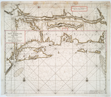
Reconnaissance of the bar and…
parent:
cf02eeb0-16ef-0135-6b1e-251
c
5e10288
c
Galveston entrance, Texas
parent:
4162e680-
c
52b-012f-
c
2dc-3
c
075448cc4b
Galveston entrance, Texas: fr…
parent:
62
c
19f00-e81a-0135-983d-078a44e2ad92
Preliminary sketch of Wachapr…
parent:
87229fd0-
c
52b-012f-390d-3
c
075448cc4b
Preliminary survey of harbors…
parent:
1d172460-3631-0134-9ba3-00505686a51
c
Reconnaissance of the harbors…
parent:
42cc38b0-
c
52b-012f-4adf-3
c
075448cc4b
Coast chart no. 10 Cape Cod B…
parent:
1
c
631620-5b2a-0134-d939-00505686a51
c
… considerable land marks &
c
. &
c
.
parent:
4d2684f0-
c
5d5-012f-932f-58d385a7bc34
Mouth of Chester River : (Har…
parent:
54
c
27df0-
c
52b-012f-8018-3
c
075448cc4b
Pas kaart van West Indien : b…
parent:
37d78a10-
c
5d5-012f-2ab1-58d385a7bc34
… : with soundings &
c
taken by Lt
parent:
503a2300-
c
5d5-012f-4d9a-58d385a7bc34
Preliminary chart of the sea …
parent:
f58affb0-
c
52a-012f-56dd-3
c
075448cc4b
… considerable land marks &
c
. &
c
.
parent:
e4e3d7a0-
c
5d3-012f-9
c
95-58d385a7bc34
Mouth of Chester River : (Har…
parent:
54312bb0-
c
52b-012f-b8e9-3
c
075448cc4b
Pas-Kaart vande zee kusten va…
parent:
577
c
1320-
c
5d5-012f-
c
161-58d385a7bc34
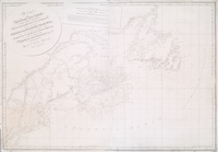
Alaska Peninsula and Aleutian…
parent:
d4fe8590-b142-0132-d8
c
1-58d385a7bbd0
… : from
C
. Cod to
C
parent:
df21a560-
c
5d3-012f-1973-58d385a7bc34
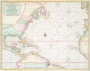
Ocean Atlantique, ou, Mer du …
parent:
14f482
c
0-
c
5d5-012f-ddd5-58d385a7bc34
America, N.W. Coast, Strait o…
parent:
7d109db0-
c
52a-012f-b115-3
c
075448cc4b
Preliminary sketch of Mobile …
parent:
8d6cee50-7
c
6b-0135-3765-1f2
c
5910acc2
… Rip, &
c
.
parent:
c
2a15940-52a5-0134-b2a3-00505686a51
c
… Carolina, &
c
.
parent:
063e9970-
c
5d5-012f-
c
5e2-58d385a7bc34
Ocean Atlantique, ou, Mer du …
parent:
70d5ac90-
c
5d5-012f-f9a6-58d385a7bc34
…, Antecosty, Sable, &
c
parent:
59e6e4e0-
c
5d5-012f-ce77-58d385a7bc34
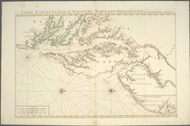
Carte particuliere de Virgini…
parent:
b1104e20-
c
6f0-012f-bce2-3
c
075448cc4b
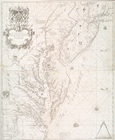
A new map of Virginia, Maryla…
parent:
08d75a10-
c
5d5-012f-6751-58d385a7bc34
Preliminary chart of St. Mark…
parent:
793
c
8630-16f2-0135-4246-6765cf2aaff7
…, dangers, bancs, &
c
parent:
4dda5f10-
c
5d5-012f-cca1-58d385a7bc34
…, Antecosty, Sable, &
c
parent:
5a7712a0-
c
5d5-012f-d51f-58d385a7bc34
City and harbor of Portland, …
parent:
51a7ed50-a2ba-0134-1e57-00505686a51
c
Chart of Long Island Sound, 1…
parent:
c
9fc54f0-
c
5d4-012f-ba00-58d385a7bc34
Entrance to New York Bay from…
parent:
ca95ce80-
c
5d4-012f-a2df-58d385a7bc34
Nautical chart of Little Egg …
parent:
cb28a870-
c
5d4-012f-88e0-58d385a7bc34
The Bay and river of Delaware
parent:
cbcef260-
c
5d4-012f-1
c
60-58d385a7bc34
Chart of the entrance to Ches…
parent:
cc57
c
570-
c
5d4-012f-acf7-58d385a7bc34
The harbor of Wood's Hole, Ma…
parent:
30d2
c
2e0-6bce-0134-65e7-00505686a51
c
Harbors of Sheffield Island a…
parent:
5ea59630-3
c
97-0134-0a6b-00505686a51
c
Alaska Peninsula and Aleutian…
parent:
d73f7
c
10-ed97-0135-8755-332a5039146f
Preliminary chart of Gloucest…
parent:
8cc893
c
0-52aa-0134-1483-00505686a51
c
… of New York, Boston, &
c
parent:
4552ba40-
c
5d5-012f-009f-58d385a7bc34
…, &
c
.]
parent:
87db1950-
c
5d5-012f-63bc-58d385a7bc34
Passe A Loutre, Mississippi D…
parent:
49fc01f0-
c
52b-012f-0aff-3
c
075448cc4b
Preliminary chart of Cedar Ke…
parent:
c
1d2ef30-13d2-0135-d440-3f4da83e2bb8
…, &
c
.
parent:
89202d60-
c
5d5-012f-af15-58d385a7bc34
St. Mary's River and Fernandi…
parent:
61bfcf90-16f7-0135-3cc2-00
c
15915f2a5
Albemarle Sound, N. Carolina,…
parent:
95489e10-3ff2-0135-6
c
5e-5bcdf66b6168
Cat and Ship Island harbors :…
parent:
4162e680-
c
52b-012f-
c
2dc-3
c
075448cc4b
The harbor of Holmes' Hole: t…
parent:
f3f39f60-52af-0134-5671-00505686a51
c
Preliminary chart of St. Andr…
parent:
30262ab0-13f9-0135-b66
c
-077ac48cd231
A chart of the coast of Ameri…
parent:
0b6fd3f0-
c
5d5-012f-dfb3-58d385a7bc34