Click to visit the main New York Public Library Homepage
The New York Public Library
Digital Collections
About Digital Collections
Browse
Search only public domain materials
Items
Collections
Divisions
Home
Search
Browse
About
Search only public domain materials
Items
Collections
Divisions
Digital Collections
Using Images
Using Data
Search
Filtered search
Show filters
Hide filters
Show Only Public Domain
topic
x
Cities and towns
Landowners
25
Real property
24
Villages
15
Administrative and political divisions
9
More
Less
name
Lange, Dorothea
16
United States. Farm Security Administration
16
Smith, Robert Pearsall, 1827-1898
9
Worley & Bracher
5
Beers, S. N
4
More
Less
collection
Maps of New York City and State
25
Maps of North America
21
Farm Security Administration Photographs
16
American popular songs
3
Atlases of the United States
2
More
Less
place
New York (State)
27
Pennsylvania
9
New York
7
California
5
New Jersey
5
More
Less
genre
Maps
50
Cadastral maps
20
Photographs
17
Illustrations
6
Prints
3
More
Less
publisher
State Board of Health
4
G.W. & C.B. Colton & Co
3
A. Pomeroy
2
Engraved by J.M. Atwood
2
Sanborn Map Company
2
More
Less
division
Map Division
50
Wallach Division: Photography Collection
16
Music Division
3
Wallach Division: Art & Architecture Collection
2
General Research Division
1
More
Less
type
cartographic
50
still image
27
notated music
3
text
1
Date Range
to
74 results found
Filtering on:
x
Topic
: Cities and towns
Sort by:
Title
Date created
Date digitized
Sequence
Vid goroda Sent-Dzhames na os…
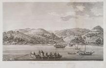
Vid Megasaki bliz goroda Nang…
m
Military map of Cuba
A map of the state of New Yor…
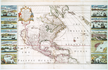
A new & correct map of the tr…
m
While the city sleeps
m
He brought home another - wor…
m
While the city sleeps
m
Map of the state of New-York:…
Onondaga County & adjacent te…
m
Map of Otsego Co., New York: …
Topographical map of Seneca C…
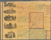
Plate II. Sketches of village…
Plate III : Sketches of villa…
Plate IV. Sketches of village…
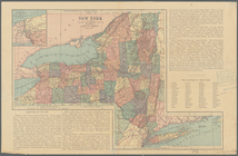
[Map of] New York [State]: [S…
m
Canaan, Connecticut
Map of Saratoga Co., New York…
A topographical map of Steube…
m
Schuyler County, New York, wi…
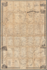
Map of Broome County, New York
Insurance maps of Tarrytown, …
Insurance maps of Tarrytown, …
Rand, McNally & Co.'s new com…
m
Gillette's map of Oneida Co.,…
m
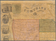
Map of Tompkins County, New Y…
Map of Seneca Co., New York: …
m
Map of Tioga County, New York…
m
Map of Suffolk Co., L.I., New…
Township map of New Jersey an…
Massachusetts with Connecticu…
Map of the city of Washington…
m
Topographical map of the stat…
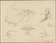
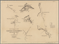
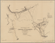
Plate I. Map of the watershed…
Map of Northumberland County,…
A new and accurate map of Nor…
Map of Washington Co., Pennsy…
m
Map of Fulton Co., Pennsylvan…
m
Map of Cambria Co., Pennsylva…
m
Map of Clearfield Co., Pennsy…
Map of Perry County, Ohio
m
Map of Trumbull County, Ohio
m
Map of Mahoning County, Ohio …
Map of Clinton County, Ohio
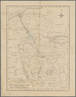
Map of the surveyed portions …
m
Map of Dutchess Co., New York…
m
Map of Allegany Co., N.Y.: fr…
m
Map of the vicinity of Philad…
m
Map of Monroe County, Wiscons…
Map of Philadelphia photograp…