Click to visit the main New York Public Library Homepage
The New York Public Library
Digital Collections
About Digital Collections
Browse
Search only public domain materials
Items
Collections
Divisions
Home
Search
Browse
About
Search only public domain materials
Items
Collections
Divisions
Digital Collections
Using Images
Using Data
Search
Filtered keyword search
Show filters
Hide filters
Show Only Public Domain
topic
Nautical charts
125
Railroads
54
Administrative and political divisions
46
Harbors
39
History
34
More
Less
name
United States Coast Survey
115
Bache, A. D. (Alexander Dallas), 1806-1867
100
Geological Survey (U.S.)
30
Mathiot, G
30
United States. Army. Corps of Topographical Engineers
23
More
Less
collection
Maps of North America
383
Maps of New York City and State
46
Lawrence H. Slaughter Collection of English maps, charts, globes, books and atlases
9
Atlases of the United States
8
Maps of North and South America
4
More
Less
place
United States
59
New York (State)
50
Virginia
33
California
26
Michigan
21
More
Less
genre
Maps
454
Nautical charts
103
Bathymetric maps
55
Topographic maps
31
Geological maps
13
More
Less
publisher
U.S. Coast Survey
56
U.S. Coast Survey Office
35
publisher not identified
26
U.S. Geological Survey
15
G.W. & C.B. Colton & Co
9
More
Less
division
Map Division
454
Wallach Division: Print Collection
1
type
x
cartographic
still image
10
text
4
Date Range
to
455 results found for:
x
C. W. S
Filtering on:
x
Type
: cartographic
Sort by:
Relevance
Title
Date created
Date digitized
Sequence
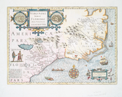
Amérique ou Indes Occidentale…
parent:
5cf10890-
c
6b9-012f-5a67-58d385a7bc34
A new & exact map of the coas…
parent:
9
c
4bf3d0-1149-0133-ce0f-58d385a7b928
Stanford's library map of Nor…
parent:
5d52f8d0-
c
52a-012f-8383-3
c
075448cc4b
Washington city
parent:
d8b77e40-
c
5d4-012f-135f-58d385a7bc34
Mitchell's county and townshi…
parent:
2799fcc0-801f-0133-
c
8cc-00505686d14e
m
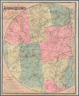
Diagrams of the New-York and …
parent:
c
9306b40-8b03-0133-477a-00505686a51
c
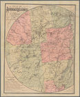
Diagrams of the New-York and …
parent:
adee4f00-8b0a-0133-
c
5df-00505686d14e
Territory of Columbia
parent:
e1042d90-
c
5d4-012f-9b1a-58d385a7bc34
Map of the U.
S
. and Territories…North Central.
parent:
a1ac6d70-
c
52a-012f-dfc2-3
c
075448cc4b
Map of the U.
S
. and Territories…North East.
parent:
a207bd40-
c
52a-012f-7153-3
c
075448cc4b
Map of the United States of A…
parent:
9
c
354510-
c
52a-012f-9
c
98-3
c
075448cc4b
Virginia, Marylandia et Carol…
parent:
03cd6720-
c
5d5-012f-75f8-58d385a7bc34
… Carolina, &
c
.
parent:
063e9970-
c
5d5-012f-
c
5e2-58d385a7bc34
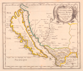
Chart of the coast of Califor…
parent:
e8cd26
c
0-fcb1-0132-a8e1-58d385a7b928
A general map of the southern…
parent:
7d109db0-
c
52a-012f-b115-3
c
075448cc4b
A chart of the coast of Ameri…
parent:
0b6fd3f0-
c
5d5-012f-dfb3-58d385a7bc34
Extract from a map of the Bri…
parent:
48f38d80-234
c
-0133-deb4-58d385a7b928
Map showing the principal rai…
parent:
7d109db0-
c
52a-012f-b115-3
c
075448cc4b
Map showing the position of t…
parent:
7d109db0-
c
52a-012f-b115-3
c
075448cc4b
North America west coast, Har…
parent:
267
c
9660-3221-0133-0f42-58d385a7b928
m
Mitchell's new national map e…
parent:
7d109db0-
c
52a-012f-b115-3
c
075448cc4b
Virginiae item et Floridae Am…
parent:
137271e0-
c
5d5-012f-97ed-58d385a7bc34
Map of the boundary lines bet…
parent:
a9f066a0-54
c
7-0133-8d30-00505686a51
c
A Map of Carolana and of the River Meschacebe &
c
.
parent:
44571050-
c
5d5-012f-a444-58d385a7bc34
… of New York, Boston, &
c
parent:
4552ba40-
c
5d5-012f-009f-58d385a7bc34
…, Californie, &
c
.
parent:
9f7580f0-
c
5d5-012f-5b45-58d385a7bc34
Map of the Adirondack wildern…
parent:
f2250050-7f21-0133-
c
228-00505686a51
c
Map of the Adirondack wildern…
parent:
41bdda20-
c
5aa-012f-4dde-58d385a7bc34
Map of the New York wildernes…
parent:
41bdda20-
c
5aa-012f-4dde-58d385a7bc34
… Adirondacks Illustrated" by
S
parent:
dae911e0-a1ba-0133-e445-00505686a51
c
… Adirondacks Illustrated" by
S
parent:
546f2f70-a1
c
5-0133-ef10-00505686d14e
Cataraugus harbor and the pub…
parent:
37b5da00-a1d7-0133-cf3d-00505686a51
c
Map showing the route of the …
parent:
4bc11160-
c
5aa-012f-ca8b-58d385a7bc34
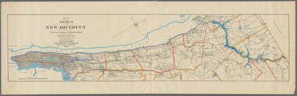
Aqueduct Commissioners topogr…
parent:
41e8f680-b8ae-0133-32
c
6-00505686a51
c
m
Survey for a ship canal to co…
parent:
4ee62e00-
c
5aa-012f-a458-58d385a7bc34
m
United States of America, 1834
parent:
dc6882b0-
c
52a-012f-f8ea-3
c
075448cc4b
United States of America
parent:
e21406f0-
c
52a-012f-655b-3
c
075448cc4b
… the continent &
c
parent:
79965
c
20-8bdd-0133-f603-00505686d14e
Map of the United States exhi…
parent:
805
c
4990-bd5b-0133-e05a-00505686d14e
Map of the United States exhi…
parent:
2fc58880-
c
6d6-0133-841
c
-00505686a51
c
Mineral spring resorts of the…
parent:
407ba280-e56b-0133-359f-00505686a51
c
m
Colton's railroad and commerc…
parent:
4615ae80-58e2-0134-5fbf-00505686a51
c
Virginia, Marylandia et Carol…
parent:
18cbec30-
c
52b-012f-10f3-3
c
075448cc4b
…, Maryland, Virginia &
c
parent:
30b827d0-
c
52b-012f-a862-3
c
075448cc4b
Map of the territory of the U…
parent:
3b8f9be0-
c
52b-012f-
c
37
c
-3
c
075448cc4b
Map showing the lands assigne…
parent:
3e7e5800-
c
52b-012f-df79-3
c
075448cc4b
Preliminary chart of the sea …
parent:
f58affb0-
c
52a-012f-56dd-3
c
075448cc4b
Map of reconnaissance exhibit…
parent:
f58affb0-
c
52a-012f-56dd-3
c
075448cc4b
Dodge expedition route map fr…
parent:
2e8dd1a0-321
c
-0133-a309-00505686a51
c
Map illustrating the plan of …
parent:
99737
c
20-3225-0133-f206-58d385a7b928
1
2
Previous
Next
1
2
Previous
Next