Click to visit the main New York Public Library Homepage
The New York Public Library
Digital Collections
About Digital Collections
Browse
Search only public domain materials
Items
Collections
Divisions
Home
Search
Browse
About
Search only public domain materials
Items
Collections
Divisions
Digital Collections
Using Images
Using Data
Search
Filtered keyword search
Show filters
Hide filters
Show Only Public Domain
topic
Post roads
16
Nautical charts
15
History
11
Business enterprises
6
Commerce
6
More
Less
name
Goodrich, A. T. (Andrew Thompson), 1789-1845
15
Rollinson, William, 1762-1842
15
Bridges
14
United States Coast Survey
13
Bache, A. D. (Alexander Dallas), 1806-1867
12
More
Less
collection
Maps of North America
57
Atlases of the United States
22
Lawrence H. Slaughter Collection of English maps, charts, globes, books and atlases
21
Maps of New York City and State
19
New York City directories
6
More
Less
place
New York (State)
35
New York (N.Y.)
27
New Jersey
16
United States
15
Hudson River (N.Y. and N.J.) -- Maps
14
More
Less
genre
Maps
130
Atlases
22
Nautical charts
14
Bathymetric maps
8
Books
6
More
Less
publisher
Published by A.T. Goodrich, 124 Broad Way
14
publisher not identified
8
Century Atlas Co
7
U.S. Coast Survey
7
Printed by H. Sweitzer, for M. Carey,
5
More
Less
division
Map Division
122
Rare Book Division
7
Manuscripts and Archives Division
1
type
x
cartographic
text
6
still image
4
Date Range
to
130 results found for:
x
Williams, T
Filtering on:
x
Type
: cartographic
Sort by:
Relevance
Title
Date created
Date digitized
Sequence
m
A chart of the discoveries of…
is:
true
m
A map of South Carolina and a…
is:
true
m
A map of South Carolina and a…
is:
true
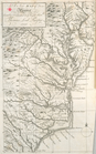
A Map of the British and Fren…
is:
true
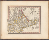
A mapp of Virginia
is:
true
A new and correct map of Amer…
is:
true
A new and exact map of the Un…
is:
true
A new map of North America sh…
is:
true
A new map of North America sh…
is:
true
A new map of the most conside…
is:
true
A New map of Virginia.
is:
true
A plan of Bahia del Espiritu …
is:
true
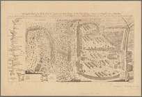
A prospective view of the bat…
is:
true
A prospective view of the bat…
is:
true
A sketch of the operations of…
is:
true
A topographical map of the no…
is:
true
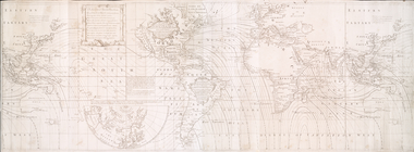
Accuratissima totius terrarum…
is:
true
Albemarle Sound, N. Carolina,…
is:
true
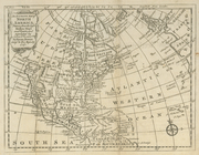
An accurate map of North Amer…
is:
true
…., Goethe St.,
William
St
is:
true
… by Broadway, Peck St.,
William
is:
true
… [Map bounded by
William
is:
true
… [Map bounded by
William
is:
true
…,
William
St., Walden Ave
is:
true
… [Map bounded by
William
is:
true
…,
William
St.]
is:
true
Charleston harbour, S. Ca. : …
is:
true
Chengwatana, Pine County, M.
T
. …
is:
true
m
City of Washington, statistic…
is:
true
Colorado (Dolores County), Ri…
is:
true
Copy of plate of Kenosha harb…
is:
true
Die vereinigten Staaten von N…
is:
true
Galveston entrance, Texas: fr…
is:
true
….
T
.J. Cram,
T
.E
is:
true
Geological map of the distric…
is:
true
Geological section of the Ber…
is:
true
Geological section of the Coa…
is:
true
Harbors of Captain's Island E…
is:
true
Hind, Hindoostan, or India
is:
true
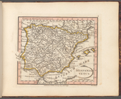
Hispania Vetus
is:
true
Land register map of the City…
is:
true
Lloyd's map of the lower Miss…
is:
true
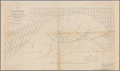
Map exhibiting the route of t…
is:
true
Map of Boston in the state of…
is:
true
Map of Dunkirk Harbor, showin…
is:
true
… by
William
T
. Davis
is:
true
Map of Teller Reindeer Statio…
is:
true
Map of the boundary lines bet…
is:
true
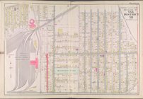
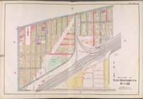
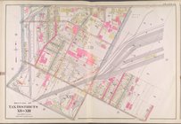
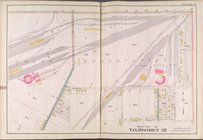
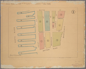
Map of the city of New-York
is:
true
Map of the city of New-York
is:
true