Click to visit the main New York Public Library Homepage
The New York Public Library
Digital Collections
About Digital Collections
Browse
Search only public domain materials
Items
Collections
Divisions
Home
Search
Browse
About
Search only public domain materials
Items
Collections
Divisions
Digital Collections
Using Images
Using Data
Search
Filtered keyword search
Show filters
Hide filters
Show Only Public Domain
topic
Administrative and political divisions
265
Nautical charts
242
Railroads
205
Real property
170
History
108
More
Less
name
United States Coast Survey
259
Bache, A. D. (Alexander Dallas), 1806-1867
207
Burr, David H., 1803-1875
91
Rawdon, Clark & Co
75
United States. General Land Office
74
More
Less
collection
Maps of North America
1218
Maps of New York City and State
175
Atlases of the United States
145
Lawrence H. Slaughter Collection of English maps, charts, globes, books and atlases
84
I. N. Phelps Stokes Collection of American Historical Prints
27
More
Less
place
New York (State)
268
United States
209
New York (N.Y.)
157
Virginia
124
Washington (D.C.)
81
More
Less
genre
Maps
1733
Nautical charts
195
Atlases
144
Bathymetric maps
116
Topographic maps
66
More
Less
publisher
U.S. Coast Survey
133
U.S. Coast Survey Office
66
publisher not identified
65
C.K. Stone
42
General Land Office
39
More
Less
division
Map Division
1681
Wallach Division: Print Collection
31
General Research Division
16
Rare Book Division
4
Dorot Jewish Division
2
More
Less
type
x
cartographic
still image
42
text
18
Date Range
to
1,740 results found for:
x
D. C
Filtering on:
x
Type
: cartographic
Sort by:
Relevance
Title
Date created
Date digitized
Sequence
Results 751 - 800
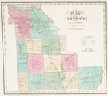
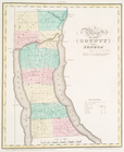
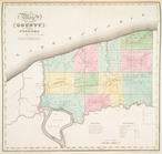
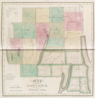
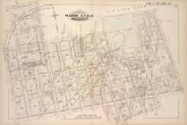
Map of the county of Madison
parent:
ae509850-
c
5ed-012f-8232-58
d
385a7bc34
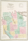
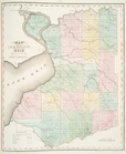
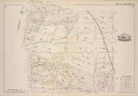
Map of the county of Onondaga
parent:
aedf01e0-
c
5ed-012f-2b3
c
-58
d
385a7bc34
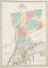
Map of the counties of New Yo…
parent:
a642f440-
c
5ed-012f-
d
858-58
d
385a7bc34
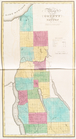
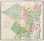
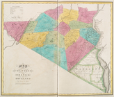
Map of the county of Cayuga
parent:
af75e4f0-
c
5ed-012f-
c
347-58
d
385a7bc34
Map of the county of Seneca
parent:
b0093840-
c
5ed-012f-af54-58
d
385a7bc34
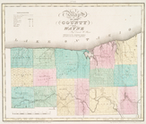
Map of the county of Wayne
parent:
b13f9080-
c
5ed-012f-0384-58
d
385a7bc34
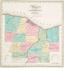
Map of the county of Monroe
parent:
b1
c
2f220-
c
5ed-012f-aae0-58
d
385a7bc34
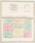
Map of the county of Orleans
parent:
b2492e50-
c
5ed-012f-2750-58
d
385a7bc34
Map of the county of Niagara
parent:
b2
c
4ff10-
c
5ed-012f-ae60-58
d
385a7bc34
Map of the county of Erie
parent:
b363e4
c
0-
c
5ed-012f-5070-58
d
385a7bc34
Map of the county of Westches…
parent:
a6e58200-
c
5ed-012f-204
c
-58
d
385a7bc34
Map of the county of Ulster
parent:
a8aa8
d
80-
c
5ed-012f-eeac-58
d
385a7bc34
Geological map of the Lake Su…
parent:
c
2e47e80-b143-0132-9cdd-58
d
385a7bbd0
Preliminary map of Central Co…
parent:
28
d
4aaa0-b143-0132-
c
9cc-58
d
385a7bbd0
Preliminary chart of Gray's H…
parent:
aca6b700-2
c
5b-0136-ea47-5
d
3f5f807056
Harbor of Manitowoc, Wis. : t…
parent:
f057
c
8a0-e510-0135-
c
143-19a288da4f36
Geological map of the distric…
parent:
c
2e47e80-b143-0132-9cdd-58
d
385a7bbd0
Preliminary chart of the sea …
parent:
52a622
d
0-b144-0132-78
c
9-58
d
385a7bbd0
Preliminary chart of Bass Riv…
parent:
ad3ce6
c
0-529b-0134-643a-00505686a51
c
Preliminary chart of York Riv…
parent:
87229fd0-
c
52b-012f-390
d
-3
c
075448cc4b
Drainage map of Colorado
parent:
28
d
4aaa0-b143-0132-
c
9cc-58
d
385a7bbd0
Reconnaissance of the western…
parent:
c
3caa0b0-50fd-0134-6a48-00505686a51
c
Biloxi Bay, Mississippi : fro…
parent:
29702880-2eaa-0135-92ba-0
d
426a5169
c
1
Reconnaissance of the western…
parent:
4162e680-
c
52b-012f-
c
2dc-3
c
075448cc4b
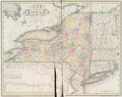
Map of the state of New-York …
parent:
a4ed7f00-
c
5ed-012f-7761-58
d
385a7bc34
Map of the county of Herkimer
parent:
ad2925b0-
c
5ed-012f-bfd4-58
d
385a7bc34
Map of the counties of Ontari…
parent:
b0ad7f00-
c
5ed-012f-defa-58
d
385a7bc34
Map of the counties of Orange…
parent:
a80b5600-
c
5ed-012f-96fa-58
d
385a7bc34
Map of the counties of Albany…
parent:
ab6b1960-
c
5ed-012f-0a24-58
d
385a7bc34
Ceded part of Dakota Territor…
parent:
96cfaee0-
d
916-0135-db37-23dd29
c
51711
Harbor of Refuge, Dutch Islan…
parent:
7ae52
d
50-
c
54
c
-0134-025e-00505686a51
c
m
Dakota Territory
parent:
903cbb80-
d
914-0135-113b-55f89
c
891
c
13
Petaluma and Napa Creeks, Cal…
parent:
42cc38b0-
c
52b-012f-4adf-3
c
075448cc4b
Preliminary chart of Key-West…
parent:
4162e680-
c
52b-012f-
c
2dc-3
c
075448cc4b
Rappahannock River, Virginia …
parent:
3ba0
c
580-68
d
6-0135-df13-4b72a4264fa6
A map of the extremity of Cap…
parent:
b57bf580-5b26-0134-fa2a-00505686a51
c
Key West Harbor and its appro…
parent:
4162e680-
c
52b-012f-
c
2dc-3
c
075448cc4b
m
Reconnoissance of the western…
parent:
99e59950-3639-0134-cdf9-00505686a51
c
m
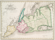
Eastern part of Long Island S…
parent:
a1a9
d
830-
c
5a6-012f-00ec-58
d
385a7bc34
Reconnaissance of the western…
parent:
6a1381
c
0-3636-0134-02
c
4-00505686a51
c
An accurate map of North Amer…
parent:
6a5739
c
0-
c
5
d
4-012f-7f0b-58
d
385a7bc34
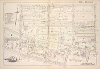
Map bound by Fifth St., Sixth…
parent:
b70fd2
d
0-
c
5fa-012f-e297-58
d
385a7bc34
Map bound by Whale Creek Cana…
parent:
c
55
c
0fe0-
c
5fa-012f-0
c
03-58
d
385a7bc34
Map bounded by Putnam Ave., T…
parent:
a89
c
52
d
0-
c
5fa-012f-cece-58
d
385a7bc34
A plan of the attack of Fort …
parent:
4162e680-
c
52b-012f-
c
2dc-3
c
075448cc4b
Map bound by Sands St., U.S. …
parent:
bdaca380-
c
5fa-012f-6f5f-58
d
385a7bc34
.Map bound by Frost St., King…
parent:
afe02040-
c
5fa-012f-18a1-58
d
385a7bc34
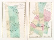
Map of the city of Washington…
parent:
91a438
c
0-
c
52b-012f-bc7b-3
c
075448cc4b
Map of the city of Washington…
parent:
91a438
c
0-
c
52b-012f-bc7b-3
c
075448cc4b
…
D
.
C
.
parent:
8579ecf0-f161-0134-eb62-6b43de1ad87
c
1
2
3
4
5
6
7
Previous
Next
1
2
3
4
5
6
7
Previous
Next