Click to visit the main New York Public Library Homepage
The New York Public Library
Digital Collections
About Digital Collections
Browse
Search only public domain materials
Items
Collections
Divisions
Home
Search
Browse
About
Search only public domain materials
Items
Collections
Divisions
Digital Collections
Using Images
Using Data
Search
Filtered keyword search
Show filters
Hide filters
Show Only Public Domain
topic
Real property
865
Administrative and political divisions
480
Railroads
439
Fire insurance
309
Cities & towns
274
More
Less
name
New York (N.Y.). Board of Estimate and Apportionment
334
Sanborn Map Company
292
G.W. Bromley & Co
153
M.B. Brown Printing and Binding Co
109
Ullitz, Hugo
93
More
Less
collection
Maps of New York City and State
1169
Atlases of New York City
1150
Maps of North America
1063
Atlases of the United States
464
Lawrence H. Slaughter Collection of English maps, charts, globes, books and atlases
304
More
Less
place
New York (State)
1809
New York
807
New York (N.Y.)
770
Manhattan (New York, N.Y.)
400
United States
392
More
Less
genre
Maps
4426
Atlases
452
Cadastral maps
132
Prints
78
Topographic maps
70
More
Less
publisher
Sanborn Map Company
276
New York (N.Y.). Board of Estimate and Apportionment
184
G.W. Bromley & Co
140
publisher not identified
113
M.B. Brown Printing & Binding Co.,
109
More
Less
division
Map Division
4286
Wallach Division: Print Collection
49
Manuscripts and Archives Division
44
Schomburg Jean Blackwell Hutson Research and Reference Division
32
Rare Book Division
21
More
Less
type
x
cartographic
text
103
still image
46
three dimensional object
1
Date Range
to
Looking for this collection?
Maps of New York City and State
2,059 items
4,471 results found for:
x
United States. Circuit Court (New York : Northern District)
Filtering on:
x
Type
: cartographic
Sort by:
Relevance
Title
Date created
Date digitized
Sequence
Results 1751 - 1800
m
Post route map of the
state
of Colorado …
use:
… partner (e.g.,
New
York
Post route map of the
state
of Maine
use:
… partner (e.g.,
New
York
Lloyd's official map of the
state
use:
… partner (e.g.,
New
York
… in the
state
of Minnesota …
use:
… partner (e.g.,
New
York
Township and railway map of the
state
use:
… partner (e.g.,
New
York
… in the
state
of Minnesota …
use:
… partner (e.g.,
New
York
Nell's topographical map of the
state
use:
… partner (e.g.,
New
York
m
Post route map of the
state
of Louisiana …
use:
… partner (e.g.,
New
York
County map of the
states
of Georgia
use:
… partner (e.g.,
New
York
Post route map of the
state
of Minnesota …
use:
… partner (e.g.,
New
York
Post route map of the
state
of Colorado …
use:
… partner (e.g.,
New
York
Shelton & Kensett's map of the
state
use:
… partner (e.g.,
New
York
Congressional map of the
state
of Kansas, 1875 …
use:
… partner (e.g.,
New
York
m
Skinner Street, near the
State
Prison
use:
… partner (e.g.,
New
York
m
Post route map of the
state
of Minnesota, …
use:
… partner (e.g.,
New
York
…, in the
state
of Michigan …
use:
… partner (e.g.,
New
York
Map of the
states
of North & South Carolina
use:
… partner (e.g.,
New
York
Colton's sectional map of the
state
use:
… partner (e.g.,
New
York
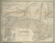
Map of the
state
of
New
York
: showing
use:
… partner (e.g.,
New
York
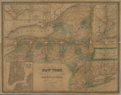
Map of the
state
of
New
York
: showing
use:
… partner (e.g.,
New
York
Map of the
state
of
New
York
: showing
use:
… partner (e.g.,
New
York
Map of the
state
of
New
York
: showing
use:
… partner (e.g.,
New
York
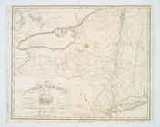
A map of the
state
of
New
York
: compiled
use:
… partner (e.g.,
New
York
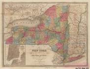
Map of the
state
of
New
York
showing
use:
… partner (e.g.,
New
York
Map of the
state
of
New
York
showing
use:
… partner (e.g.,
New
York
Bounded by
Northern
Avenue, Wadsworth Avenue
use:
… partner (e.g.,
New
York
m
…
Court
of
New
York
use:
… partner (e.g.,
New
York
Map of Erie County,
New
York
use:
… partner (e.g.,
New
York
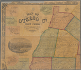
m
Map of Otsego Co.,
New
York
use:
… partner (e.g.,
New
York
Map of Broome County,
New
York
use:
… partner (e.g.,
New
York
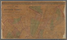
m
Higginson's map of
New
York
and vicinity
use:
… partner (e.g.,
New
York
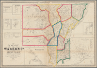
Map of Warren Co.,
New
York
use:
… partner (e.g.,
New
York
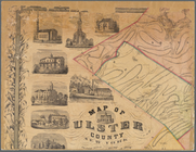
m
Map of Ulster County,
New
York
use:
… partner (e.g.,
New
York
m
Map of the borough of Brooklyn,
New
York
…
use:
… partner (e.g.,
New
York
Map No. II
New
York
use:
… partner (e.g.,
New
York
m
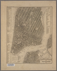
New
York
City elevated railroads
use:
… partner (e.g.,
New
York
m
Map of Ontario County,
New
York
use:
… partner (e.g.,
New
York
Map of the cities of
New
York
and Brooklyn
use:
… partner (e.g.,
New
York
m
Map of Tioga County,
New
York
use:
… partner (e.g.,
New
York
Map of the
New
York
Wilderness
use:
… partner (e.g.,
New
York
Plan von
New
-
York
, 1851
use:
… partner (e.g.,
New
York
Map of the
New
York
& Boston Railway
use:
… partner (e.g.,
New
York
New
-
York
and vicinity as proposed
use:
… partner (e.g.,
New
York
m
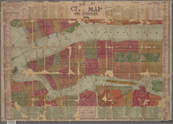
New
York
City map and directory.
use:
… partner (e.g.,
New
York
m
Sea Gate,
New
York
Harbor
use:
… partner (e.g.,
New
York
Map of the borough of Brooklyn,
New
York
use:
… partner (e.g.,
New
York
Map of part of
New
York
City
use:
… partner (e.g.,
New
York
New
York
med trakten däromkring
New
-
York
, N. Jersey and Pennsylvania.
use:
… partner (e.g.,
New
York
A draught of
New
York
and Perthamboy
use:
… partner (e.g.,
New
York
1
2
…
5
6
7
8
9
10
11
12
…
17
18
Previous
Next
1
2
…
5
6
7
8
9
10
11
12
…
17
18
Previous
Next