Click to visit the main New York Public Library Homepage
The New York Public Library
Digital Collections
About Digital Collections
Browse
Search only public domain materials
Items
Collections
Divisions
Home
Search
Browse
About
Search only public domain materials
Items
Collections
Divisions
Digital Collections
Using Images
Using Data
Search
Filtered keyword search
Show filters
Hide filters
Show Only Public Domain
topic
Real property
865
Administrative and political divisions
480
Railroads
439
Fire insurance
309
Cities & towns
274
More
Less
name
New York (N.Y.). Board of Estimate and Apportionment
334
Sanborn Map Company
292
G.W. Bromley & Co
153
M.B. Brown Printing and Binding Co
109
Ullitz, Hugo
93
More
Less
collection
Maps of New York City and State
1169
Atlases of New York City
1150
Maps of North America
1063
Atlases of the United States
464
Lawrence H. Slaughter Collection of English maps, charts, globes, books and atlases
304
More
Less
place
New York (State)
1809
New York
807
New York (N.Y.)
770
Manhattan (New York, N.Y.)
400
United States
392
More
Less
genre
Maps
4426
Atlases
452
Cadastral maps
132
Prints
78
Topographic maps
70
More
Less
publisher
Sanborn Map Company
276
New York (N.Y.). Board of Estimate and Apportionment
184
G.W. Bromley & Co
140
publisher not identified
113
M.B. Brown Printing & Binding Co.,
109
More
Less
division
Map Division
4286
Wallach Division: Print Collection
49
Manuscripts and Archives Division
44
Schomburg Jean Blackwell Hutson Research and Reference Division
32
Rare Book Division
21
More
Less
type
x
cartographic
text
103
still image
46
three dimensional object
1
Date Range
to
Looking for this collection?
Maps of New York City and State
2,059 items
4,471 results found for:
x
United States. Circuit Court (New York : Northern District)
Filtering on:
x
Type
: cartographic
Sort by:
Relevance
Title
Date created
Date digitized
Sequence
Results 2001 - 2050
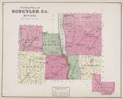
Outline Plan of Schuyler Co.
New
York
use:
… partner (e.g.,
New
York
m
Center of
New
York
, first city of the world
use:
… partner (e.g.,
New
York
Center of
New
York
, first city of the world
use:
… partner (e.g.,
New
York
m
…. Blaau's estate in
New
York
use:
… partner (e.g.,
New
York
m
City of
New
York
, boroughs of Manhattan
use:
… partner (e.g.,
New
York
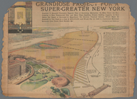
Grandiose Project for a Super-Greater
New
York
use:
… partner (e.g.,
New
York
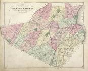
Outline Plan of Orange County
New
York
use:
… partner (e.g.,
New
York
Map of the Borough of Richmond, City of
New
York
use:
… partner (e.g.,
New
York
Outline map of
New
York
Harbor & vicinity
use:
… partner (e.g.,
New
York
m
Birds eye view of
New
York
and vicinity
use:
… partner (e.g.,
New
York
Map of the borough of Brooklyn, City of
New
York
…
use:
… partner (e.g.,
New
York
m
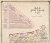
Outline map of Essex County,
New
York
.
use:
… partner (e.g.,
New
York
m
Map of
New
-
York
Bay and Harbor and the environs
use:
… partner (e.g.,
New
York
Map of the Hackensack &
New
York
use:
… partner (e.g.,
New
York
Sketch map of the city of
New
York
use:
… partner (e.g.,
New
York
m
Huguenot Park, Westchester County,
New
York
use:
… partner (e.g.,
New
York
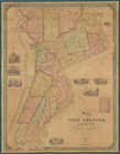
Map of West Chester County,
New
York
use:
… partner (e.g.,
New
York
New
York
, the English colonial city
use:
… partner (e.g.,
New
York
m
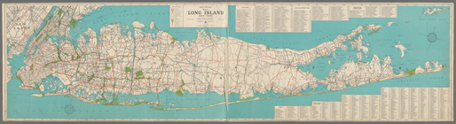
Hagstrom's map of Long Island
New
York
…
use:
… partner (e.g.,
New
York
m
… plan of greater
New
York
use:
… partner (e.g.,
New
York
… map of the Port of
New
York
use:
… partner (e.g.,
New
York
m
Hagstom's map of Long Island
New
York
use:
… partner (e.g.,
New
York
m
Panoramic view of
New
York
City
use:
… partner (e.g.,
New
York
m
Edsalls'
New
York
City guide map
use:
… partner (e.g.,
New
York
Panoramic view of
New
York
City
use:
… partner (e.g.,
New
York
[Map of] Friends' in the vicinity of
New
York
.
use:
… partner (e.g.,
New
York
Coltons map of the
New
York
wilderness
use:
… partner (e.g.,
New
York
m
City of
New
York
, map of the borough
use:
… partner (e.g.,
New
York
m
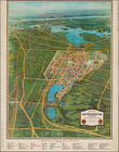
Bird's eye view of
New
York
City
use:
… partner (e.g.,
New
York
Hagstrom's map of lower
New
York
City …
use:
… partner (e.g.,
New
York
m
The Wanamaker diary map of
New
York
use:
… partner (e.g.,
New
York
Map of the borough of Brooklyn, City of
New
York
, …
use:
… partner (e.g.,
New
York
Map of the
New
York
world's fair
use:
… partner (e.g.,
New
York
A topographical map of Lewis Co.,
New
York
use:
… partner (e.g.,
New
York
m
Hammond's complete map of
New
York
City
use:
… partner (e.g.,
New
York
Hammond's complete map of
New
York
City
use:
… partner (e.g.,
New
York
Block sketch 1679,
New
York
City
use:
… partner (e.g.,
New
York
m
Hammond's complete map of
New
York
City
use:
… partner (e.g.,
New
York
m
Map of the borough of Brooklyn, City of
New
York
…
use:
… partner (e.g.,
New
York
New
York
and vicinity roads and rail
use:
… partner (e.g.,
New
York
… facilities in Greater
New
York
…
use:
… partner (e.g.,
New
York
A topographical map of Steuben Co.,
New
York
use:
… partner (e.g.,
New
York
… and
New
York
use:
… partner (e.g.,
New
York
Map, Copake (Columbia County,
New
York
)…
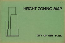
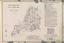
Height Zoning Map. City of
New
York
.
note:
On each map: Amended height
district
m
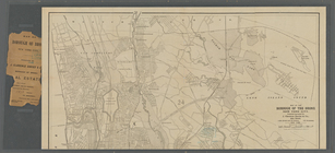
Map of the borough of the Bronx,
New
York
City
use:
… partner (e.g.,
New
York
Use Zoning Map. City of
New
York
.
m
Map of the borough of Brooklyn, City of
New
York
use:
… partner (e.g.,
New
York
m
Gillette's map of Oneida Co.,
New
York
use:
… partner (e.g.,
New
York
Map of part of Orange County,
New
York
use:
… partner (e.g.,
New
York
1
2
…
6
7
8
9
10
11
12
13
…
17
18
Previous
Next
1
2
…
6
7
8
9
10
11
12
13
…
17
18
Previous
Next