Click to visit the main New York Public Library Homepage
The New York Public Library
Digital Collections
About Digital Collections
Browse
Search only public domain materials
Items
Collections
Divisions
Home
Search
Browse
About
Search only public domain materials
Items
Collections
Divisions
Digital Collections
Using Images
Using Data
Search
Filtered keyword search
Show filters
Hide filters
Show Only Public Domain
topic
Railroads
2
Administrative and political divisions
1
Human settlements
1
Indian reservations
1
Steamboat lines
1
name
Barbot, Jean, 1655-1712
1
Bew, John, -1793
1
Child, G
1
Knight, John
1
Lodge, John, -1796
1
More
Less
collection
Maps of North America
2
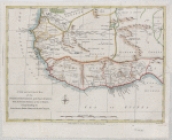
A new and accurate map of the European settlements on the coast of Africa, from the River Senegal to that of Benin, comprehending the gum, grain, ivory, gold and slave coasts
1
Atlases, gazetteers, guidebooks and other books
1
Map of part of the windward coast of Guinea, and of the Malaghetta or Grain Coast, with the adjacent territories
1
Maps of Europe
1
place
East Saint Louis (Ill.)
1
English Channel
1
Europe
1
Idaho
1
Missouri
1
More
Less
genre
Maps
6
Nautical charts
1
publisher
J. Bew
1
Poole Bros.?
1
Rand, McNally & Co
1
Steele & co
1
s.n
1
division
Map Division
4
Schomburg Jean Blackwell Hutson Research and Reference Division
2
type
x
cartographic
Date Range
to
6 results found for:
x
Grains
Filtering on:
x
Type
: cartographic
Sort by:
Relevance
Title
Date created
Date digitized
Sequence
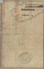
Map of the Oregon Railroad an…
abstract:
…. In bottom margin: For
grains
…, and of the Malaghetta or
Grain
Coast
note:
Coast of West Africa, named
Grain
Coast
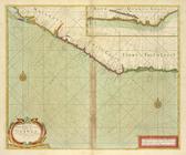
A chart of the
Grain
Ivory and Quaqua
…, comprehending the gum,
grain
m
A chart of the British Channe…
note:
….
Grain
, Exmouth Bar
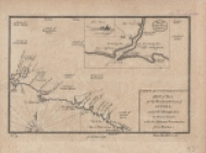
Rand, McNally & Co.'s indexed…
abstract:
… and passenger depots,
grain