Click to visit the main New York Public Library Homepage
The New York Public Library
Digital Collections
About Digital Collections
Browse
Search only public domain materials
Items
Collections
Divisions
Home
Search
Browse
About
Search only public domain materials
Items
Collections
Divisions
Digital Collections
Using Images
Using Data
Search
Filtered keyword search
Show filters
Hide filters
Show Only Public Domain
topic
Administrative and political divisions
25
Railroads
11
Nautical charts
9
Distances, etc
6
History
6
More
Less
name
G.W. & C.B. Colton & Co
9
Geological Survey (U.S.)
9
Ely, W. W., -1879
7
Stoddard, Seneca Ray, 1844-1917
6
U.S. Coast and Geodetic Survey
6
More
Less
collection
Maps of North America
44
Maps of New York City and State
28
Atlases of New York City
2
Atlases of the United States
2
Cartographic materials from the Emmet collection of manuscripts etc. relating to American history
1
More
Less
place
New York (State)
29
Adirondack Mountains (N.Y.)
14
New York (N.Y.)
10
United States
7
Manhattan (New York, N.Y.)
6
More
Less
genre
Maps
78
Nautical charts
8
Topographic maps
8
Bathymetric maps
6
Road maps
4
More
Less
publisher
U.S. Geological Survey
8
Engraved, printed and published by G.W. & C.B. Colton & Co
7
G.W. & C.B. Colton & Co
4
S.R. Stoddard
4
publisher not identified
4
More
Less
division
Map Division
78
Milstein Division
1
type
x
cartographic
text
2
Date Range
to
79 results found for:
x
Washington Heights (New York, N.Y.)
Filtering on:
x
Type
: cartographic
Sort by:
Relevance
Title
Date created
Date digitized
Sequence
m
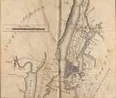
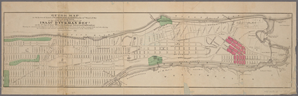
Washington
Heights
, Manhattan, its eventful past
use:
… partner (e.g.,
New
York
m
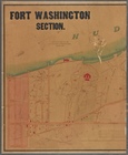
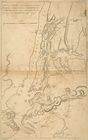
Fort
Washington
section.
use:
… partner (e.g.,
New
York
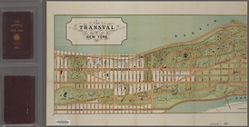
m
The Transval of
New
York
use:
… partner (e.g.,
New
York
m
…
Heights
immediately south of and adjoining University
Heights
use:
… partner (e.g.,
New
York
… as Belair
Heights
[Kalorama
Heights
]
use:
… partner (e.g.,
New
York
…., Maywood
Heights
, Etna,
N
.
Y
. and
N
.J. Investment Co
use:
… partner (e.g.,
New
York
Staten Island,
N
.
Y
., ed. of Feb. 1900
use:
… partner (e.g.,
New
York
A plan of
New
York
use:
… partner (e.g.,
New
York
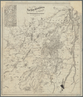
Map of the
New
York
Wilderness
use:
… partner (e.g.,
New
York
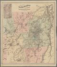
Map of the
New
York
Wilderness
use:
… partner (e.g.,
New
York
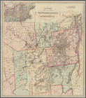
Map of the
New
York
wilderness accompanying "The
use:
… partner (e.g.,
New
York
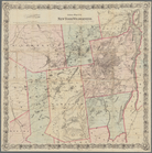
Map of the
New
York
wilderness accompanying "The
use:
… partner (e.g.,
New
York
Map of the
New
York
wilderness
use:
… partner (e.g.,
New
York
Colton's map of the
New
York
wilderness
use:
… partner (e.g.,
New
York
Map of the Adirondack wildern…
use:
… partner (e.g.,
New
York
Map of the state of
New
York
use:
… partner (e.g.,
New
York
Map of the Adirondack wildern…
use:
… partner (e.g.,
New
York
Map of the
New
York
wilderness
use:
… partner (e.g.,
New
York
Map of the Adirondack wildern…
use:
… partner (e.g.,
New
York
Asher & Adams' United States …
use:
… partner (e.g.,
New
York
Bay and harbor of
New
York
use:
… partner (e.g.,
New
York
Map of the Adirondack wildern…
use:
… partner (e.g.,
New
York
Coltons map of the
New
York
wilderness
use:
… partner (e.g.,
New
York
Colton's map of the
New
York
wilderness
use:
… partner (e.g.,
New
York
Distance map of the state of
New
York
use:
… partner (e.g.,
New
York
m
Map of the highlands of the H…
use:
… partner (e.g.,
New
York
A plan of
New
York
use:
… partner (e.g.,
New
York
Geological map of the distric…
use:
… partner (e.g.,
New
York
… ... from
New
York
Harbor the Fort
Washington
.
use:
… partner (e.g.,
New
York
Mt.
Washington
and vicinity
use:
… partner (e.g.,
New
York
…., Vine St.,
York
St
use:
… partner (e.g.,
New
York
Map bound by Poplar St., Sand…
use:
… partner (e.g.,
New
York
… at
Washington
Heights
use:
… partner (e.g.,
New
York
Map of the territory of Minne…
use:
… partner (e.g.,
New
York
Land classification map,
New
York
, Mt
use:
… partner (e.g.,
New
York
The Hawaiian Islands: compile…
use:
… partner (e.g.,
New
York
Map of North Carolina showing…
use:
… partner (e.g.,
New
York
Distance map of the state of
New
York
use:
… partner (e.g.,
New
York
America,
N
.W. Coast, Strait of Juan de Fuca
use:
… partner (e.g.,
New
York
A geological map of the Black…
use:
… partner (e.g.,
New
York
… by the hon. Jeff'
n
Davis
use:
… partner (e.g.,
New
York
Hydrographical basin of the u…
use:
… partner (e.g.,
New
York
General chart of Alaska : com…
use:
… partner (e.g.,
New
York
Improved map of the territori…
use:
… partner (e.g.,
New
York
New
Jersey (Sussex County) Franklin Furnace
use:
… partner (e.g.,
New
York
Map of the Black Hills : from…
use:
… partner (e.g.,
New
York
Johnson's Vermont and
New
Hampshire
use:
… partner (e.g.,
New
York
m
Map of the territory of the U…
use:
… partner (e.g.,
New
York
m
Territory of the United State…
use:
… partner (e.g.,
New
York
Map of the territory of Minne…
use:
… partner (e.g.,
New
York