Click to visit the main New York Public Library Homepage
The New York Public Library
Digital Collections
About Digital Collections
Browse
Search only public domain materials
Items
Collections
Divisions
Home
Search
Browse
About
Search only public domain materials
Items
Collections
Divisions
Digital Collections
Using Images
Using Data
Search
Filtered keyword search
Show filters
Hide filters
Show Only Public Domain
topic
Nautical charts
143
Administrative and political divisions
112
Railroads
83
Real property
64
History
57
More
Less
name
United States Coast Survey
118
Bache, A. D. (Alexander Dallas), 1806-1867
96
United States. General Land Office
75
Bien, Julius, 1826-1909
45
Roeser, C. (Charles)
34
More
Less
collection
Maps of North America
518
Maps of New York City and State
134
Lawrence H. Slaughter Collection of English maps, charts, globes, books and atlases
84
Atlases of New York City
60
William J. Wilgus papers
16
More
Less
place
New York (State)
110
United States
79
Virginia
56
New York (N.Y.)
55
North America
48
More
Less
genre
Maps
884
Nautical charts
96
Bathymetric maps
55
Topographic maps
45
Cadastral maps
40
More
Less
publisher
U.S. Coast Survey
60
General Land Office
38
publisher not identified
36
U.S. Coast Survey Office
32
Topographical Bureau
30
More
Less
division
Map Division
830
Manuscripts and Archives Division
30
General Research Division
10
Schomburg Jean Blackwell Hutson Research and Reference Division
7
Rare Book Division
4
More
Less
type
x
cartographic
text
22
still image
15
Date Range
to
890 results found for:
x
source_note_id%3ABRW
Filtering on:
x
Type
: cartographic
Sort by:
Relevance
Title
Date created
Date digitized
Sequence
…
sources
of the Hudson
use:
Release
Source
File for Free (i.e., high-res
Map of the United States and …
use:
Release
Source
File for Free (i.e., high-res
m
New map of that portion of No…
use:
Release
Source
File for Free (i.e., high-res
Map of the United States and …
use:
Release
Source
File for Free (i.e., high-res
Map or plan of section 10 [Cr…
use:
Release
Source
File for Free (i.e., high-res
Map of the United States and …
use:
Release
Source
File for Free (i.e., high-res
Industrial & political map of…
use:
Release
Source
File for Free (i.e., high-res
Relief map of the state of Ne…
use:
Release
Source
File for Free (i.e., high-res
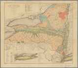
Economic and geologic map of …
use:
Release
Source
File for Free (i.e., high-res
Map of the United States and …
use:
Release
Source
File for Free (i.e., high-res
Topographical map of the Dist…
use:
Release
Source
File for Free (i.e., high-res
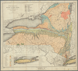
Economic and geologic map of …
use:
Release
Source
File for Free (i.e., high-res
The Course of the River Cali …
collection:
Journal of the discovery of the
source
Colton's new illustrated & em…
use:
Release
Source
File for Free (i.e., high-res
m
… authentic
sources
use:
Release
Source
File for Free (i.e., high-res
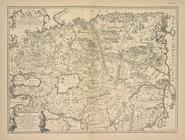
Kopiia s karty Sibiri N. Vits…
collection:
… by E.I.
Ides
. P. 27, 28
m
Ide
's map of Montana …
use:
Release
Source
File for Free (i.e., high-res
m
Atlas géologique
note:
Exhibition
ID
m
Colton's new sectional map of…
use:
Release
Source
File for Free (i.e., high-res
m
Johnson's new illustrated & e…
use:
Release
Source
File for Free (i.e., high-res
m
Watson's new county and railr…
use:
Release
Source
File for Free (i.e., high-res
…
Source
of the Nile.
m
Map of the United States and …
use:
Release
Source
File for Free (i.e., high-res
m
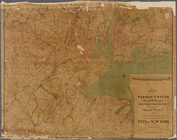
Map of the Passaic and Croton…
use:
Release
Source
File for Free (i.e., high-res
Map of the State of Louisiana…
use:
Release
Source
File for Free (i.e., high-res
Carte du cap & du port de Cet…
m
Official map of south-west po…
use:
Release
Source
File for Free (i.e., high-res
State of Florida: compiled fr…
use:
Release
Source
File for Free (i.e., high-res
Johnson's new illustrated & e…
use:
Release
Source
File for Free (i.e., high-res
Map showing the location of t…
use:
Release
Source
File for Free (i.e., high-res
Ægyptus antiqua : Mandato ser…
note:
Foxing on image.
Source
information
m
Colton's map of the state of …
use:
Release
Source
File for Free (i.e., high-res
Sketch map of Africa
collection:
… a discussion on the
sources
Map of Philadelphia
use:
Release
Source
File for Free (i.e., high-res
Stannard and Son's perspectiv…
note:
compiled from the latest official
sources
Virginia
Our centennial--plan of the g…
use:
Release
Source
File for Free (i.e., high-res
Map of modern Boston: from th…
use:
Release
Source
File for Free (i.e., high-res
New England
Map illustrating the operatio…
note:
… notation, lost, Image
ID
Cerca la
Source
.
use:
Release
Source
File for Free (i.e., high-res
Land given to the town of Qui…
use:
Release
Source
File for Free (i.e., high-res
… & other authentic
sources
.
use:
Release
Source
File for Free (i.e., high-res
A map showing the routes of s…
abstract:
http://
id
.loc.gov/authorities/subjects/sh85001531
Boston Harbor, Massachusetts:…
use:
Release
Source
File for Free (i.e., high-res
Map of the city of Savannah, …
use:
Release
Source
File for Free (i.e., high-res
Indian Territory, 1883
use:
Release
Source
File for Free (i.e., high-res
State of Illinois
use:
Release
Source
File for Free (i.e., high-res
State of Ohio
use:
Release
Source
File for Free (i.e., high-res
… to the
source
of the Mississippi
use:
Release
Source
File for Free (i.e., high-res
1
2
3
4
Previous
Next
1
2
3
4
Previous
Next