Click to visit the main New York Public Library Homepage
The New York Public Library
Digital Collections
About Digital Collections
Browse
Search only public domain materials
Items
Collections
Divisions
Home
Search
Browse
About
Search only public domain materials
Items
Collections
Divisions
Digital Collections
Using Images
Using Data
Search
Keyword search
Show filters
Hide filters
Show Only Public Domain
topic
Real property
11050
Fire insurance
5305
Cities & towns
5016
City planning
1101
Social conditions
946
More
Less
name
Sanborn Map Company
5108
G.W. Bromley & Co
2551
New York (N.Y.). City Planning Commission
980
M.I.T. Press
942
Bromley, George Washington
857
More
Less
collection
Atlases of New York City
11722
Atlases of the United States
3868
Maps of North America
3345
Maps of New York City and State
2059
Lawrence H. Slaughter Collection of English maps, charts, globes, books and atlases
1252
More
Less
place
New York (State)
14041
New York
5623
New York (N.Y.)
3511
Manhattan (New York, N.Y.)
2385
Brooklyn (New York, N.Y.)
1222
More
Less
genre
Maps
25787
Atlases
3791
Prints
1428
Topographic maps
1062
Surveys
1034
More
Less
publisher
Sanborn Map Company
5145
G.W. Bromley & Co
2371
MIT Press
942
E. Belcher Hyde
807
K.u.K. Militargeographisches Institut
774
More
Less
division
Map Division
23798
Manuscripts and Archives Division
1281
Wallach Division: Print Collection
746
Rare Book Division
518
Dorot Jewish Division
477
More
Less
type
cartographic
24808
still image
3785
text
2063
notated music
10
sound recording
3
More
Less
Date Range
to
Looking for one of these collections?
Atlases of New York City
11,722 items
Atlases of the United States
3,868 items
Maps of North America
3,345 items
Maps of New York City and State
2,059 items
Lawrence H. Slaughter Collection of English maps, charts, globes, books and atlases
1,252 items
Bancker plans
1,080 items
28,779 results found for:
Maps
Sort by:
Relevance
Title
Date created
Date digitized
Sequence
Results 1251 - 1300
Sheet No. 31. [Includes Castl…
Sheet No. 32. [Includes Gryme…
Sheet No. 33. [Includes Conco…
Sheet No. 37. [Includes Rockl…
Sheet No. 38. [Includes Port …
Sheet No. 43. [Includes Wild …
Sheet No. 44. [Includes Linol…
Sheet No. 45. [Includes New S…
Sheet No. 46. [Includes Rockl…
Sheet No. 47.[includes Egbert…
Sheet No. 49. [Includes Linde…
Sheet No. 50. [Includes South…
Sheet No. 51 [Includes Island…
Sheet No. 55. [Includes (Egbe…
Sheet No. 58. [Includes Bened…
Sheet No. 60. [Includes Bridg…
Sheet No. 69. [Includes Dewey…
Sheet No. 71. [Includes Oakwo…
Sheet No. 74. [Includes Rossv…
Sheet No. 81. [Includes Sharr…
Sheet No. 82. [Includes Sharr…
Sheet No. 84. [Includes Annad…
Sheet No. 85. [Includes (Gree…
Sheet No. 94. [Includes Richm…
Sheet Nos. 99 & 100.[Include …
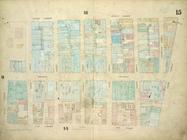
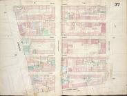
Plate 15:
Map
bounded by Church Street
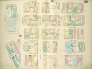
Plate 30:
Map
bounded by Cannon Street
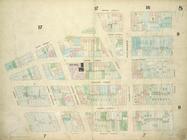
Plate 7:
Map
bounded by Murray Street
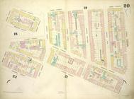
Plate 20:
Map
bounded by Sullivan Street
Map
bounded by Fifth Street, First
Plate 8:
Map
bounded by Duane Street
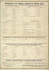
Warehouse for General Storage…
collection:
Maps
of the city of New-York [1857-1862]
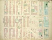
Plate 27:
Map
bounded by Montgomery
Plate 25:
Map
bounded by Bowery
Plate 19:
Map
bounded by West Houston
Plate 24:
Map
bounded by Crosby Street
Key Plan Showing the System o…
collection:
Insurance
maps
of the City of New York
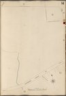
Bronx, V. A, Plate No. 14 [
Map
bounded
Bronx, V. A, Plate No. 55 [
Map
bounded
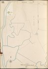
Bronx, V. A, Plate No. 57 [
Map
bounded
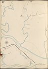
Bronx, V. A, Plate No. 59 [
Map
bounded
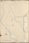
Bronx, V. A, Plate No. 60 [
Map
bounded
Bronx, V. B, Plate No. 14 [
Map
bounded
Bronx, V. B, Plate No. 47 [
Map
bounded
Bronx, V. B, Plate No. 48 [
Map
bounded
Bronx, V. B, Plate No. 49 [
Map
bounded
Bronx, V. B, Plate No. 50 [
Map
bounded
Map
of Woodlawn Cemetery.
Map
of Woodlawn Cemetery.
Map
of New York and vicinity
1
2
3
4
5
6
7
8
9
10
…
115
116
Previous
Next
1
2
3
4
5
6
7
8
9
10
…
115
116
Previous
Next