Click to visit the main New York Public Library Homepage
The New York Public Library
Digital Collections
About Digital Collections
Browse
Search only public domain materials
Items
Collections
Divisions
Home
Search
Browse
About
Search only public domain materials
Items
Collections
Divisions
Digital Collections
Using Images
Using Data
Search
Keyword search
Show filters
Hide filters
Show Only Public Domain
topic
Real property
316
Business enterprises
190
Maps
55
Railroads
45
Pictorial works
39
More
Less
name
Austro-Hungarian Monarchy. Militärgeographisches Institut
773
Stone & Stewart
151
Beers, S. N
146
Beers, D. G. (Daniel G.)
141
Geological Survey (U.S.)
101
More
Less
collection
Spezialkarte der Osterreichisch-Ungarischen Monarchie
773
Atlases of the United States
534
Maps of North America
316
Atlases of New York City
213
Maps of New York City and State
89
More
Less
place
New York (State)
425
Staten Island (New York, N.Y.)
91
Bronx (New York, N.Y.)
85
New Jersey
81
New York (N.Y.)
62
More
Less
genre
Maps
1897
Topographic maps
1062
Atlases
534
Prints
29
Cadastral maps
26
More
Less
publisher
K.u.K. Militargeographisches Institut
773
Stone & Stewart
99
Topographical Bureau
82
The Suvery
52
C. K. Stone
46
More
Less
division
Map Division
1931
Rare Book Division
18
General Research Division
5
Wallach Division: Picture Collection
5
Wallach Division: Print Collection
5
type
cartographic
1909
text
51
still image
26
Date Range
to
Looking for this collection?
Spezialkarte der Osterreichisch-Ungarischen Monarchie
774 items
1,964 results found for:
Topographic maps
Sort by:
Relevance
Title
Date created
Date digitized
Sequence
Results 1751 - 1800
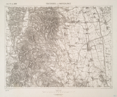
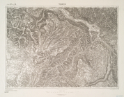
Toketerebes und Nagyszalancz.
Tolmein.
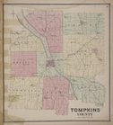
Tompkins County
collection:
New
topographical
atlas of Tompkins County
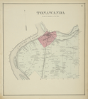
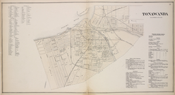
Tonawanda [Township]
collection:
New
topographical
atlas of Erie Co., New
Tonawanda [Village]; Tonawand…
collection:
New
topographical
atlas of Erie Co., New
Topographic
sheet
note:
…, chief
topographer
; E.M. Douglas,
topographer
Topographical
& township
map
note:
Mapping
the Nation (NEH grant, 2015-2018)…
m
Topographical
and irrigation
map
of the Great
note:
… catalog of the
Map
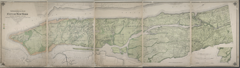
Topographical
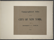
atlas of the City of New York
note:
One
map
in 5 sheets.
m
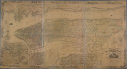
Topographical
atlas of the city of New York
note:
One
map
in 5 sheets.
Topographical
map
in ten-foot contour
note:
Mapping
the Nation (NEH grant, 2015-2018)…
Topographical
map
in thirty-foot contour
note:
Mapping
the Nation (NEH grant, 2015-2018)…
Topographical
map
made from surveys
note:
… and
topographical
engineer.
m
Topographical
map
of central California
note:
NYPL
Map
Div. copy has accession no
Topographical
map
of Fairmount Park, Philadelphia …
note:
… catalog of the
Map
Topographical
map
of Fairmount Park, Philadelphia …
note:
NYPL
Map
Div. copy: manuscript additions in black
m
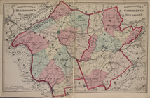
Topographical
map
of Hunterdon Co., New Jersey
note:
Includes 3 ancillary
maps
on verso
Topographical
Map
Topographical
map
of lands belonging
note:
Mapping
the Nation (NEH grant, 2015-2018)…
m
Topographical
map
of Massachusetts
note:
NYPL
Map
Div. copy is divided into 4 sheets, 65
Topographical
map
of Middlesex Fells Reservation
note:
… & Taylor,
topographers
Topographical
map
of Monadnock Mountain, New
note:
Mapping
the Nation (NEH grant, 2015-2018)…
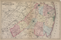
Topographical
Map
of Monmouth Co., New Jersey.
m
Topographical
map
of New York and vicinity …
note:
Insets: Navesink Park --
Map
of Long
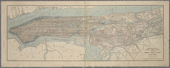
Topographical
map
of New York City
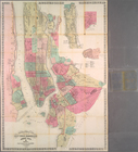
m
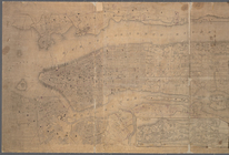
Topographical
map
of New York City, county
note:
Cadastral
map
covering area south of 155
m
Topographical
map
of New York City, County
note:
Cadastral
map
. Covers the area south
Topographical
map
of New York City, County
note:
Mapping
the Nation (NEH grant, 2015-2018)…
m
Topographical
map
of New York City, County
topic:
New York (N.Y.)--
Maps
Topographical
map
of Seneca County, N.Y.
note:
Mapping
the Nation (NEH grant, 2015-2018)…
Topographical
map
of that portion of New Jersey
note:
Mapping
the Nation (NEH grant, 2015-2018)…
Topographical
Map
of the cities of New York
Topographical
map
of the city and county of New
note:
… to Early
Maps
of the Middle
Topographical
map
of the city and county of New
collection:
Topographical
map
of the city and county
m
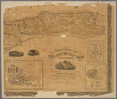
Topographical
map
m
Topographical
map
of the City of New York
note:
… an actual survey;
Map
of New
Topographical
map
of the coal and iron ore lands
note:
… catalog of the
Map
Topographical
map
of the country between the Mohawk
note:
Mapping
the Nation (NEH grant, 2015-2018)…
m
Topographical
map
of the county of Penobscot
note:
NYPL
Map
Div. copy is divided into 6 sheets, 79
m
Topographical
map
of the County of Winnebago
note:
… at H.F. Walling's
Map
m
Topographical
map
of the District of Columbia
note:
Mapping
the Nation (NEH grant, 2015-2018)…
Topographical
map
of the District of Columbia
note:
Partial cadastral
map
showing landowners
Topographical
map
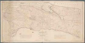
of the northern part of New York
Topographical
map
of the northern section
note:
… to Early
Maps
of the Middle
Topographical
map
of the original District
note:
Mapping
the Nation (NEH grant, 2015-2018)…
Topographical
map
of the state of New Jersey
note:
…: Meteorological
map
of the state
m
Topographical
map
of the state of New Jersey
note:
…: Meteorological
map
of the state
Topographical
map
of the state of New Jersey
note:
Mapping
the Nation (NEH grant, 2015-2018)…
m
Topographical
map
of the state of Pennsylvania
note:
…, and inset
maps
.
Topographical
map
of the state of Rhode Island
note:
Mapping
the Nation (NEH grant, 2015-2018)…
1
2
3
4
5
6
7
8
Previous
Next
1
2
3
4
5
6
7
8
Previous
Next