Click to visit the main New York Public Library Homepage
The New York Public Library
Digital Collections
About Digital Collections
Browse
Search only public domain materials
Items
Collections
Divisions
Home
Search
Browse
About
Search only public domain materials
Items
Collections
Divisions
Digital Collections
Using Images
Using Data
Search
Keyword search
Show filters
Hide filters
Show Only Public Domain
topic
Nautical charts
382
Harbors
72
Coasts
61
Navigation
32
Pilot guides
8
More
Less
name
United States Coast Survey
199
Thornton, Samuel
173
Bache, A. D. (Alexander Dallas), 1806-1867
171
Mathiot, G
47
Alden, James, 1810-1877
31
More
Less
collection
Maps of North America
254
Atlases, gazetteers, guidebooks and other books
178
Lawrence H. Slaughter Collection of English maps, charts, globes, books and atlases
71
Maps of New York City and State
37
Maps of the Oceans
12
More
Less
place
Atlantic Ocean
55
New York (N.Y.)
35
New Jersey
34
Maps
32
Massachusetts
31
More
Less
genre
Maps
569
Nautical charts
399
Bathymetric maps
100
Prints
10
Illustrations
4
More
Less
publisher
U.S. Coast Survey
95
U.S. Coast Survey Office
51
United States Coast Survey
21
publisher not identified
9
The Survey
6
More
Less
division
Map Division
560
Wallach Division: Print Collection
7
General Research Division
5
type
cartographic
571
still image
11
text
5
Date Range
to
572 results found for:
Nautical charts
Sort by:
Relevance
Title
Date created
Date digitized
Sequence
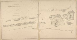
Bermuda Islands
Bermuda Island. Hamilton
Jamaica Bay and Rockaway Inle…
collection:
… and Geodetic Survey.
Nautical
chart
; no. 542.
Alaska Peninsula and Aleutian…
note:
…"Track
chart
Bering Sea Fleet, C. L
Coast
chart
topic:
Nautical
charts
m
1896 Connecticut River, Conn.…
topic:
Nautical
charts
m
Map of the portion of the Con…
topic:
Nautical
charts
Alaska Peninsula and Aleutian…
abstract:
… in fathoms. "Track
chart
General
chart
of Alaska …
topic:
Nautical
charts
Geo. W. Eldridge's
chart
B
note:
… with this
chart
."…
Hawaiian or Sandwich Islands
topic:
Nautical
charts
Beaufort River, S.C. : from B…
topic:
Nautical
charts
Bay and harbor of New York
note:
Includes text,
charts
, and views.
1889, Larchmont Harbor, N.Y.:…
topic:
Nautical
charts
Alaska Peninsula and adjacent…
abstract:
… U.S.C. survey
charts
nos
Blackwell's, Ward's and Randa…
note:
… and Geodetic Survey.
Nautical
chart
; no. 3040.
Océan Atlantique nord, côtes …
topic:
Nautical
charts
Coast
Chart
no. 9, Boston Bay and approaches
topic:
Nautical
charts
Coast
chart
no. 10 Cape Cod Bay
topic:
Nautical
charts
Charleston harbour, S. Ca. : …
abstract:
… or
chart
of the Atlantic
Preliminary
chart
of Calibogue Sound and Skull
topic:
Nautical
charts
Sketch showing the progress o…
topic:
Nautical
charts
Nantucket Sound: western part
topic:
Nautical
charts
Asher & Adams' map of the bay…
m
United States--east coast, Ne…
note:
Chart
no.: 12327
Reconnaissance of the western…
topic:
Nautical
charts
Map of the coast of Massachus…
topic:
Nautical
charts
The harbor of New Bedford
topic:
Nautical
charts
City and harbor of Portland, …
topic:
Nautical
charts
Plan of Boston and its vicini…
note:
….
Chart
of Boston Harbor
Reconnaissance of the western…
topic:
Nautical
charts
Plan of Boston and its vicini…
note:
….
Chart
of Boston Harbor
Boston Harbor, Massachusetts:…
note:
Includes
charts
of tides, bottom types
Erie Harbor, Pa.
topic:
Nautical
charts
America, N.W. Coast, Strait o…
topic:
Nautical
charts
Reconnaissance of Doboy Bar a…
topic:
Nautical
charts
North America west coast, Har…
Lynn Harbor, Massachusetts 18…
topic:
Nautical
charts
Reconnaissance of the western…
topic:
Nautical
charts
Preliminary
chart
of entrance to Pensacola Bay
note:
Includes sailing directions, tide
charts
Preliminary
chart
of Hampton Roads and James
topic:
Nautical
charts
Atlantic Coast, Chesapeake en…
topic:
Nautical
charts
Coast
chart
no. 48, Cape Fear
topic:
Nautical
charts
St. Mary's River and Fernandi…
topic:
Nautical
charts
Preliminary
chart
of Hatteras Inlet, North
topic:
Nautical
charts
Stono Inlet, South Carolina
topic:
Nautical
charts
Metomkin Inlet, Virginia : fr…
topic:
Nautical
charts
m
Preliminary
chart
of Savannah River, Georgia …
topic:
Nautical
charts
Harbor of Refuge, Dutch Islan…
topic:
Nautical
charts
Tybee Bay and Calibogue Sound…
note:
…
chart
of Lieut. Wilkes
1
2
3
Previous
Next
1
2
3
Previous
Next