Click to visit the main New York Public Library Homepage
The New York Public Library
Digital Collections
About Digital Collections
Browse
Search only public domain materials
Items
Collections
Divisions
Home
Search
Browse
About
Search only public domain materials
Items
Collections
Divisions
Digital Collections
Using Images
Using Data
Search
Keyword search
Show filters
Hide filters
Show Only Public Domain
topic
Real property
316
Business enterprises
190
Maps
55
Railroads
45
Pictorial works
39
More
Less
name
Austro-Hungarian Monarchy. Militärgeographisches Institut
773
Stone & Stewart
151
Beers, S. N
146
Beers, D. G. (Daniel G.)
141
Geological Survey (U.S.)
101
More
Less
collection
Spezialkarte der Osterreichisch-Ungarischen Monarchie
773
Atlases of the United States
534
Maps of North America
316
Atlases of New York City
213
Maps of New York City and State
89
More
Less
place
New York (State)
425
Staten Island (New York, N.Y.)
91
Bronx (New York, N.Y.)
85
New Jersey
81
New York (N.Y.)
62
More
Less
genre
Maps
1897
Topographic maps
1062
Atlases
534
Prints
29
Cadastral maps
26
More
Less
publisher
K.u.K. Militargeographisches Institut
773
Stone & Stewart
99
Topographical Bureau
82
The Suvery
52
C. K. Stone
46
More
Less
division
Map Division
1931
Rare Book Division
18
General Research Division
5
Wallach Division: Picture Collection
5
Wallach Division: Print Collection
5
type
cartographic
1909
text
51
still image
26
Date Range
to
Looking for this collection?
Spezialkarte der Osterreichisch-Ungarischen Monarchie
774 items
1,964 results found for:
Topographic maps
Sort by:
Relevance
Title
Date created
Date digitized
Sequence
m
Map
of the Cedar Knolls, at Bronxville
note:
Topographical
map
of Cedar Knolls. Shows
Saratoga Springs [Township]
collection:
New
topographical
atlas of Saratoga Co
Schuylerville Business Direct…
collection:
New
topographical
atlas of Saratoga Co
Saratoga [Township]
collection:
New
topographical
atlas of Saratoga Co
Stillwater [Township]
collection:
New
topographical
atlas of Saratoga Co
References; Waterford [Villag…
collection:
New
topographical
atlas of Saratoga Co
Waterford [Township]
collection:
New
topographical
atlas of Saratoga Co
Beechers Hollow [Village]; Be…
collection:
New
topographical
atlas of Saratoga Co
Wilton [Township]
collection:
New
topographical
atlas of Saratoga Co
Map
of Saratoga County
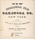
New
topographical
atlas of Saratoga Co
Residence of James Carrigan, …
collection:
New
topographical
atlas of Saratoga Co
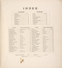
Index
collection:
New
topographical
atlas of Saratoga Co
Acres of Land, Population, Dw…
collection:
New
topographical
atlas of Saratoga Co
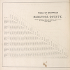
Table of Distances in Saratog…
collection:
New
topographical
atlas of Saratoga Co
Ballston [Township]
collection:
New
topographical
atlas of Saratoga Co
Ballston Spa Business Directo…
collection:
New
topographical
atlas of Saratoga Co
Charlton [Township]
collection:
New
topographical
atlas of Saratoga Co
Grangerville [Village]; Grang…
collection:
New
topographical
atlas of Saratoga Co
Clifton Park [Township]
collection:
New
topographical
atlas of Saratoga Co
Corinth [Township]; Palmer Fa…
collection:
New
topographical
atlas of Saratoga Co
Clifton Park [Village]; Clift…
collection:
New
topographical
atlas of Saratoga Co
Day Corners Business Director…
collection:
New
topographical
atlas of Saratoga Co
Edinburgh [Township]
collection:
New
topographical
atlas of Saratoga Co
Crescent [Village]; Crescent …
collection:
New
topographical
atlas of Saratoga Co
Galway [Township]; Yorks Corn…
collection:
New
topographical
atlas of Saratoga Co
Greenfield [Township]; Pages …
collection:
New
topographical
atlas of Saratoga Co
Bloodville [Village]; Bloodvi…
collection:
New
topographical
atlas of Saratoga Co
Hadley [Township]; Hadley Bus…
collection:
New
topographical
atlas of Saratoga Co
Half Moon [Township]
collection:
New
topographical
atlas of Saratoga Co
Factory Village [Village]; Fa…
collection:
New
topographical
atlas of Saratoga Co
Malta [Township]
collection:
New
topographical
atlas of Saratoga Co
Burnt Hills [Village]; Burnt …
collection:
New
topographical
atlas of Saratoga Co
Milton [Township]
collection:
New
topographical
atlas of Saratoga Co
Moreau [Township]
collection:
New
topographical
atlas of Saratoga Co
Conklingville [Village]; Conk…
collection:
New
topographical
atlas of Saratoga Co
Northumberland [Township]
collection:
New
topographical
atlas of Saratoga Co
Providence [Township]; Hagedo…
collection:
New
topographical
atlas of Saratoga Co
References; Saratoga Springs …
collection:
New
topographical
atlas of Saratoga Co
Map
of the borough of Brooklyn, City of New York
Records of searches in relati…
note:
compiled in the
Topographical
Bureau Board
m
New York City and vicinity
collection:
Maps
of New York City and State
Topographical
map
showing street system
note:
… of Queens,
Topographical
m
New York und Umgegend
collection:
Maps
of New York City and State
Relief
map
of New York and vicinity
note:
…
map
.
Map
of the City of New York and vicinity
note:
…"New York, December 1892
Topographical
New York City and environs : …
collection:
Maps
of New York City and State
m
Sanitary &
topographical
map
of the city
note:
Street
map
overlaid on
topographical
map
.
m
Topographical
map
of New York City, county
note:
Cadastral
map
covering area south of 155
m
Topographical
map
1
2
3
4
5
6
7
8
Previous
Next
1
2
3
4
5
6
7
8
Previous
Next