Click to visit the main New York Public Library Homepage
The New York Public Library
Digital Collections
About Digital Collections
Browse
Search only public domain materials
Items
Collections
Divisions
Home
Search
Browse
About
Search only public domain materials
Items
Collections
Divisions
Digital Collections
Using Images
Using Data
Search
Filtered search
Show filters
Hide filters
Show Only Public Domain
topic
History
91
Description and travel
56
Road maps
54
Geography
47
Atlases, British
44
More
Less
name
Sayer, Robert, 1725-1794
59
Tiebout, Cornelius, 1777-1832
57
Colles, Christopher, 1738-1816
53
Faden, William, 1749-1836
45
Dunn, Samuel, d. 1794
44
More
Less
collection
Bancker plans
544
Lawrence H. Slaughter Collection of English maps, charts, globes, books and atlases
190
Maps of North America
157
Atlases, gazetteers, guidebooks and other books
52
Maps of New York City and State
45
More
Less
place
United States
126
Middle Atlantic States
74
North America
66
New York (N.Y.)
54
Maps
53
More
Less
genre
Maps
1087
Surveys
543
land surveys
471
Documents
74
Prints
67
More
Less
publisher
Printed for Robert Sayer, No. 53, Fleet-Street
44
Printed for Lockyer Davis
40
publisher not identified
22
s.n
19
Presso Antonio Zatta
12
More
Less
division
Manuscripts and Archives Division
551
Map Division
477
General Research Division
61
Wallach Division: Print Collection
23
Rare Book Division
10
More
Less
type
x
cartographic
text
90
still image
9
Date Range
to
1,135 results found
Filtering on:
x
Date
: 1769 - 1791
x
Type
: cartographic
Sort by:
Title
Date created
Date digitized
Sequence
Karta Shelekhova. Stranstvova…
m
New York City directory, 1791
m
Continuation of Greenwich Str…
m
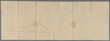
Fresh Water
m
Water and ground belonging to…
m
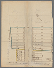
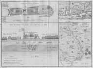
Plan of a House at Number 5 H…
m
Catherine Lane and Catherine …
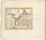
Atlas des enfans..., XVI
m
Thomas Gardener's lots
Atlas des enfans..., XV
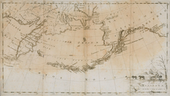
Sketch of the Northern Part o…
Northern Hemisphere ; Souther…
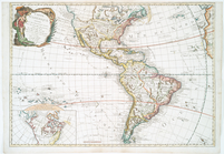
New World, or, Western Hemisp…
Chart of the coast of America…
Chart of the coast of America…
Chart of the coast of America…
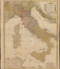
Italia in sous Status divisa …
m
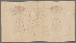
Maps
m
Lots 24, 25, 26 in the square…
m
New York City directory, 1790
m
Yellis Mandeville homestead a…
m
Thomas Gardner's lots at Crow…
m
Water lots East River
m
Mrs. Foxcraft's Rose Hill at …
m
Foxcraft at Greenwich
m
David Johnston's lots between…
m
John Street near Queen Street…
m
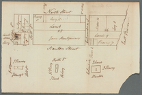
South side of Pearl Street
m
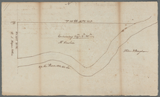
Pinhorn's Creek
m
Maiden Lane, Broadway, [Fly] …
m
Lots between Fair and John St…
m
Mr. Miller's and Mr. Ustick's…
m
R. G. Livingston's houses etc…
m
Golden Hill
m
Clark's corner Broadway and R…
m
Lots between Veasey and Barcl…
m
Land at Westchester belonging…
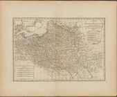
A new map of the Kingdom of P…
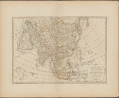
Asia, divided into its princi…
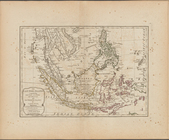
The East India Islands, compr…
Plan des achats des compagnie…
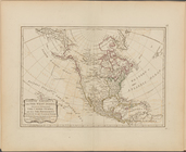
North America, with the West …
m
Susquehanna - Winship
1. Plan de L'Isle St. louis, …
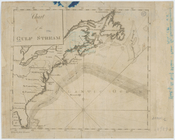
Chart of the Gulf Stream
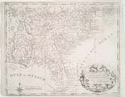
New map of the states of Geor…
Carte d'Amerique : diviseé en…
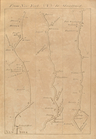
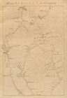
From New York (1) to Stratfor…
From New York (2) to Stratfor…
From New York (3) to Stratfor…
1
2
3
4
5
Previous
Next
1
2
3
4
5
Previous
Next