Click to visit the main New York Public Library Homepage
The New York Public Library
Digital Collections
About Digital Collections
Browse
Search only public domain materials
Items
Collections
Divisions
Home
Search
Browse
About
Search only public domain materials
Items
Collections
Divisions
Digital Collections
Using Images
Using Data
Search
Filtered search
Show filters
Hide filters
Show Only Public Domain
topic
History
91
Description and travel
56
Road maps
54
Geography
47
Atlases, British
44
More
Less
name
Sayer, Robert, 1725-1794
59
Tiebout, Cornelius, 1777-1832
57
Colles, Christopher, 1738-1816
53
Faden, William, 1749-1836
45
Dunn, Samuel, d. 1794
44
More
Less
collection
Bancker plans
544
Lawrence H. Slaughter Collection of English maps, charts, globes, books and atlases
190
Maps of North America
157
Atlases, gazetteers, guidebooks and other books
52
Maps of New York City and State
45
More
Less
place
United States
126
Middle Atlantic States
74
North America
66
New York (N.Y.)
54
Maps
53
More
Less
genre
Maps
1087
Surveys
543
land surveys
471
Documents
74
Prints
67
More
Less
publisher
Printed for Robert Sayer, No. 53, Fleet-Street
44
Printed for Lockyer Davis
40
publisher not identified
22
s.n
19
Presso Antonio Zatta
12
More
Less
division
Manuscripts and Archives Division
551
Map Division
477
General Research Division
61
Wallach Division: Print Collection
23
Rare Book Division
10
More
Less
type
x
cartographic
text
90
still image
9
Date Range
to
1,135 results found
Filtering on:
x
Date
: 1769 - 1791
x
Type
: cartographic
Sort by:
Title
Date created
Date digitized
Sequence
m
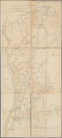
Map of the East Side of the N…
Sketch of the Northern Part o…
Caraibische Inseln
A chart of Delaware Bay and R…
Pennsylvania - Paoli, Chester…
Det gamle Norge
A new map of North America fr…
From New York (1) to Stratford
m
Plano.: de la Ysla de Sn. Jua…
Karta Shelekhova. Stranstvova…
New York province. Map of the…
m
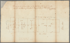
Lots on the north east side o…
m
Four lots near North Church
Province de New-York : en 4 f…
m
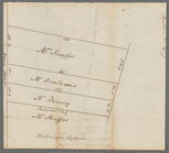
Lots near Amity Street, Broad…
m
Webber and Van Arden
m
Map of Little Bloomingdale
A map of Dutch settlements of…
m
Bloomingdale Road
m
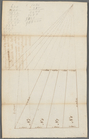
Lot on Bloomingdale Road
m
Plot of farm bounded by N. Ri…
m
Hopper Farm, showing divisions
m
The late John Hopper's farm a…
m
Phillip Webber's land between…
m
Phillip Webber's two tracts o…
m
Map of part of the late Jacob…
m
Van Arden, Warner and John Ke…
m
Bloomingdale
m
Bloomingdale Road
m
Survey of the two pieces of l…
A chorographical map of the p…
m
Isaac DePeyster's lot in Bowe…
m
circa 1780-1785
m
circa 1780-1785
m
Plot on Bowery lane
m
Bowery Lane and King's Bridge…
m
Potters field
m
Lots on the Bowery and Mott S…
m
Lot near Jewish burying ground
m
The mansion of Captain De Lan…
m
Ground on the east side of Bo…
m
Parcel of land in the Bowery
m
Brevoort, Smith and Dawson's …
m
Alderman Dykeman's land betwe…
m
Andrew Elliot's seat in Bower…
m
First sketch of James De Lanc…
m
Captain De Lancey's ground
m
Captain De Lancey - lot let t…
m
Six lots of ground on Captain…
m
Captain De Lancey's ground - …
1
2
3
4
5
Previous
Next
1
2
3
4
5
Previous
Next