


- The Library Shop
- Privacy Policy
- Rules and Regulations
- Using the Internet
- Website Terms and Conditions
- Gifts of Materials to NYPL
-
© The New York Public Library, 2024
The New York Public Library is a 501(c)(3) | EIN 13-1887440
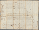
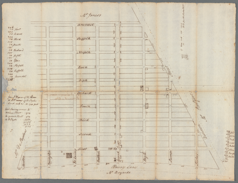
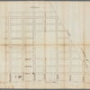
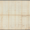
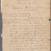
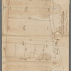
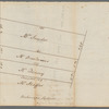
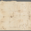
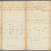
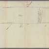
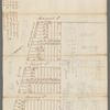
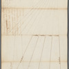
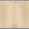
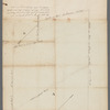
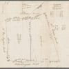
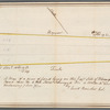
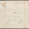
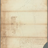
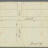
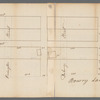
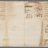
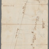
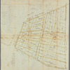
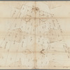
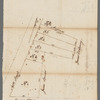
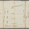
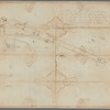
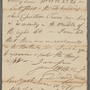
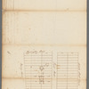
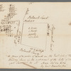
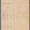
Manuscripts and Archives Division, The New York Public Library. "Captain De Lancey's ground - different plan" The New York Public Library Digital Collections. 1780 - 1789. https://digitalcollections.nypl.org/items/56618640-6a6a-0135-120d-0497bb5fce53
Manuscripts and Archives Division, The New York Public Library. "Captain De Lancey's ground - different plan" New York Public Library Digital Collections. Accessed April 26, 2024. https://digitalcollections.nypl.org/items/56618640-6a6a-0135-120d-0497bb5fce53
Manuscripts and Archives Division, The New York Public Library. (1780 - 1789). Captain De Lancey's ground - different plan Retrieved from https://digitalcollections.nypl.org/items/56618640-6a6a-0135-120d-0497bb5fce53
<ref name=NYPL>{{cite web | url=https://digitalcollections.nypl.org/items/56618640-6a6a-0135-120d-0497bb5fce53 | title=
(cartographic)
Captain De Lancey's ground - different plan, (1780 - 1789)|author=Digital Collections, The New York Public Library |accessdate=April 26, 2024 |publisher=The New York Public Library, Astor, Lenox, and Tilden Foundations}}</ref>