Click to visit the main New York Public Library Homepage
The New York Public Library
Digital Collections
About Digital Collections
Browse
Search only public domain materials
Items
Collections
Divisions
Home
Search
Browse
About
Search only public domain materials
Items
Collections
Divisions
Digital Collections
Using Images
Using Data
Search
Filtered search
Show filters
Hide filters
Show Only Public Domain
topic
History
59
Nautical charts
42
Administrative and political divisions
16
Colonies
12
Harbors
9
More
Less
name
Faden, William, 1749-1836
34
Lodge, John, -1796
20
Robert Sayer and John Bennett (Firm)
19
Kitchin, Thomas, 1718-1784
17
Bew, John, -1793
14
More
Less
collection
Maps of North America
128
Lawrence H. Slaughter Collection of English maps, charts, globes, books and atlases
108
Maps of New York City and State
43
John H. Levine Collection
12
Cartographic materials from the Emmet collection of manuscripts etc. relating to American history
9
More
Less
place
United States
55
North America
50
New Jersey
42
New York (State)
40
New York (N.Y.)
39
More
Less
genre
Maps
307
Early maps
7
Early works to 1800
7
Nautical charts
5
Atlases
2
More
Less
publisher
publisher not identified
16
s.n
14
Presso Antonio Zatta
12
J. Hinton
8
s.n.,
7
More
Less
division
x
Map Division
type
cartographic
306
text
4
still image
2
Date Range
to
308 results found
Filtering on:
x
Date
: 1775 - 1785
x
Division
: Map Division
x
Rights
: Public Domain
Sort by:
Title
Date created
Date digitized
Sequence
A map of Dutch settlements of…
Attack of the rebels upon For…
Plan of the position which th…
Grundriss des nördlichen Thei…
Plan von den Operationen der …
A plan of New York Island, pa…
Chart of the coast of Georgia
Plan of the entrance into Cap…
The harbour of Charles Town i…
m
A sketch of the operations be…
A sketch of the environs of C…
A sketch of the environs of C…
A sketch of the environs of C…
Chart of the N.W. coast of Am…
To His Excellency Genl. Washi…
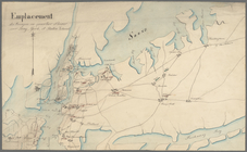
Emplacement des troupes en qu…
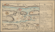
Plan der Attaque, welche Sr. …
A plan of the harbour of St. …
m
A map of the most inhabited p…
A plan of Charles Town, the c…
An accurate map of North and …
A new and accurate map of the…
A New and accurate map of the…
A new and accurate map of the…
A new and accurate map of Nor…
A plan of the several village…
A map and chart of those part…
South-Carolina and parts adja…
A plan of the attack of Fort …
Sketch of the battle of Hobki…
m
An accurate map of North and …
A new and accurate map of Nor…
Carte réduite des côtes et de…
Plan of the action at Huberto…
Position of the detachment un…
A map of such parts of Georgi…
Map of the Province of West F…
m
A map of South Carolina and a…
A plan of the attack of Fort …
Plan of the siege of Savannah
Carte d'une partie des côtes …
m
A chart of the harbour of Rho…
A Plan of the town of Newport…
A plan of the town of Newport…
A new and accurate map of the…
A new and accurate map of eas…
Plan of the action of Huberto…
A map of East and West Florid…
A map of the province of Mass…
Coastal chart of the Massachu…
1
2
Previous
Next
1
2
Previous
Next