Click to visit the main New York Public Library Homepage
The New York Public Library
Digital Collections
About Digital Collections
Browse
Search only public domain materials
Items
Collections
Divisions
Home
Search
Browse
About
Search only public domain materials
Items
Collections
Divisions
Digital Collections
Using Images
Using Data
Search
Filtered search
Show filters
Hide filters
Show Only Public Domain
topic
x
Real property
Fire insurance
3233
Cities & towns
3128
Business enterprises
468
Landowners
422
More
Less
name
Sanborn Map Company
3128
Beers, F. W. (Frederick W.)
356
Perris, William
260
E. Robinson Co
256
Robinson, E. (Elisha)
248
More
Less
collection
Atlases of New York City
3837
Atlases of the United States
1318
Maps of North America
290
Maps of New York City and State
246
Collection of broadside real estate maps announcing auctions of lots in early 19th century New York City
67
More
Less
place
New York (State)
5314
New York
807
Manhattan (New York, N.Y.)
341
Brooklyn (New York, N.Y.)
258
New York (N.Y.)
244
More
Less
genre
Maps
5577
Atlases
1315
Cadastral maps
432
Prints
69
Title pages
40
More
Less
publisher
Sanborn Map Company
3128
E. Robinson Co
209
F. W. Beers & Co
148
Perris & Browne
124
G.M. Hopkins & Co
108
More
Less
division
Map Division
5630
Manuscripts and Archives Division
2
No Division
1
type
cartographic
5640
text
144
still image
30
Date Range
to
5,763 results found
Filtering on:
x
Date
: 1777 - 1890
x
Topic
: Real property
Sort by:
Title
Date created
Date digitized
Sequence
13 lots of ground to be sold …
180 lots on the Marsellis Tra…
1st & 2nd Wards. [Map bounded…
1st & 3rd Wards. [Map bounded…
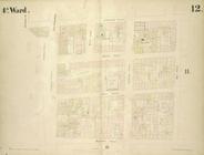
1st Ward. [Map bounded by Bow…
1st Ward. [Map bounded by Exc…
1st Ward. [Map bounded by Lib…
1st Ward. [Map bounded by Sto…
1st Ward. [Map bounded by Wes…
2nd & 4th Wards. [Map bounded…
2nd Ward. [Map bounded by Bro…
2nd Ward. [Map bounded by Pea…
2nd Ward. [Map bounded by Wil…
m
3 three story brick houses in…
3rd Ward. [Map bounded by Col…
3rd Ward. [Map bounded by Ful…
3rd Ward. [Map bounded by Gre…
3rd Ward. [Map bounded by Rob…
3rd Ward. [Map bounded by Wes…
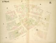
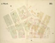
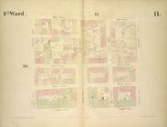
4th Ward. [Map bounded by Cat…
4th Ward. [Map bounded by Gol…
4th Ward. [Map bounded by Pec…
4th Ward. [Map bounded by Roo…
4th Ward.[Map bounded by Oak …
m
51 lots to be sold by R.R. Mi…
A chorographical map of the p…
A chorographical map of the p…
A chorographical map of the p…
m
A chorographical map of the p…
A compleat map of North-Carol…
A map of a tract of land in t…
A map of part of the land in …
A map of property belonging t…
m
A map of South Carolina and a…
A map of St. Augustine & vici…
A map of the late Jackson Est…
A map of the Manor Renselaerw…
A map of the original allotme…
A map of the original allotme…
A map of the village of Willi…
A new map of the city of Buff…
A new sectional map of Florid…
A plan of Greenville, Norwich…
A plan of the land belonging …
A plan of the Manor of Philip…
A plan of the town of Pittsfo…
A plott of ye situations of t…
A topographical map of Lewis …
m
A topographical map of Lincol…
m
A topographical map of Lincol…
1
2
3
4
5
6
7
8
9
10
…
23
24
Previous
Next
1
2
3
4
5
6
7
8
9
10
…
23
24
Previous
Next