Click to visit the main New York Public Library Homepage
The New York Public Library
Digital Collections
About Digital Collections
Browse
Search only public domain materials
Items
Collections
Divisions
Home
Search
Browse
About
Search only public domain materials
Items
Collections
Divisions
Digital Collections
Using Images
Using Data
Search
Filtered search
Show filters
Hide filters
Show Only Public Domain
topic
History
23
Nautical charts
18
Administrative and political divisions
6
Fortification
6
Coasts
5
More
Less
name
Lodge, John, -1796
19
Bew, John, -1793
14
Faden, William, 1749-1836
12
Zatta, Antonio, fl. 1757-1797
12
Hinton, John, -1781
11
More
Less
collection
Maps of North America
66
Lawrence H. Slaughter Collection of English maps, charts, globes, books and atlases
57
Maps of New York City and State
13
Cartographic materials from the Emmet collection of manuscripts etc. relating to American history
6
John H. Levine Collection
3
More
Less
place
North America
23
New York (State)
22
New Jersey
18
Maps
17
United States
15
More
Less
genre
x
Maps
Early maps
5
Early works to 1800
3
Nautical charts
2
Aerial views
1
More
Less
publisher
Presso Antonio Zatta
12
J. Hinton
8
J.F.W. Des Barres
6
publisher not identified
6
s.n
6
More
Less
division
x
Map Division
type
cartographic
148
still image
1
text
1
Date Range
to
149 results found
Filtering on:
x
Date
: 1778 - 1782
x
Division
: Map Division
x
Genre
: Maps
Sort by:
Title
Date created
Date digitized
Sequence
A map of Dutch settlements of…
Plan of the position which th…
m
A sketch of the operations be…
A sketch of the environs of C…
A sketch of the environs of C…
A sketch of the environs of C…
Chart of the N.W. coast of Am…
To His Excellency Genl. Washi…
A plan of the harbour of St. …
A new and accurate map of the…
A New and accurate map of the…
A new and accurate map of the…
A new and accurate map of Nor…
A plan of the several village…
A map and chart of those part…
A new and accurate map of Nor…
Carte réduite des côtes et de…
Plan of the action at Huberto…
Position of the detachment un…
A map of such parts of Georgi…
Map of the Province of West F…
m
A map of South Carolina and a…
Plan of the siege of Savannah
Carte d'une partie des côtes …
A new and accurate map of the…
Plan of the action of Huberto…
A map of East and West Florid…
A map of the province of Mass…
An accurate map of Rhode Isla…
Plan of part of the district …
An Accurate map of New Hampsh…
Plan of the town of Boston wi…
m
Piscataqua Harbour, Portsmout…
An exact map of the five grea…
A new and accurate map of the…
Connecticut and parts adjacent
Birds' eye view of New London…
A new and accurate map of Con…
m
The southern part of the Prov…
Carte du theatre de la guerre…
A plan of Fort Montgomery & F…
Carte de la baye et riviere d…
[A chart of New York Island &…
Mappa geographica Provinciae …
Amerique septentrionale : sui…
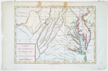
Carte de la Virginie, du Mary…
Il Maryland, il Jersey Meridi…
Carte du theatre de la guerre…
Carte du théatre de la guerre…
Carte du théatre de la guerre…