Click to visit the main New York Public Library Homepage
The New York Public Library
Digital Collections
About Digital Collections
Browse
Search only public domain materials
Items
Collections
Divisions
Home
Search
Browse
About
Search only public domain materials
Items
Collections
Divisions
Digital Collections
Using Images
Using Data
Search
Filtered search
Show filters
Hide filters
Show Only Public Domain
topic
Geography
114
Historical geography
57
Maps in education
56
Road maps
54
Atlases
53
More
Less
name
Faden, William, 1749-1836
75
Tiebout, Cornelius, 1777-1832
63
Stockdale, John, 1749?-1814
54
Colles, Christopher, 1738-1816
53
Sayer, Robert, 1725-1794
47
More
Less
collection
Bancker plans
579
Lawrence H. Slaughter Collection of English maps, charts, globes, books and atlases
264
Maps of North America
136
Atlases, gazetteers, guidebooks and other books
88
The antiquities, natural history, ruins and other curiosities of Egypt, Nubia and Thebes. Exemplified in near two hundred drawings taken on the spot
40
More
Less
place
United States
129
Great Britain
103
England
86
Middle Atlantic States
62
Egypt
42
More
Less
genre
Maps
1272
Surveys
578
land surveys
510
Documents
74
Prints
64
More
Less
publisher
Published by Wm. Faden, geographer to His Majesty, and His R.H. the Prince of Wales
53
Printed for Robert Sayer, No. 53, Fleet-Street
44
Printed for John Cary
43
Printed for Lockyer Davis
40
Chez Delamarche
30
More
Less
division
Manuscripts and Archives Division
588
Map Division
549
General Research Division
79
Pforzheimer Collection
32
Rare Book Division
19
More
Less
type
x
cartographic
text
136
still image
8
Date Range
to
1,313 results found
Filtering on:
x
Date
: 1780 - 1800
x
Type
: cartographic
Sort by:
Title
Date created
Date digitized
Sequence
Results 251 - 300
m
James Seton's and Cruger's in…
m
College ground and lots
m
Piece of Church ground leased…
m
Anthony Rutgers's land and Ch…
m
King's farm and Mr. Embree's …
m
Ground between William and Jo…
m
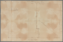
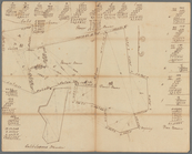
Mount Pitt
m
Malleshaw's near Fresh Water
m
Ground near Fresh Water
m
James Delancey's lot and old …
m
Tan Yard lots
m
Frankfort and Kip Streets
m
Cockraft's lot facing the Fly…
m
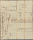
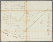
Fly Market
m
Plan of the Indian King farm …
m
Dock Street
m
East River to Dock Street
m
Cherry Street from George to …
m
Ann White's estate known by t…
m
Lots between Veasey and Barcl…
m
Sketches showing grades and d…
m
circa 1780-1785
m
Hopper Farm, showing divisions
m
Map of Little Bloomingdale
m
Lands in the Jerseys
m
Andrew Van Horne's land, Berg…
m
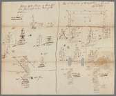
Precedents for the surveyor o…
m
From Paulus Hook to Passaic R…
m
Part of the river St. Lawrence
m
Dr. Ogden's farm at Jamaica
m
Land, meadow, and mill pond e…
m
Mill at Gowanus
m
1793 August 14
m
Brookland
m
Computations of Staten Island
m
Survey of land at Westchester…
m
Mr. Barns's land at Westchest…
m
Land at Westchester belonging…
m
Forty three acres of land at …
m
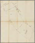
Tract of land at Morrisania
m
Several tracts in the manor o…
m
Minutes of Mr. Carley's land …
m
Surveys at Westchester
m
Horn's Hook for Abraham Duria
m
Dr. Romayne's ground agreeabl…
m
Caleb Wood's farm
m
Survey of A. Van Horn's land
m
Water lots back of A. V. Cotl…
m
Daniel, Ebenezar Bowers's, an…
m
Mr. Laight and Captain Rose's…
1
2
3
4
5
6
Previous
Next
1
2
3
4
5
6
Previous
Next